“The Original Las Vegas” was founded along the Galinas River in 1835 in the midst of Mexican rule in the area and quickly grew as a popular stop on the Santa Fe Trail. It was on the Plaza in Las Vegas where Stephen Watts Kearny claimed New Mexico for the United States during the Mexican-American War in 1846. In 1879, the Atchison, Topeka and Santa Fe Railroad came to Las Vegas and the town quickly grew into one of the largest in the region. The New Mexico Normal School (now Highlands University) was established in 1893 and Fred Harvey built the Castañeda Hotel in 1898 as part of his hospitality empire in the southwest. Las Vegas hosted Teddy Roosevelt’s Rough Riders’ first reunion in 1899, a tradition that continued for many years. In more recent years, Las Vegas has been the filming location for many movies including No Country For Old Men, Wyatt Earp (with Kevin Costner), and perhaps most notably for me, Red Dawn where it served as the fictional town of Calamut (the massive “Calamut Says Howdy” mural is still a prominent feature downtown). I found Las Vegas to be a quiet, charming University town with some spectacular architecture, fascinating history and friendly people. It may be the “other Las Vegas”, but it’s a town not to be missed on your travels in New Mexico. I hope you enjoy these photos from wonderful Las Vegas, New Mexico.
Thief River Falls gets its name from the falls at the confluence of the Red Lake River and the Thief River (which traces its name back to a conflict between the Ojibwe and Dakota people). These falls made navigation by boat impossible beyond this point, so a town was born here in 1887. Thief River Falls was originally a lumber town and then shifted to wheat farming, but it really took off when the Great Northern and Soo Line railroads came to town in the end of the 19th and beginning of the 20th centuries respectively. The rivers and railroads still power the local economy today and Thief River Falls is also the home of an Arctic Cat Snowmobiles plant. Thief River Falls has a population of around 8,600 people today and it really put on a show for me during my visit. The temperature hovered around 70 degrees under sunny skies and the sunset was absolutely spectacular. I hope you enjoy these photos from my visit to beautiful Thief River Falls, Minnesota.
Hello Everyone. It’s been another great week on the road out here in southwestern Michigan. I had to slow down a bit because of the holiday weekend, but it’s been nice to spend some time at the beach and to have some quiet time to catch up on some work. The beaches on the shores of Lake Michigan are beautiful, and the temperature has been perfect to enjoy them without getting too hot. The water is a little chilly, but it’ll sure wake you up if you jump into it. It’s been great to see some of the beautiful lighthouses out here as well and wander through some cute little towns. Most of the 4th of July celebrations in the area were cancelled due to Covid, which was understandable but also a shame. It’s definitely been a crowded week as well and I’d just as soon avoid the crowds, so I’ve been laying lower than usual this weekl. All-in-all it’s been a good week, though, and I’m still enjoying my time in Michigan. I should probably be moving a little bit quicker than I am, but my goal is to stay happy and healthy and not wear myself out so on that front, I’m doing well. Shadow Catcher is also doing well and while I need to replace the city water connection (which I just had replaced a few months ago), that seems to be the only issue at the moment which is great.
When I left you last week, I was on my way to the Gilmore Car Museum in Richland, one of the premier automotive museums in the country, and it did not disappoint. It was clear from the minute I walked into the first exhibit that this was a museum designed and built by genuine car enthusiasts. That first exhibit was on the evolution of the Corvette from a concept car (one of which was a station wagon!) into one of the most notorious American sports cars in history. From there I went on a somewhat chronological tour through cars of different decades from the early days through to the 70s, after which cars lost all style and excitement. There were also outbuildings with different collections and themes and even an old diner brought to the museum from Connecticut. One of the coolest items was a mock-up of a Ford Model A cockpit which walked you through the steps of how to get it started. I giggled with glee and did it three times in a row (nobody was waiting or watching). I spent about 4 hours at the museum and after it closed, tons of classic cars started pouring in for some kind of event. I just enjoyed standing in the parking lot and watching them go past.
From there, I headed back to Kalamazoo and straight to the Bell’s Brewery Eccentric Café. I’ve been a lover of Bell’s beer for many years now and was excited to try some of their brews that don’t make it out of their backyard. I put Bell’s right up there with Dogfish Head as one of the absolute best and most consistent breweries in the country. They didn’t disappoint and I enjoyed a few beers in their back garden while I was there. I wandered around downtown for a bit and ended up stopping in the only other brewery that was open on a Wednesday night, which was Final Gravity. Their beer was truly terrible, but the bartender was both a fellow Penn Stater and a fellow former teacher, so I really enjoyed chatting with him over my barely palatable beer. It was definitely nice to have someone to talk with for a while…
After being turned back south after the Battle of Antietam, Confederate General Robert E. Lee marched his army back to Virginia. Union General George McClellan was replaced by General Ambrose Burnside to command the Army of the Potomac, and President Lincoln urged Burnside to pursue the Army of Northern Virginia deep into the state and attack the Confederate Capital at Richmond. The major obstacle lying in their way was the Rappahannock River.
Burnside arrived at Stafford Heights overlooking the river and the small town of Fredericksburg in mid-November, 1862. He had sent orders to have pontoons at the ready to provide a means of bringing his army rapidly across the river. Tragically for Burnside and his men, the pontoons didn’t arrive for several weeks. Instead of crossing the river in boats or rafts, he chose to wait for the pontoons. By the time they got there, Confederate troops had dug in on the high ground south of the city called Marye’s Heights and behind a stone wall along a sunken road to the front of this position.
Union engineers worked through the night of December 10th to assemble the pontoon bridge, but their progress was slowed by Mississippi sharpshooters in town. A small group of Union soldiers crossed the river in boats and fought a battle to secure the streets of the town. They finally secured the town in late afternoon on the 11th, but it was winter and the daylight soon gave out. The bridge would be completed and most of the army would cross it on December 12th.
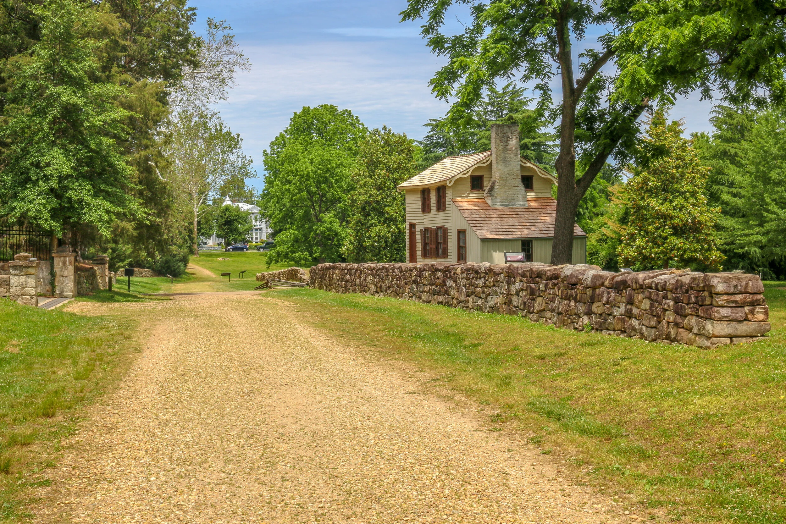
I hope you enjoy this post with photos and history from Forest Hills, a beautiful neighborhood in Northwest Washington D.C.
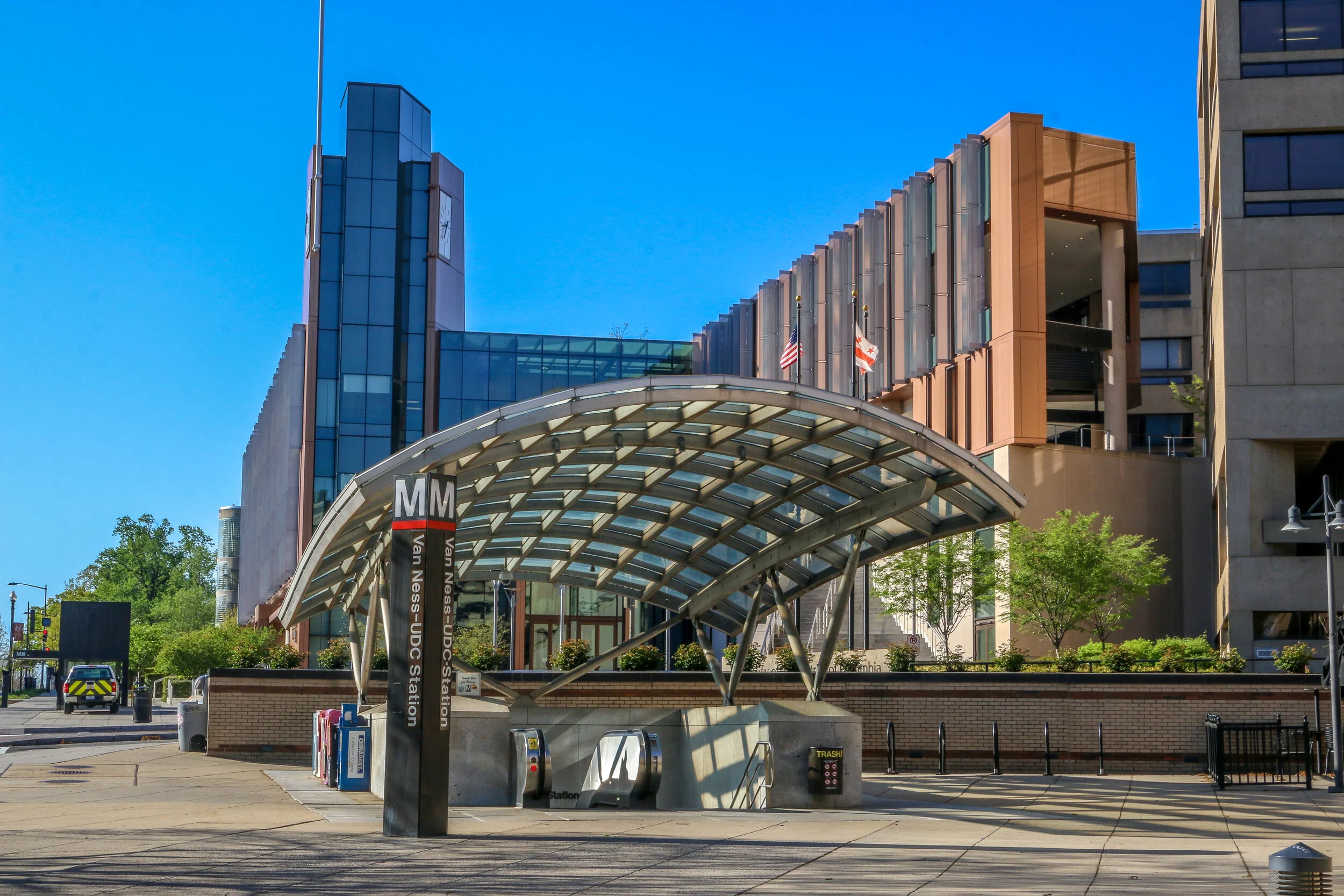
Resting quietly between Cleveland Park and Chevy Chase and bordered by Rock Creek Park to the east is the quaint neighborhood of Forest Hills. Those of us who grew up in the era of the Metro are probably more likely to think about this neighborhood as Van Ness/UDC. The station takes its name from Van Ness Street, the main cross street in the neighborhood, and the University of the District of Columbia. Since the northern border of the neighborhood is considered to be Nebraska Avenue, I grew up right across the street from Forest Hills.
Once home to a Native American soapstone quarry, Forest Hills has quite an interesting history. In 1763, long before the creation of Washington D.C., Col. Samuel Beale was granted a tract of land by Lord Baltimore and named the area Azadia. Much of this tract would later be purchased by Isaac Pierce who would build his namesake mill along Rock Creek. In 1814, Revolutionary War veteran and retired land surveyor John Adlum bought a 200 acre tract of land in the area to start a vineyard. He named his estate Springland Farm and went on to become one of the first commercial producers of wine in the country (Adlum is buried at Oak Hill Cemetery in Georgetown). During the Civil War, Forest Hills was the site of Fort Kearny – one of the ring of forts protecting the Capital City…
In 1713, two colonists were granted a tract of land extending from what is now Cleveland Park all the way to present-day Rockville. That tract long predates both the city of Washington DC and the United States as a whole, and its owners named it “Friendship”.
By the turn of the 20th Century, only two homes were located in the area, one was located a few hundred yards back from Wisconsin Avenue in a grove of silver maples, and the other lay closer to the road and was owned by the Ball family. This home had an attached blacksmith shop and also served as a changing station for stagecoaches bound between Rockville and Georgetown. In the early 1900s, trolley tracks were laid connecting Georgetown to Montgomery County, and the area became prime real estate.
Over the next decade, the land was purchased and subdivided by two men, Albert Shoemaker and Henry Offutt, and a small community began to developed. By 1914, the Village of Friendship Heights and The Hills was recognized by the state of Maryland, and the community around it was also known as Friendship Heights. This was a rural area, and an annual fall hog slaughter was a much anticipated event…
South Texas was the end of the road for me on this leg of my journey. I set out to make it across the country to the Pacific Ocean and back over the next 16 months or so, but the coronavirus put an end to all of that. When things started going from bad to worse further north, I made my way all the way south to South Padre Island and Port Isabel, stopping off at Palo Alto National Historical Park along the way. The battlefield was awesome to see and I had it almost entirely to myself. I learned a lot about the first battle of the Mexican-American War, and the two future presidents (Ulysses S. Grant and Zachary Taylor) who fought in it. The prickly pears were just starting to bloom, and the day was just on the verge of being too hot to be out in the sun. It was a beautiful and fascinating place. From there I headed to the coast and hunkered down for almost a week. While everything was pretty much shut down, I enjoyed the beach, sand art, peace and quiet and beautiful sunsets on the bay. When Shelter-In-Place orders came down for the beach communities, I knew it was time for me to head home, making this the end of the road for now. I was glad I saw it and had the chance to spend some time in this tiny, far out corner of America.
Originally home to the Karankawa people, Palacios was first settled by Europeans in the 1820s. In 1901, the land was purchased by a development company, divided into lots and sold to people looking to settle along the beautiful coast of the Gulf of Mexico. The Southern Pacific Railroad came through about the same time, providing overland access to the town-site. Over the next 20 years, the town grew as a resort community, and many businesses opened their doors to provide for the tourists flocking to the beaches. After World War I, a National Guard base called Camp Hulen opened nearby. The camp would be taken over by the War Department in World War II, eventually accommodating almost 15,000 soldiers. The base was also the site of a POW camp during the war. In the years following the war, Camp Hulen was closed and in 1961 Hurricane Carla slammed into the coast causing major damage. Today, Palacios is a quiet, pleasant seaside community of about 5,000. Home to about 400 shrimping boats, it has been called the Shrimp Capital of Texas. During my visit I found it quiet enough to enjoy its small-town tranquility but bustling enough to know it’s still alive and well. I had only planned on stopping for a few minutes to enjoy some sun by the water, and ended up staying most of the day, taking these photos, enjoying the views and chatting with the locals. I hope you enjoy these photos of Palacio, Texas, Matagorda County’s City by the Sea.
Hello Friends, boy what a difference a week makes, huh? Last week at this time things were very different than they are now. While the coronavirus was definitely making news a week ago, over the course of this week whole countries have been shut down. American travel restrictions have gone into place and cities have started to shut down non-essential businesses. Grocery shelves are bare across the country and while panic hasn’t set in yet, at least here in Texas, some of the big cities on the coasts are on high alert. New phrases like “social distancing” and “self-quarantine” have entered our lexicons, and people are, and should be worried. To read about my plans and what life has been like this week and also to get an understanding of the importance of some of the public buildings I use on a regular basis, please be sure you read my post on the coronavirus HERE. I was also sad this week to see that the Trace Theater in Port Gibson, Mississippi, which I had photographed just a few weeks ago, had caught fire and burned out pretty badly. In addition, it was the 9 year anniversary of the tsunami which rocked Japan and started the Fukushima mess - another tragedy I lived through as I was teaching in rural southern Japan at the time. It’s been a tough week out here. I decided to finally finish watching Treme, the HBO show about the rebuilding of New Orleans after Katrina, something else I was a part of for two years, and it reminded me that this too shall pass and soon this will just be a memory.
Very soon after I hit “Publish” on last week’s This Week on the Road post, my friend Christian called to tell me the Houston Rodeo had been cancelled for the rest of its run over concerns regarding the coronavirus. I’ll admit I was pretty disappointed because I was looking forward to it, but it seems now like it was for the best. There will be other rodeos in the future, and better safe than sorry in a case like this.
When I found out about the rodeo, I decided to pack up and head out of town. I made my way south to Galveston Island on the Gulf Coast. I had spent some time in Galveston before, but many years ago. It’s a beautiful place with an old, historic city on the bay side and a decent beach on the gulf side
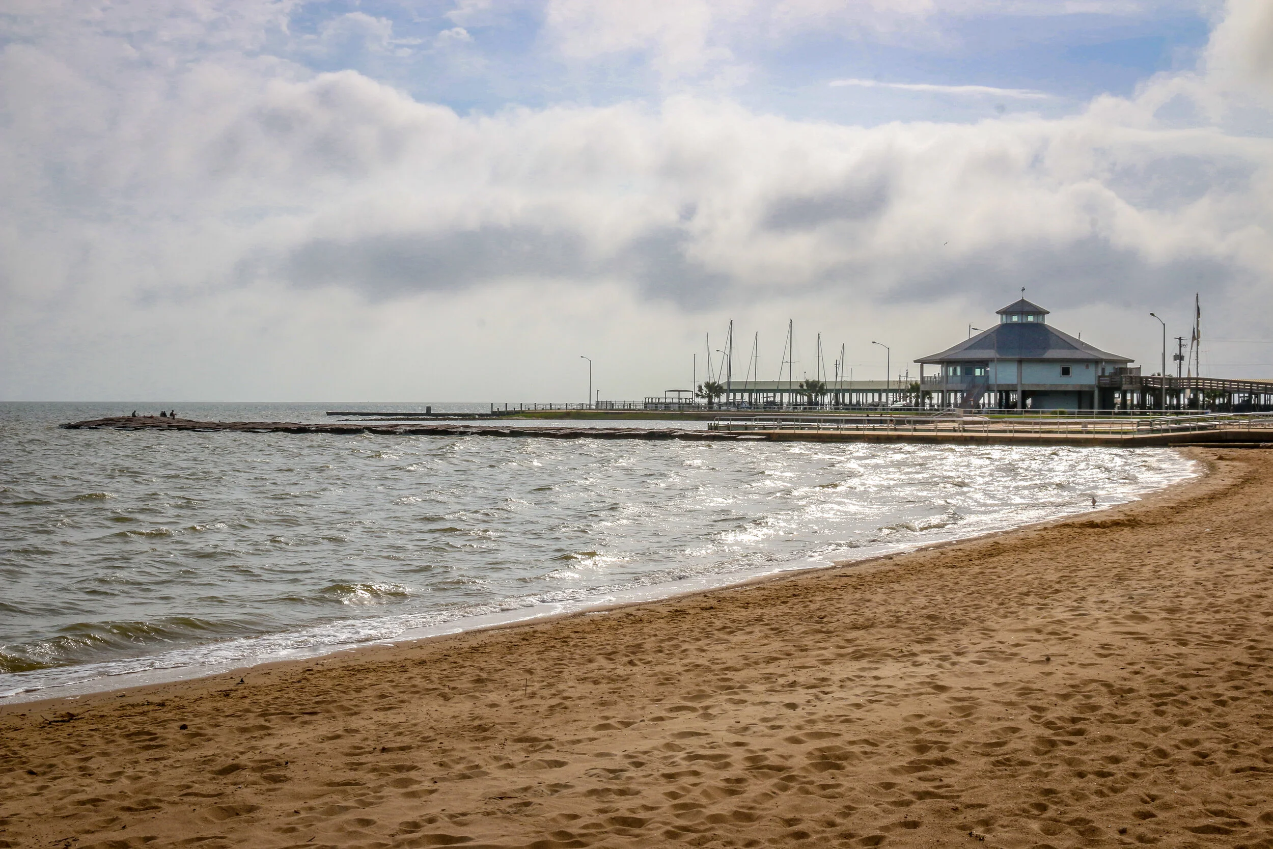
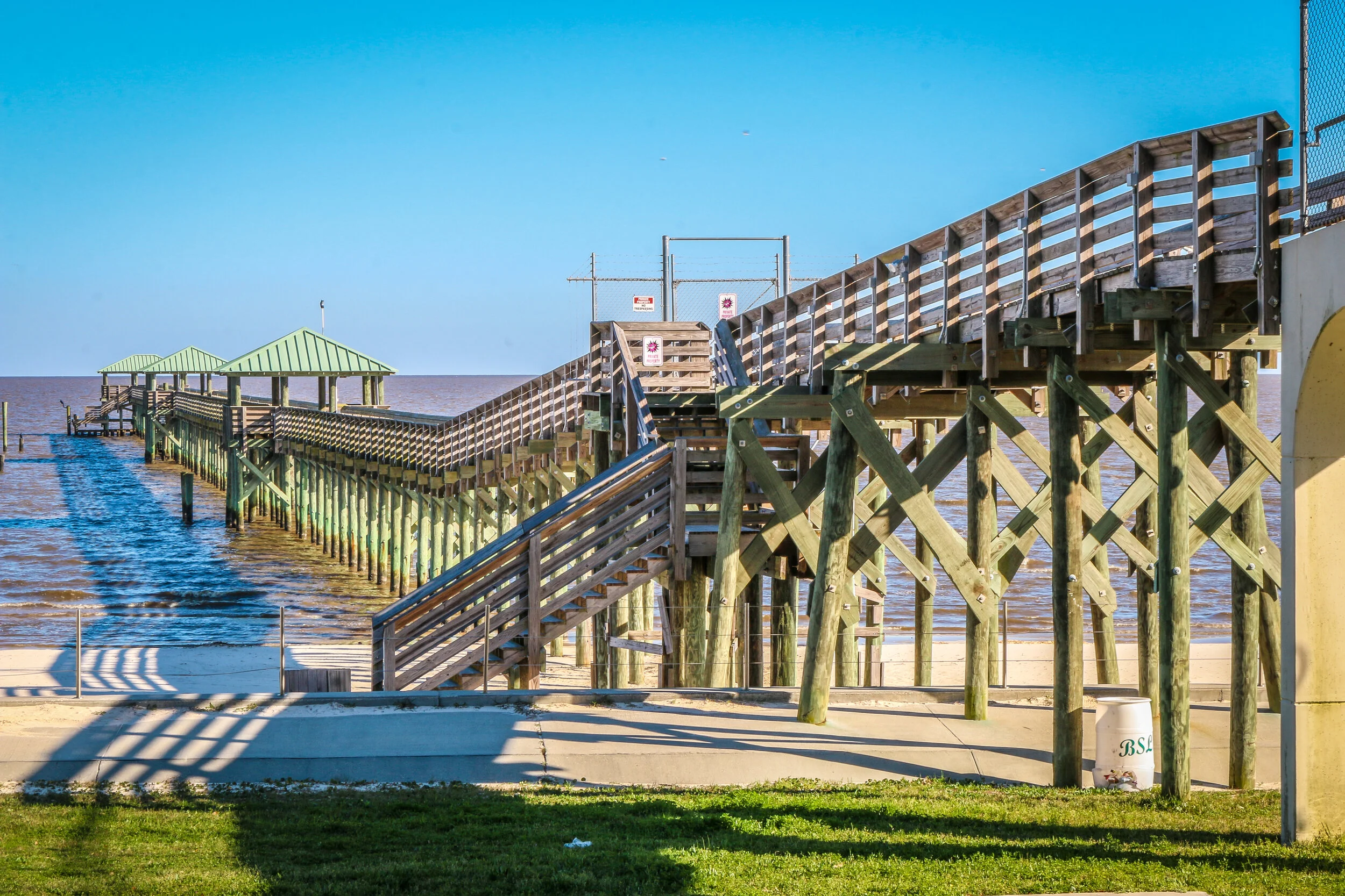
On August 25th, 1699, Jean Baptiste LeMoyne, the Sieur d’Bienville was exploring the region that is now Mississippi’s Gulf Coast under a French flag and named this bay for King Louis IX. A small settlement was begun, consisting of just 16 soldiers. After the area was bought from France as part of the Louisiana Purchase of 1803, it was opened to homesteaders and thousands of people poured in from the Upper South. The town, originally called Shieldsboro, was incorporated by the first Mississippi state legislature in 1818 and it wouldn’t be until 1875 that its original name was restored. Bay St. Louis was severely damaged by Hurricane Katrina in 2005, and is still in the process of recovering from the storm. Today, Bay St. Louis is a charming little town of about 10,000 people. The downtown area is bustling with restaurants, bars and quaint local shops and the beach is a lovely place to while away an afternoon. Located just an hour from New Orleans, Bay St. Louis shares many of the Creole characteristics of The Big Easy. I loved my visit to Bay St. Louis, and found it to be one of the most livable places on the Gulf Coast of Mississippi. But don’t tell anyone that. It’ll just be our little secret. I hope you enjoy these photos from Bay St. Louis, A Place Apart on Mississippi’s Gulf Coast.
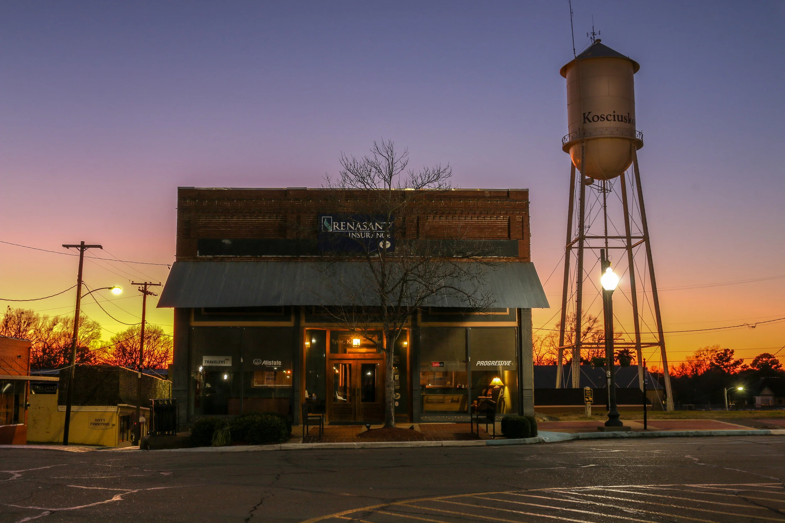
Central Mississippi geographic names pay tribute to our two most famous foreign-born Revolutionary War heroes. Lafayette County, which has Oxford as its county seat, is named for the French Marquis de Lafayette, and the county seat of Attala County is the tiny town of Kosciusko, named in honor of the Polish-born Tadeusz Kosciuszko. Koscuszko grew up attending military schools in Europe, and in 1776, at the age of 30, happened to be in Paris and heard about the American War for Independence. Making his way across the ocean, he volunteered in George Washington’s Army and would rise to the rank of Brigadier General. There are many lasting tributes to Kosciuszko around the country and the world including a garden at the U.S. Military Academy at West Point, and National Memorial in Philadelphia, an island in Alaska and a wonderful statue in Lafayette Park in my hometown of Washington D.C.
The Mississippi city which now bears his name was once a simple campsite along the Natchez Trace Trail known as Red Bud Springs. At some point, a tavern and blacksmith shop were built to provide for travelers making their way up the Trace. Over time this settlement grew, and would eventually be chosen as the county seat of the new Attala County.
Kosciusko is a friendly and welcoming town which centers around a stunning town square. It gets its nickname, The Beehive of the Hills because it is the industrial and retail trade center of the region (there are beehive sculptures around the square which I mistook as pineapples when I arrived). Kosciusko is probably best known as the hometown of Oprah Winfrey, but bluesman Charlie Musselwhite also hails from the town. As did James Meredith, the first African-American student to attend Ole Miss. I loved my visit to this beautiful little community where I stopped off for the night as travelers have for centuries. It was really quiet when I visited, despite it being Saturday evening, and I almost felt like I had the square to myself. The twilight was perfect for taking these photos, and the sky was a wonderful blue when I went back in the morning. I hope you enjoy these pictures of beautiful downtown Kosciusko, Mississippi - The Beehive of the Hills..
Hi Guys, it’s that time of the week again. It’s been another great week on the road in Mississippi, and I’m happy to share some of the highlights with you here. My week started in Cascilla in the rural center of the state, led me on a quick loop through the Delta with night stops in Cleveland, Clarksdale and Greenwood and is ending right here in beautiful but rainy Vicksburg. It’s been a week of beautiful towns, incredible food, good music and some really great photo opportunities. Despite the gloomy weather which has been a pretty constant companion this week, my spirits are high and I’m enjoying myself out here. I’m finding some good balance and trying to stress less and enjoy more. In all, it’s been a pretty awesome week out here.
Storms came hard in Central Mississippi as my week began, with hail, tornadoes and damaging wind. I was grateful to my friend John and his family for giving me shelter from the storm last Wednesday night (and for two nights before that). By the time I left Thursday morning, the worst of the storms had passed although the clouds persisted. Shadow Catcher was a whole different vehicle with new shocks, and we no longer bounce down the road like Tigger. That would come in really handy on the less-than-ideal roads of the Delta. I went with stiffer shocks because it’s a big van, so it’s not a smooth ride, but it’s enormously improved on what it was last week.
Decending from John’s place in the hills and heading west on Route 8, I came out into the beautiful, pancake-flat Mississippi Delta. Cotton fields hemmed in the road, and the familiar sights of rusted out cars in front of old sharecroppers’ cabins made me feel like I was once again on familiar ground…