People have been visiting the natural hot springs in the Palomas Basin for centuries. The Spanish called them Ojo Caliente de Las Palomas and the cowboys called them Palomas Hot Springs. In the late 18th century, a public bath was built on a ranch in the area where people could come and take the waters. When the Elephant Butte Dam was built in 1912 to help with irrigation, the area became more attractive to settlers and the town of Hot Springs, New Mexico was incorporated in 1916. Twenty-one years later, it would become the county seat of Sierra County. In 1950, Ralph Edwards, the host of the popular radio show Truth or Consequences, promised to air their 10th anniversary show live from any town that would change its name to match that of the show. Hot Springs residents jumped at the opportunity and officially changed its name to Truth or Consequences. Edwards made good on his promise and visited the town on the first weekend of May every year for the next 50 years. His visit was turned into a celebration, Fiesta, which still happens every year at that time. T or C, as the locals call it, is a wonderful and colorful little town full of hot springs resorts and art galleries and with a backdrop of beautiful mountains that light up when the sun is low in the sky. I loved my brief stay in one of the country’s most uniquely named towns, and I hope you enjoy these photos of fabulous Truth or Consequences.
Thief River Falls gets its name from the falls at the confluence of the Red Lake River and the Thief River (which traces its name back to a conflict between the Ojibwe and Dakota people). These falls made navigation by boat impossible beyond this point, so a town was born here in 1887. Thief River Falls was originally a lumber town and then shifted to wheat farming, but it really took off when the Great Northern and Soo Line railroads came to town in the end of the 19th and beginning of the 20th centuries respectively. The rivers and railroads still power the local economy today and Thief River Falls is also the home of an Arctic Cat Snowmobiles plant. Thief River Falls has a population of around 8,600 people today and it really put on a show for me during my visit. The temperature hovered around 70 degrees under sunny skies and the sunset was absolutely spectacular. I hope you enjoy these photos from my visit to beautiful Thief River Falls, Minnesota.
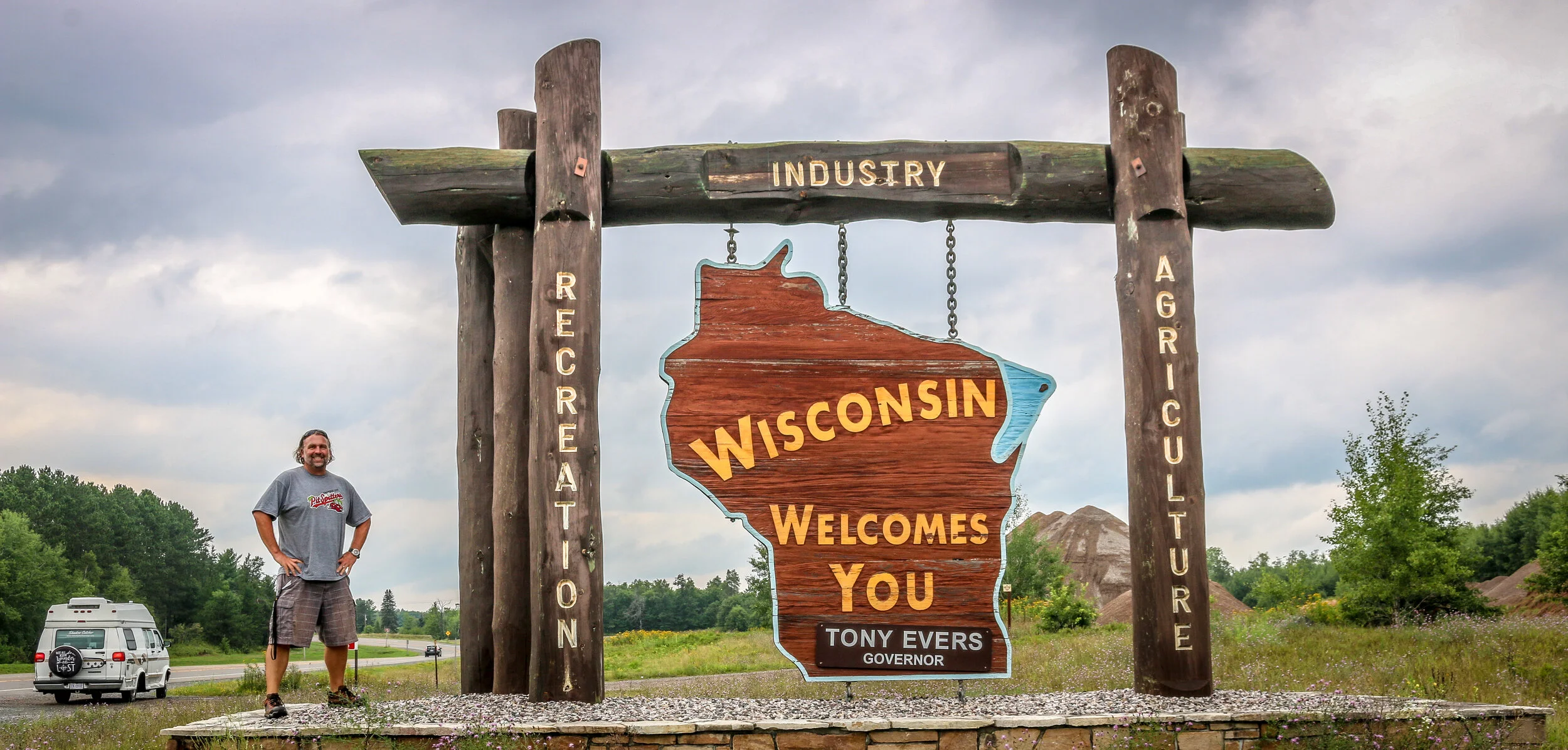
Hello Everyone and greetings from Green Bay, Wisconsin! I have completed my two month journey through Michigan and have moved on to the Badger State. I spent the first half of the week out in beautiful Isle Royale National Park, a destination I was really looking forward to and which definitely lived up to my expectations. Returning from the park on Saturday, it was time for me to make tracks and get myself into Wisconsin. Summer is passing quickly and I still hope to get through both Wisconsin and Minnesota before winter sets in. It’s been a good week, and I’m excited to tell you what I’ve been up to.
I headed out to Isle Royale on the Isle Royale Queen IV out of Copper Harbor bright and early on Wednesday morning. There are three boats that make the trip to the island, and this one just worked better with my schedule. It was fast and made the 55 mile crossing in about 3.5 hours and I enjoyed chatting with a mother and daughter who I sat with on the way out. The mother owned the rock shop in Copper Harbor and had a grandfather who once lived and worked as a fisherman on Isle Royale. Her daughter was in Copper Harbor for the summer and working at one of the restaurants in town. I was surprised by how many people I met who had family connections back to Isle Royale before it became a National Park.
When we arrived on the island, the rangers gave us their briefing, issued backcountry permits and we were off and running. Most of the park is designated wilderness, so unless you are staying at the lodge near the ferry dock you are on your own for the duration of your stay. I shouldered my pack and made my way a little over 7 miles to Daisy Farm Campground on the east side of the island. It’s been years since I’ve carried a full pack that distance, but I have been doing a lot of walking and hiking and it really wasn’t too bad. I even saw my first of nine moose I would see during my visit on this hike. Because I was there alone, it was easy to hear footsteps which weren’t my own and an adult moose has some pretty heavy footsteps. I was able to see the moose through the dense forest and enjoyed spending some time with her before heading on to camp where I took up residence in one of the shelters they had there. I had my tent with me, but since the shelters were available it seemed like an easier option even though it only takes 5 minutes to set up my tent. I had my first dehydrated meal in many years, something which has improved dramatically since the last time I ate one. It was a beautiful campground right on the lake and even though it was pretty busy, people were spread out and it didn’t seem crowded. I met some really nice people in camp and found it easy to talk to people as we obviously had shared interests in hiking, camping and/or National Parks and had gone to some length to get to this remote island.
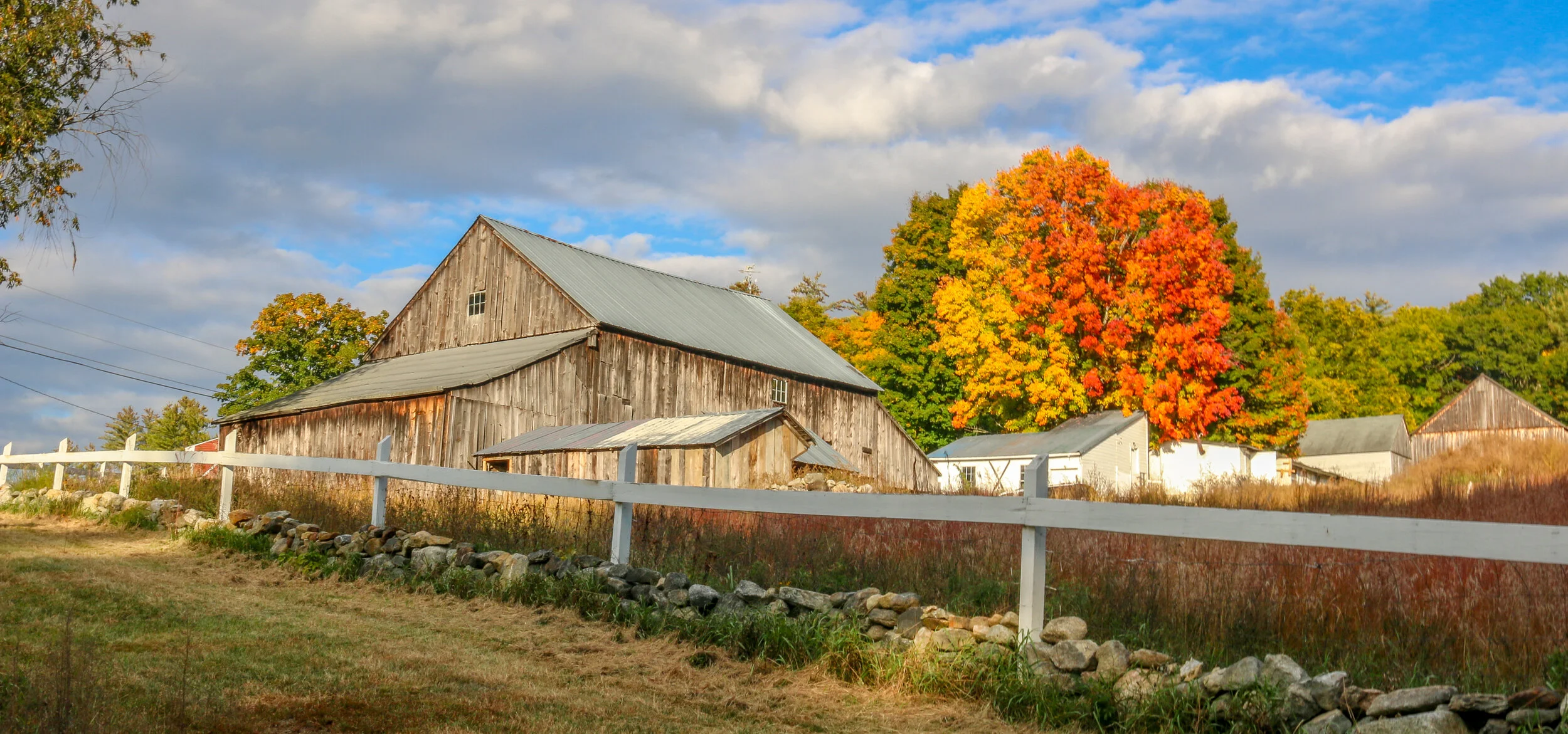
A few weeks ago I had the wonderful opportunity to go and spend a week with my brother in southern New Hampshire. We went out to explore some of the most beautiful parts of the area by car, by boat and on foot. The fall colors were just starting to kick into high gear, and some of the scenes we saw were truly spectacular. We saw covered bridges over the Ashuelot River, lakefront vistas at Lake Winnipesaukee, and charming small towns like Peterborough and Amherst. I took a lot of photos, and this is the first of at least two posts which will allow you to see the area through my lens. I hope you enjoy these photos from fabulous southern New Hampshire.
Bryce Canyon National Park is one of the most striking and beautiful places in all of North America, and I’ve seen a lot of beautiful places on this continent in my 14 years as a cross-country tour guide. My very first visit to Bryce was back in May of 2000 and I had truly never seen anything like it in my life. It felt like I had arrived on some alien landscape. Unlike Grand Canyon, it seemed as though I could take in Bryce in one sweeping view, but yet my mind couldn’t comprehend how such a beautiful and fragile landscape could exist at all. It was truly striking. The awe I felt at that first breathtaking view out over the canyon has only grown with each subsequent visit, and there have been many in the intervening years although not as many recently as I would have liked. To hike among the Hoodoos, as the colorful spires are called, is the best way to experience the park and gain a better understanding of the scale of the formations. While beautiful at any time of day, the colors are most vivid at sunrise which is definitely the best time to visit the park. Be sure to bring your jacket though because at 8,000’ above sea level, Bryce is cold even in the middle of summer. In winter it can be downright brutal, but the snow makes an incredible contrast to the pink and orange spires. Bryce Canyon is one of my very favorite National Parks and is worth the drive to get there. You can get a good feel for the park with one full day to spend there, but I would definitely recommend an overnight stay so you can be there for sunrise. To find out more about Bryce Canyon National Park, visit the park’s website here. I hope you enjoy these photos I’ve taken over the years on my many trips to the park.
The photos below come from a recent visit to the battlefields of the greater Richmond/Petersburg Area. With the exception of the first few from Gaines Mill which was important to the Peninsula Campaign of 1862, most of these battles were part of the 1864 Overland Campaign. This long, brutal and bloody series of battles would eventually lead to the capture of Petersburg and the fall of Richmond which set the stage for the surrender of the Army of the Potomac at Appomattox. Civil War Chronicles will trace the major battles of the Eastern Theater of the war through photos and brief histories
Richmond was not the original capital of the Confederacy, but became the capital after Virginia seceded from the Union in April of 1861. Richmond and neighboring Petersburg were major industrial hubs with rail lines connecting to points near and far and the James River to further move supplies in and out of the area. The rivers surrounding the city made defending it somewhat easier as well. Because of the strategic importance of Richmond, it would be the focus of several major campaigns during the war.
Our visit started at Gaines Mill Farm which saw some of the worst fighting of the Seven Days Battle during the Peninsula Campaign of 1862. This battle was the first in which Robert E. Lee had command of the Army of Northern Virginia following the wounding of Joseph Johnston. Lee’s ability to hold off George McClellan and his Union forces would direct the war away from Richmond and back to Northern Virginia to Fredericksburg and Chancellorsville which we visited several weeks ago…
The area we now call Cleveland Park in Washington D.C. was once a part of a massive 1000 acre estate owned by Colonel Ninian Biell. He called his estate Pretty Prospect and built a small stone cottage on the land in 1740. In 1790, the property was acquired by General Uriah Forrest, who would later become mayor of Georgetown, and a large wood-framed house was built onto the front of the stone cottage. Forrest renamed the property Rosedale. When his son inherited this land, he built an even bigger home and called it Forrest Hill. In 1886, Forrest Hill was purchased as a country retreat by then-president Grover Cleveland who converted the house into a Victorian mansion and renamed it Oak View. It is from President Cleveland that the current neighborhood takes its name.
After Cleveland lost his reelection bid in 1889, the land was purchased and converted into housing subdivisions. The neighborhood’s early success was made possible by the Rock Creek Railway line which ran up Connecticut Avenue from downtown all the way to Chevy Chase Lake in Montgomery County, Maryland. In order to make this streetcar line happen, a massive bridge had to be built over the Klingle Valley and Rock Creek connecting the area to the rest of the city. The neighborhood developed around the natural contours of the land, with a little help from the firm of landscape architect Frederick Law Olmstead, and you’ll find more winding roads here than in most parts of the city. Many of the houses were built to be unique to those around them and many were designed by renowned architects of the day. The result was that Cleveland Park was once heralded as the “prettiest suburb of Washington”, and many of those beautiful houses survive in the neighborhood today.
Chevy Chase dates back all the way to 1725, when Col. Joseph Belt was granted 1000 acres by Lord Baltimore, the first proprietor of the Colony of Maryland. Col. Belt, who had commanded the Prince George’s County Militia in the French and Indian War, named his new farm Cheivy Chase after an area in Northern England. A portion of the land was bought up for development in the late 1800s, and lots began to sell when a streetcar line connected the neighborhood to downtown Washington. Many of the houses in Chevy Chase were bought straight from a Sears and Roebuck catalog and remain standing today. Much of the architecture in the area is in the humble Bungalow, Foursquare and Dutch Colonial styles, but many of my favorites are in the less well represented Tudor revival style. Some of the key landmarks of the community are Magruder’s Market which opened in 1875, the 1923 Avalon Theater and the far newer Chevy Chase Library and Community Center. Chevy Chase is my home neighborhood, and I have wonderful memories from my childhood of movies at the Avalon, art and gymnastics classes at the community center, going to the old Riggs Bank with my grandmother and for ice cream at the long-gone Baskin Robbins. I often take my morning walk up Connecticut Avenue, the central road of the neighborhood, and reminisce about times gone by and five generations of my family who have wandered these streets. It made my heart feel good to go out and shoot these photos of my home neighborhood.
Port Lavaca is a lovely and quiet port town on Matagorda Bay and serves as the county seat of Calhoun County. Originally named simply La Vaca (“the cow”), the town was laid out in 1840 after Comanche raids forced people to abandon their homes in nearby Linnville. In addition to the port, the newly laid out town became the coastal terminus of a stagecoach route from Victoria, and eventually connected to the San Antonio and Mexican Gulf Railroad. In the early days, they did a fair trade in not just cattle, but also cotton, wool, pecans and precious metals. La Vaca lost its role as County Seat to nearby Indianola in 1852 but after a terrible hurricane hit the coast in 1886, it was moved back to La Vaca and remains there today. The port still plays a major role in the town’s economy, as do fishing and shrimping, but manufacturing employs many of the town’s residents today. I enjoyed my short stay in Port Lavaca with its charming downtown, beautiful marina and friendly people. I can see why locals refer to their hometown as “Paradise on the Bay”.
What exactly is Galveston? Is it a typically Southern town? An island with a beach vibe? An historic port city like New Orleans? A Texan town? The answer to all of those is “yes”. Galveston is a fascinating place with so much to offer. Even after a few days there I felt like I had only begun to scratch the surface of the Queen City of the Gulf.
The first non-natives to inhabit Galveston came in 1816 with the pirate Louis-Michel Aury. When Aury went on a raid the following year, he returned to find that the island had been occupied by the infamous pirate Jean Lafitte. Lafitte set up a “Pirate Kingdom” there and remained with his people for the next 5 years. The Port of Galveston was established under the Mexican government in 1825, and the town would serve briefly as the capital of the Independent Republic of Texas in 1836. Galveston, along with the rest of Texas, joined the Confederacy during the Civil War and became a target due to its major port…
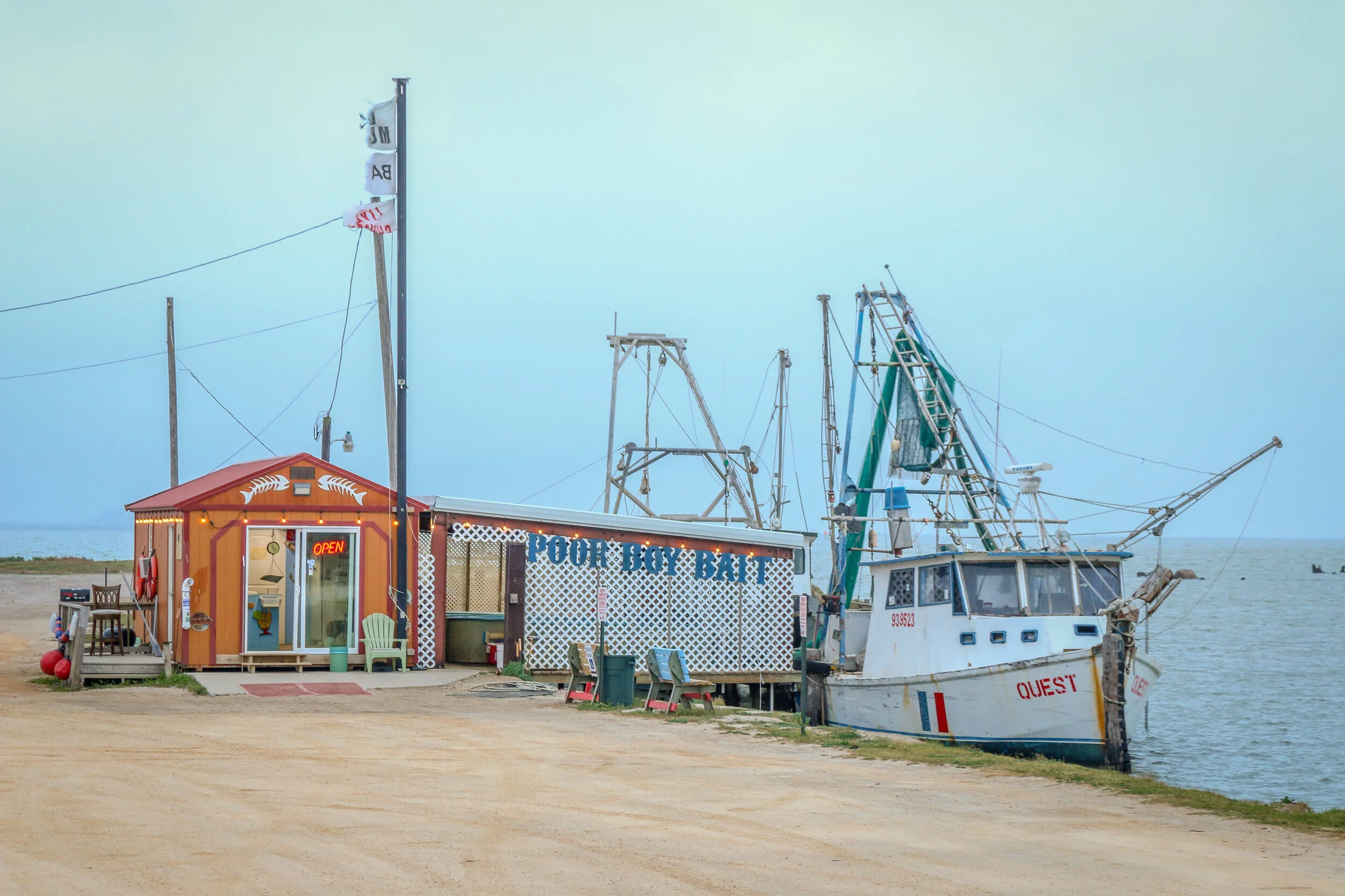
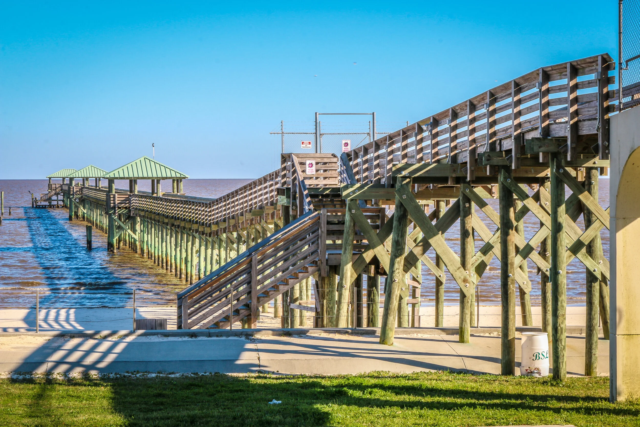
On August 25th, 1699, Jean Baptiste LeMoyne, the Sieur d’Bienville was exploring the region that is now Mississippi’s Gulf Coast under a French flag and named this bay for King Louis IX. A small settlement was begun, consisting of just 16 soldiers. After the area was bought from France as part of the Louisiana Purchase of 1803, it was opened to homesteaders and thousands of people poured in from the Upper South. The town, originally called Shieldsboro, was incorporated by the first Mississippi state legislature in 1818 and it wouldn’t be until 1875 that its original name was restored. Bay St. Louis was severely damaged by Hurricane Katrina in 2005, and is still in the process of recovering from the storm. Today, Bay St. Louis is a charming little town of about 10,000 people. The downtown area is bustling with restaurants, bars and quaint local shops and the beach is a lovely place to while away an afternoon. Located just an hour from New Orleans, Bay St. Louis shares many of the Creole characteristics of The Big Easy. I loved my visit to Bay St. Louis, and found it to be one of the most livable places on the Gulf Coast of Mississippi. But don’t tell anyone that. It’ll just be our little secret. I hope you enjoy these photos from Bay St. Louis, A Place Apart on Mississippi’s Gulf Coast.
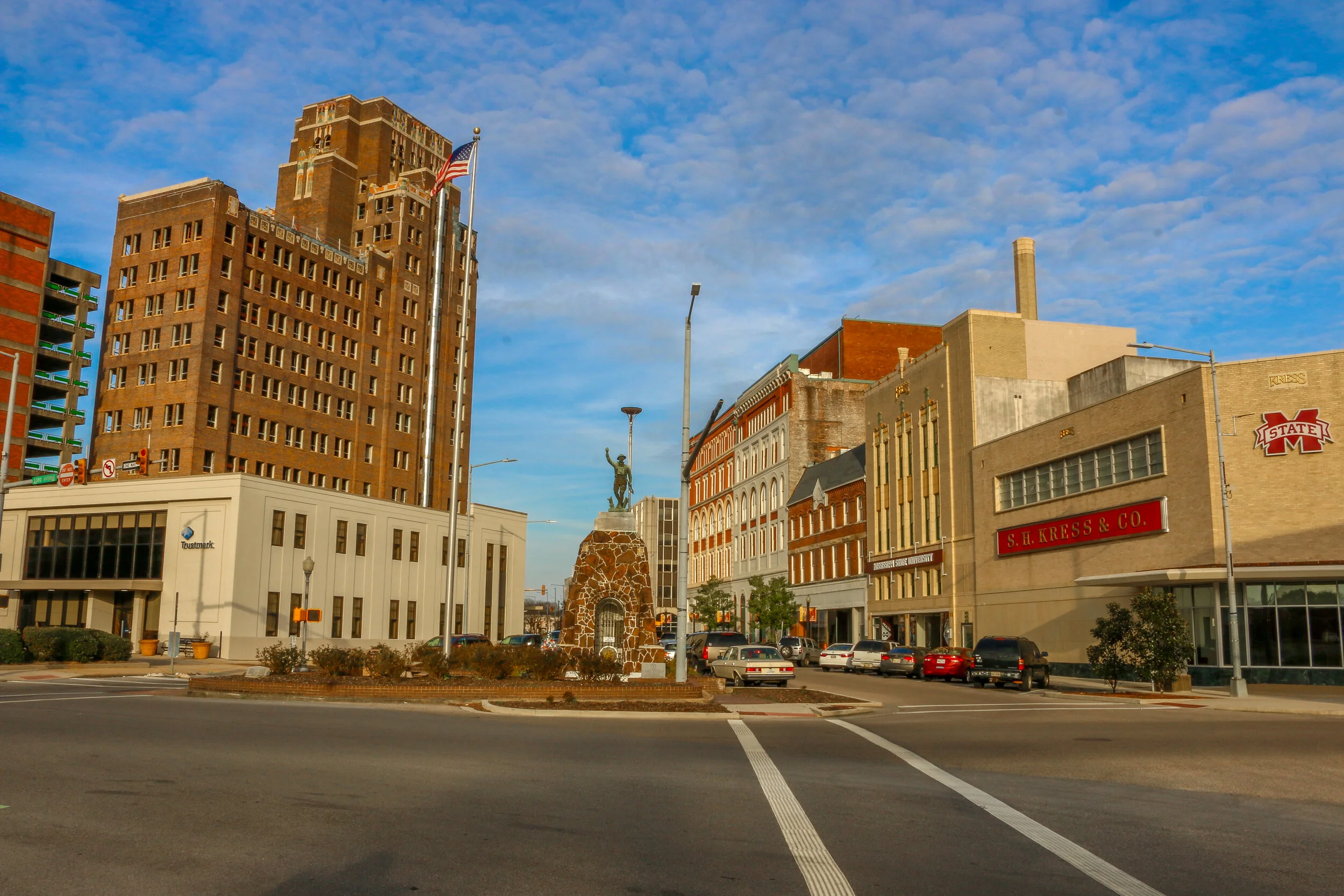
Meridian, Mississippi was chartered in 1860 at the junction of the Mobile & Ohio and Southern Railways. When the Civil War broke out the following year, Meridian was just a small town but its railroad connection made it logistically important. After the Battle of Meridian in 1864, General Sherman all but burnt the town to the ground. After the war, the town was rebuilt and quickly grew as a manufacturing center and railroad hub, and was actually the largest city in the state from 1890 to 1930. In the midst of this boom-time, Meridian’s most famous son, Jimmie Rodgers was born. He would grow up to be known as the “Father of Country Music”, although much of his style was more closely associated with the blues music he heard as a young man working for the railroad. Meridian today is a beautiful small city with a population of around 40,000. While the trains still roll through downtown, Meridian’s economy has diversified with two nearby military bases, a major regional hospital and Peavey Electronics Corporation. I’ve enjoyed watching the Renaissance of the downtown area in recent years, and the new MAX Museum is a great addition to the city. On my most recent visit, I saw a lot of new businesses opening with many more in the works which really made me happy. Of course, a stop at Weidman’s Restaurant has been a must since it opened in 1870. If you’re ever on this side of Mississippi, stop in for a night or two, you’ll be glad you did. Mississippi’s Queen City is sure to win your heart as it has mine.