The homes we now refer to as the Gila Cliff Dwellings were built beginning around 1276. The rivers in the area provided a constant source of water, a necessity in the desert and probably the reason the people who built these dwellings chose this location. While they were contemporaries of the people we now call the Ancestral Puebloans, differences in their construction styles, pottery and art have caused archaeologists to give them a different name and we refer to them as the Mogollon. The time that the Mogollon spent in these dwellings, approximately 25 years, coincides with prolonged drought in the area which caused many groups to move in search of water. It seems that the Mogollon moved into these alcoves near the beginning of the drought, and left as it was ending. When looking at history, it’s easy to think of 25 years as the blink of an eye, but it’s a whole generation of children growing to adulthood and having their own babies and adults moving into the roles of elders as elders pass on. There was love and loss and laughter as this group passed the time farming, hunting, building, creating and growing.
The Mogollon seem to have moved on around 1300 as the drought was coming to its end and these isolated dwellings likely remained empty for quite some time. The Chiricahua Apache migrated to the region in the 1500s and the great leader Geronimo was born near the headwaters of the Gila River around 1820. Spanish settlers came to the area in 1598, but there is no evidence they penetrated the wilderness anywhere near to the dwellings. Prospector H.B. Ailman documented the cliff dwellings in 1878 and by the time archaeologist Adolph Bandelier arrived in 1884, looters had ransacked the alcoves and made off with whatever artifacts were to be found. Homesteaders, miners, prospectors and ranchers arrived over the next few decades and President Theodore Roosevelt protected the area as Gila Cliff Dwellings National Monument in 1907. Not too long after he did, Aldo Leopold came to the region as a forester and lobbied the Forest Service to establish the GIla Wilderness, the first designated wilderness area in the country and an inspiration for the 1964 Wilderness Act.
Today, the Gila Wilderness is a quiet and magical place. It’s a two hour drive from Silver City, the nearest town of any real size, to the Cliff Dwellings. The road that brings you in is the aptly named Trail of the Mountain Spirits National Scenic Byway and it is a truly beautiful drive. During my visit, I toured the cliff dwellings, scouted out some beautiful pictographs, hiked the fabulous Little Bear Creek Canyon trail to the Middle Fork of the Gila River and soaked in wonderful hot springs. I loved my time in the Gila Wilderness and hope you enjoy these photos from my visit.
Bay City, Michigan is clearly an old industrial town which once thrived on timber and shipbuilding, but which has reinvented itself as a modern and livable city on the shores of the Saginaw River. I enjoyed a scenic cruise on the river aboard the Princess Wenonah, a stroll past the timber barons houses on Central Avenue and plenty of time in the lively downtown core. I love towns that aren’t trying to cover up or destroy their past, but rather repurpose it in the modern world. In my time in Bay City, I’d say they are doing just that. I hope you enjoy these photos from Bay City, Michigan as much as I enjoyed being there.
Port Huron is a lovely mid-sized town where Lake Huron empties into the St. Clair River. Originally inhabited by the Ojibwa people, the site was settled during the War of 1812 with the establishment of Fort Gratiot. People moved to the area for jobs in the lucrative lumber and shipbuilding industries. While he was born in Ohio, Thomas Edison spent his formative years in Port Huron, selling candy and newspaper on the Grand Trunk Railroad route to Detroit. Today, Port Huron is a quiet town with a beautiful lighthouse, a charming downtown area and a wonderful riverfront walk that takes you right under the Bluewater Bridge which connects Port Huron to Sarnia, Ontario. I had a great stay in Port Huron and absolutely stunning weather while I was there. I hope you enjoy these photos from my time in this lovely waterfront town.
Beaumont, Texas traces its roots back to 1824 when Bobby and Nancy Tevis settled on the Neches River and built a small farm. A community grew up around them called Tevis Bluff. Developers Henry Millard, Joseph Pulsifer and Thomas Byers Huling purchased all of the land in the area in 1835 and began selling lots in a town to be called “Beaumont” after Henry Millard’s wife Mary Beaumont. Lumber, cattle and rice were early drivers of the local economy, as was the port which got these products to market. That all changed in 1901 when oil was discovered at Spindletop, and America’s first oil field was developed right there in Beaumont. The town’s population tripled almost overnight and oil has been the city’s main economic driver ever since. Today, Beaumont is a quiet city of about 120,000 people, with most living outside of the downtown core. I found the city to be charming, with a lot of great historical buildings. My favorites were the Jefferson Theater and Tyrell Historical Library. I was sad to see that despite some wonderful efforts at reviving the downtown area there didn’t seem to be much going on there during my visit. Regardless, I enjoyed my stay in Beaumont and it is definitely a city I will return to in the future.
Ocean Springs, Mississippi got its start as a French colonial fort called Fort Maurepas way back in 1699. The fort was founded by the famed Canadian explorer Pierre Le Moyne d'Iberville and was used to protect French interests in the area from Spanish encroachment. The city was incorporated in 1892 as Ocean Springs, named after the natural springs found in the area. Today, Ocean Springs is an enchanting coastal town with a thriving artists community. There is a lovely beach with a pier jutting out into the gulf for fishing or just relaxing with a good book. Downtown if bustling with shops, galleries, restaurants and bars and is a nice break from the nearby casino-centered towns. I really enjoyed my visit to this quaint seaside community shaded by ancient oak trees draped in Spanish moss. It was cool to see the Mardi Gras decorations up while I was there and I even got to see the town’s Mardi Gras parade during my visit. If you ever find yourself cruising the Mississippi Gulf Coast, be sure you take a minute to stop into Ocean Springs for a look. You might just find yourself sticking around longer than you had planned. I sure did. I hope you enjoy these photos from Mississippi’s City of Discovery.
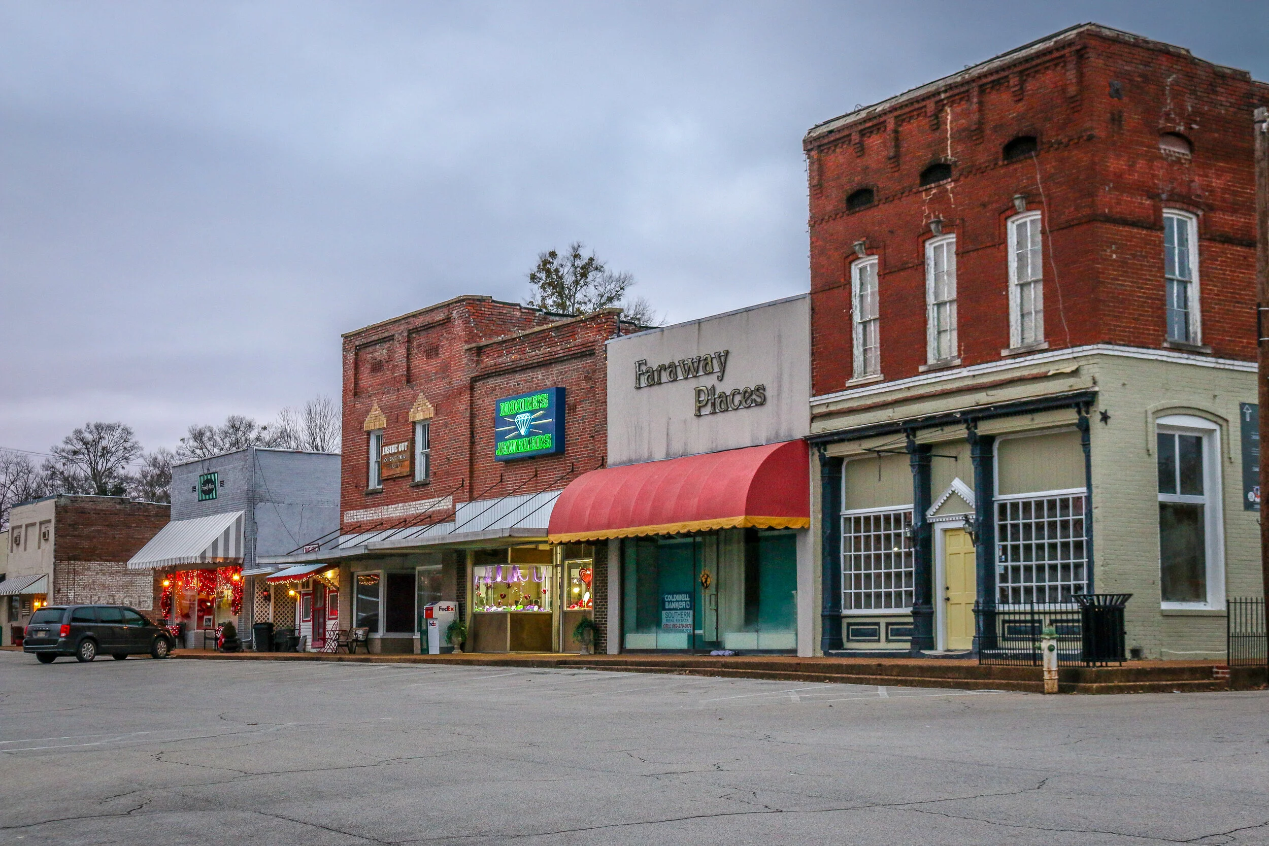
Founded by French colonists in 1729, Port Gibson is one of the oldest towns in what’s now the state of Mississippi. Today, it serves as the county seat of Claiborne County and it is home to the beautiful county courthouse pictured below. Port Gibson was the site of several skirmishes during the Civil War, but most of its antebellum buildings survived because General Ulysses S. Grant called the town “too beautiful to burn”. The town’s population today is probably only around 1500 which explains why it’s so quiet. There are several beautiful old churches along the appropriately named Church Street and some great old buildings around the downtown area. I really enjoyed the wonderful, sunny afternoon I spent taking these photos in the charming town of Port Gibson.
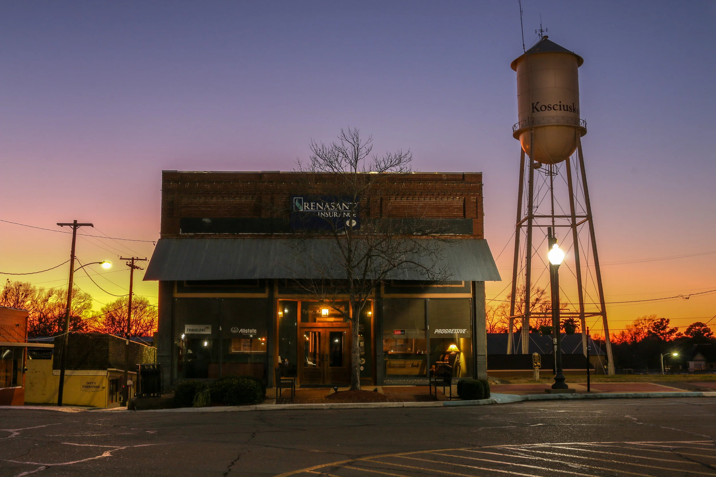
Central Mississippi geographic names pay tribute to our two most famous foreign-born Revolutionary War heroes. Lafayette County, which has Oxford as its county seat, is named for the French Marquis de Lafayette, and the county seat of Attala County is the tiny town of Kosciusko, named in honor of the Polish-born Tadeusz Kosciuszko. Koscuszko grew up attending military schools in Europe, and in 1776, at the age of 30, happened to be in Paris and heard about the American War for Independence. Making his way across the ocean, he volunteered in George Washington’s Army and would rise to the rank of Brigadier General. There are many lasting tributes to Kosciuszko around the country and the world including a garden at the U.S. Military Academy at West Point, and National Memorial in Philadelphia, an island in Alaska and a wonderful statue in Lafayette Park in my hometown of Washington D.C.
The Mississippi city which now bears his name was once a simple campsite along the Natchez Trace Trail known as Red Bud Springs. At some point, a tavern and blacksmith shop were built to provide for travelers making their way up the Trace. Over time this settlement grew, and would eventually be chosen as the county seat of the new Attala County.
Kosciusko is a friendly and welcoming town which centers around a stunning town square. It gets its nickname, The Beehive of the Hills because it is the industrial and retail trade center of the region (there are beehive sculptures around the square which I mistook as pineapples when I arrived). Kosciusko is probably best known as the hometown of Oprah Winfrey, but bluesman Charlie Musselwhite also hails from the town. As did James Meredith, the first African-American student to attend Ole Miss. I loved my visit to this beautiful little community where I stopped off for the night as travelers have for centuries. It was really quiet when I visited, despite it being Saturday evening, and I almost felt like I had the square to myself. The twilight was perfect for taking these photos, and the sky was a wonderful blue when I went back in the morning. I hope you enjoy these pictures of beautiful downtown Kosciusko, Mississippi - The Beehive of the Hills..
Water Valley is an endearing small town of about 3400 people in Yalobusha County in North-Central Mississippi. Settlers began moving to the area after the treaties of Dancing Rabbit Creek and Pontotoc which would push the native Choctaw and Chickasaw people out of the area. Cotton plantations began to spring up in the region with most of the cotton traveling to market along the Yalobusha and Yocona Rivers. Then the Mississippi Central Railroad came to town in 1860 and Water Valley became a bit of a boom town. Beautiful Victorian homes were built and downtown was thriving. The Civil War came to Water Valley in 1862 when Union forces occupied the town. After the war, Water Valley would thrive again, but when rail traffic was diverted elsewhere the town would begin a long slow decline. Some time around 2008, Water Valley underwent a renaissance as people began to discover a beautiful town with cheap real estate and empty storefronts. Today, Water Valley is starting to come into its own yet again. If it weren’t in the heart of Central Mississippi, I might even call it “hip”. It’s still quiet and a little sleepy, but you can feel renewal in the air. As I walked around, I saw a lot of people working in the empty buildings and turning them into something fresh and new. Meanwhile, Turnage Drugstore which has been in operation since 1905, is still at the heart of the community and remains a great place to visit, grab an ice cream and catch up on the gossip (and get your prescriptions filled too, I assume). I really enjoyed this delightful little town…
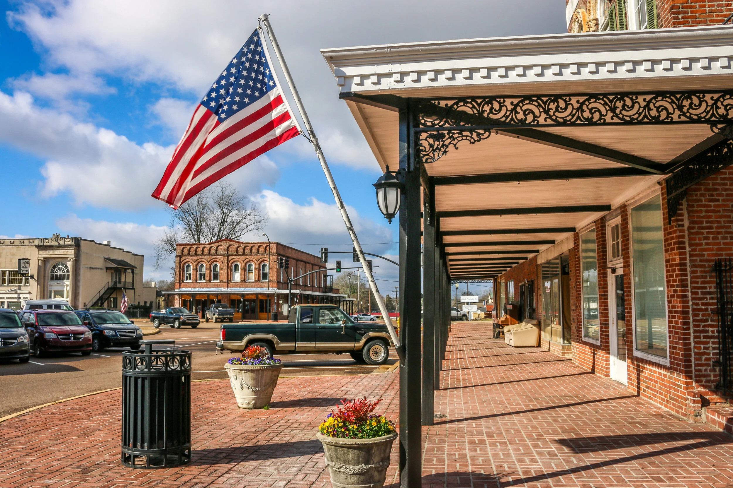
Holly Springs was founded in 1836 on land previously occupied by the Chickasaw people after the Treaty of Pototoc Crreek forced them west. New settlers came to the region quickly and scrambled to buy up land and start planting cotton. As the county seat, Holly Springs grew rapidly as well and even more-so when the Mississippi Central Railroad came through in 1855. During the Civil War, the strategic nature of the railroad came into play and Holly Springs was occupied by Ulysses S. Grant and his Army of the Tennessee. Confederate Cavalry Commander Earl Van Dorn rode into Holly Springs before dawn on December 20th, 1862. The surprise attack temporarily cut off the Union supply route as Van Dorn’s men took all the supplies they could carry and burned the rest. After the war, Holly Springs would resume its role as a cotton center and railroad hub. Rust College was established in Holly Springs in 1866 to help educated newly freed slaves in the area. The college is still in operation today, making it one of the oldest Historically Black Colleges and Universities in the South.
Holly Springs today is a pleasant town of about 7500. I was thrilled to see construction going on while I was there and to find a Mississippi town which is growing and improving instead of deteriorating. There are a number of wonderful Antebellum homes to see in town, and the bustling town square has several restaurants and coffee shops when you get hungry. When I was there, I stopped in to the Visitors Center and spoke with Jamie who was super helpful in pointing out all the wonderful things Holly Springs has to offer. It should definitely be your first stop when you go to visit. I had a great day in Holly Springs and loved taking the photos you’ll see in this post. It’s a town on the rise, and I look forward to seeing how far it’s gotten the next time I’m in town.
The tiny town of Iuka, Mississippi (population 3,000) was founded by David Hubbard in 1857 along the route of the Memphis and Charleston Railroad. Built on the sight of an old Chickasaw Indian village, the town takes its name from one of the chiefs of that village, Chief Ish-ta-ki-yu-ka-tubbe . Iuka (pronounced “aye-you-ka”) was the site of the Battle of Iuka during the Civil War, an engagement between Union General Rosecrans’ Army of the Mississippi and Confederate General Sterling Price’s Confederate Army of the West. The battle resulted in over 2300 casualties before Price withdrew his troops and marched on to join General Van Dorn in the 2nd Battle of Corinth. The Brinkley House, also called Dunrobin, was used as General Grant’s Headquarters during the battle, and is a really cool antebellum home.
Today, Iuka is a charming little town with a cute downtown area and a wonderful park. The park’s centerpiece is the Iuka Mineral Springs, where natural spring water flows for all to enjoy. I really liked this park for some reason and enjoyed taking photos of the old playground equipment which reminded me of the things I played on when I was a kid. Iuka has a beautiful War Memorial and a history museum in their old courthouse which was sadly closed during my visit. There were also several beautiful churches and some neat looking shops. Much like my visit to Corinth, short days and cold weather kept me from exploring too far afield, but I thought Iuka was an adorable little town and that these photos would give you a feel for my visit.