Grand Canyon is one of the most spectacular places on the face of the earth. It is one of the three “Crown Jewels” of the U.S. National Park system, the lowest step in the geologic Grand Staircase of Time, a UNESCO World Heritage Site and one of the Seven Wonders of the Natural World. The rock layers most recently exposed by the Colorado River, which runs through the Canyon’s heart, are roughly 1.8 billion years old. Therefore, when you are sitting on the rim gazing out over the Canyon, you are looing at roughly 40% of the geologic history of the planet. Grand Canyon is remarkable at all times of the year and in all different kinds of weather. There are amazing hiking opportunities at Grand Canyon, but be sure you set aside some time to just sit on the rim and ponder. I’ve been fortunate in my life to visit Grand Canyon well over a hundred times and these are some of my favorite photos I’ve taken through the years. I hope you enjoy them!
Viewing entries in
National Park
Glacier National Park, in far northern Montana, is my very favorite place in the world. Jagged mountains, quiet turquoise lakes, abundant wildlife, cascading waterfalls, amazing trails, awe-inspiring vistas and beautiful historic park lodges come together to form an alpine paradise straight out of a dream world. Glacier’s remote location keeps it from becoming as severely overcrowded as many other National Parks have become in peak summer months, although every summer visitation seems to grow. Glacier forms one half of the extensive Waterton-Glacier International Peace Park in association with neighboring Alberta, Canada. I’ve been very fortunate to visit Glacier National Park many times over the last 20 years and always look forward to my visits. Here, I’ve assembled some of my favorite shots I’ve taken of this beautiful park over the years. I hope you enjoy these photos from stunning Glacier National Park.
Wrangell-St. Elias National Park is one of the most beautiful places I’ve ever been, and that’s saying something. Second only to Montana’s Glacier National Park in my heart, Wrangell-St. Elias is America’s biggest National Park, encompassing an area of over 13 million acres. Wrangell-St. Elias was designated a UNESCO World Heritage Site in 1979 and a National Park in 1980. Plate tectonics, volcanic activity and glaciation all worked together over time to form this magnificent landscape, but it was copper that brought people into these mountains in the early 20th Century. The Kennecott copper mines produced over $200 million worth of copper between 1911 and 1938 ($3.6 billion in today’s dollars)
Today you can drive on the old rail line until you get to the “end of the road” where you will have to cross the river bridge on foot. From there you can catch a shuttle to Kennecott and explore the park from there. Glacier Walks, Mill Tours and Ice Climbing are all on offer, or you can simply go for a hike. The hikes to the old mines high on the mountains aren’t long, but they’re pretty strenuous. After a long day in the park you can find good meals at the Kennecott Lodge or in the old town of McCarthy down the road. Alternatively, the north end of the park is accessible along the beautiful Nabesna Road. The season in Alaska is short, and there isn’t much happening once the businesses close so summer is definitely the right season to visit the Wrangells. I hope you enjoy these photos I took in the park during the last summer I spent guiding there (2017).
Bryce Canyon National Park is one of the most striking and beautiful places in all of North America, and I’ve seen a lot of beautiful places on this continent in my 14 years as a cross-country tour guide. My very first visit to Bryce was back in May of 2000 and I had truly never seen anything like it in my life. It felt like I had arrived on some alien landscape. Unlike Grand Canyon, it seemed as though I could take in Bryce in one sweeping view, but yet my mind couldn’t comprehend how such a beautiful and fragile landscape could exist at all. It was truly striking. The awe I felt at that first breathtaking view out over the canyon has only grown with each subsequent visit, and there have been many in the intervening years although not as many recently as I would have liked. To hike among the Hoodoos, as the colorful spires are called, is the best way to experience the park and gain a better understanding of the scale of the formations. While beautiful at any time of day, the colors are most vivid at sunrise which is definitely the best time to visit the park. Be sure to bring your jacket though because at 8,000’ above sea level, Bryce is cold even in the middle of summer. In winter it can be downright brutal, but the snow makes an incredible contrast to the pink and orange spires. Bryce Canyon is one of my very favorite National Parks and is worth the drive to get there. You can get a good feel for the park with one full day to spend there, but I would definitely recommend an overnight stay so you can be there for sunrise. To find out more about Bryce Canyon National Park, visit the park’s website here. I hope you enjoy these photos I’ve taken over the years on my many trips to the park.
This post shares photos and a brief history of the The Old Stone House in Georgetown in Washington D.C.
The Old Stone House was built was built in 1765 on what was then Bridge Street (now M Street) in Georgetown, ten years before the Declaration of Independence and almost 30 years before the founding of Washington D.C. Built of locally quarried stone as a one story structure by a cabinetmaker named Christopher Layman, the building would serve as both his home and shop. After his death later that year, Layman’s widow sold the building to Cassandra Chew who added a rear kitchen in 1767 and a second floor soon thereafter. The third floor was added in the 1790s. Over the next hundred and fifty years, the building would change hands, and uses, many times. By 1953, when the National Park Service purchased the property, it was the site of a local car dealership. The Park Service has since restored much of the Old Stone House to an 18th Century appearance and it is open to the public as part of C & O Canal National Historical Park. It is considered the oldest standing structure in Washington D.C. on it’s original foundation, and is one of very few pre-Revolutionary buildings to be found in the District.
Interestingly, the Park Service points to a mistaken identity as one of the reasons the Old Stone House was preserved. On March 29th, 1791 George Washington was meeting with area landowners to discuss the purchase of land by the federal government to establish the new capital city.
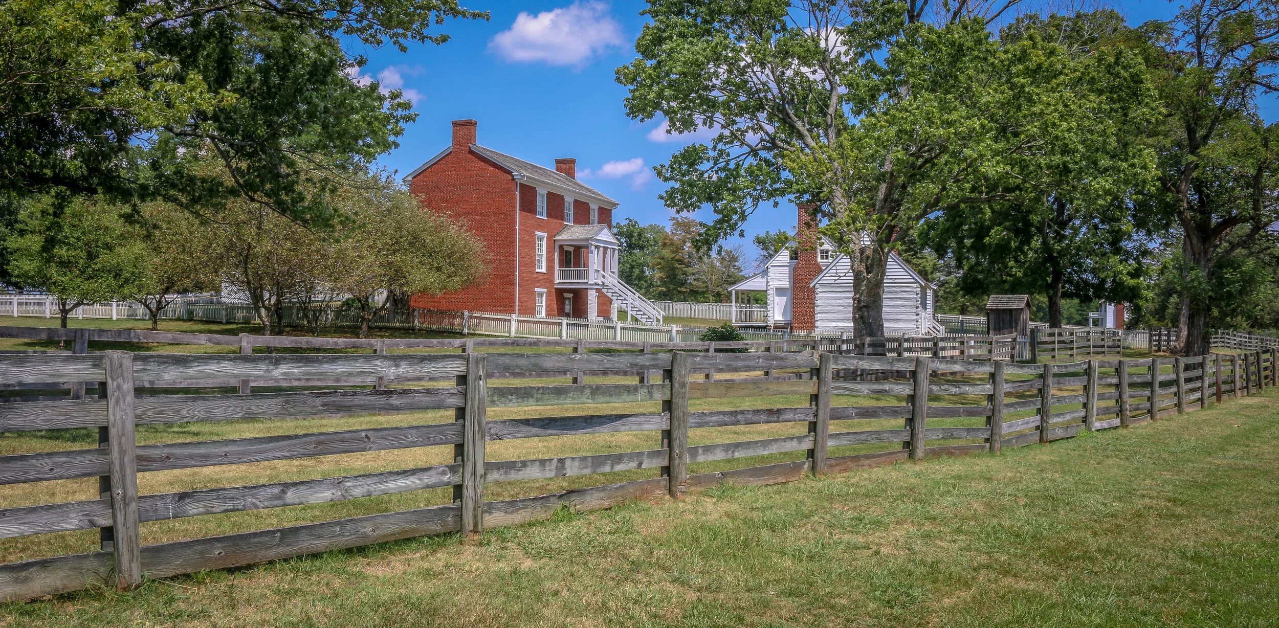
The photos below come from a recent visit to Appomattox Court House National Historical Park near the town of Lynchburg, Virginia. It was the site of the surrender of the Army of Northern Virginia which effectively ended the American Civil War.
After the siege of Petersburg and the fall of the Confederate Capital at Richmond, General Robert E. Lee led his Army of Northern Virginia west with the hopes of turning south to North Carolina and joining with General Joseph Johnson’s army there. They moved towards the train depot at Appomattox Station hoping to find much needed supplies waiting for them there. Union General Phillip Sheridan and his cavalry arrived first, capturing the supply trains and forcing Lee to turn his thoughts towards Lynchburg instead. Surrounded by Union troops, they made one final push at dawn on April 9th, 1865. It didn’t take long to realize that they were surrounded and Lee called for a meeting with Ulysses S. Grant to discuss the terms of surrender.
The site chosen for this conversation was the home of Wilmer McLean in the tiny village of Appomattox Court House. The generals met in the parlor, recreated above, to hammer out the details. The terms offered were very generous as the Confederate soldiers were to be immediately paroled and even allowed to keep their horses and sidearms. Their parole papers were printed in the nearby Clover Hill Tavern. The Southerners marched into town, stacked their rifles, turned over their cannons and marched out. While the surrender of Lee’s Army of Northern Virginia was not the end of the Civil War, there was little chance or hope for the Southern cause in its aftermath. The war would technically drag on until early summer, with skirmishes across the south, but the surrender at Appomattox Courthouse was the beginning of the end. Four long years of fighting which cost over 600,000 lives was finally nearing its conclusion…
The photos below come from a recent visit to the battlefields of the greater Richmond/Petersburg Area. With the exception of the first few from Gaines Mill which was important to the Peninsula Campaign of 1862, most of these battles were part of the 1864 Overland Campaign. This long, brutal and bloody series of battles would eventually lead to the capture of Petersburg and the fall of Richmond which set the stage for the surrender of the Army of the Potomac at Appomattox. Civil War Chronicles will trace the major battles of the Eastern Theater of the war through photos and brief histories
Richmond was not the original capital of the Confederacy, but became the capital after Virginia seceded from the Union in April of 1861. Richmond and neighboring Petersburg were major industrial hubs with rail lines connecting to points near and far and the James River to further move supplies in and out of the area. The rivers surrounding the city made defending it somewhat easier as well. Because of the strategic importance of Richmond, it would be the focus of several major campaigns during the war.
Our visit started at Gaines Mill Farm which saw some of the worst fighting of the Seven Days Battle during the Peninsula Campaign of 1862. This battle was the first in which Robert E. Lee had command of the Army of Northern Virginia following the wounding of Joseph Johnston. Lee’s ability to hold off George McClellan and his Union forces would direct the war away from Richmond and back to Northern Virginia to Fredericksburg and Chancellorsville which we visited several weeks ago…
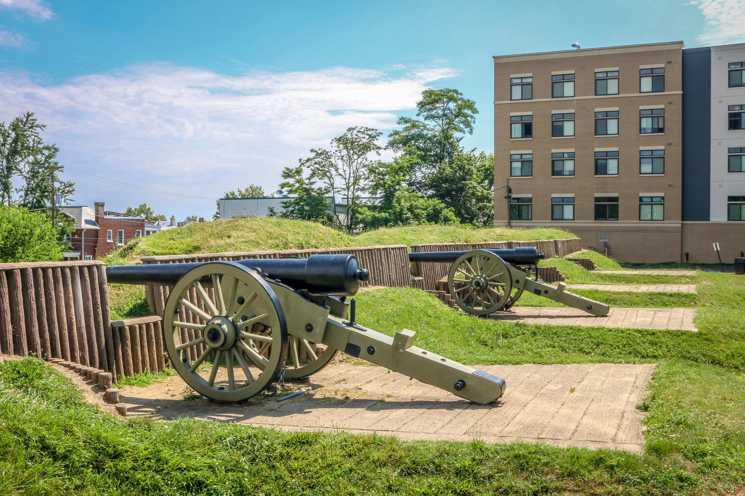
The photos below come from a recent visit to Fort Stevens in Washington D.C. - site of the only battle fought inside D.C. during the Civil War, and of Battleground National Cemetery up the street. The final photo came from Grace Episcopal Church in Silver Spring, MD. Civil War Chronicles will trace the major battles of the Eastern Theater of the war through photos and brief histories.
After overcoming Union General Lew Wallace and his men at the Battle of Monocacy on July 9th, 1864,, Confederate General Jubal Early continued his march towards the Capital of Washington D.C. The Confederate soldiers made the march in two days. Thankfully, Wallace had delayed the Confederates long enough for General Grant to send reinforcements via steamship from Richmond who soon took up position in the northern section of the circle of forts surrounding the city. Fort Stevens guarded the 7th Street Pike, one of the main roads into the city (now Georgia Avenue).
The armies exchanged fire on July 11th and 12th, but Early felt the city was too heavily defended to mount a full scale attack. Both sides lost men in the skirmishing, but casualties were relatively light by Civil War standards. Notably, President Abraham Lincoln came to Fort Stevens on July 12th with his wife, Mary. The two came under fire, the only time in American history that a sitting president was in the direct line of enemy fire. A memorial stone on the parapet marks that location today. That evening, Early would withdraw his men through Maryland and cross the Potomac back into Virginia, marking the end of the final Confederate attack into the North. They paused briefly en-route to bury 17 of their dead comrades at Grace Episcopal Church in Silver Spring…
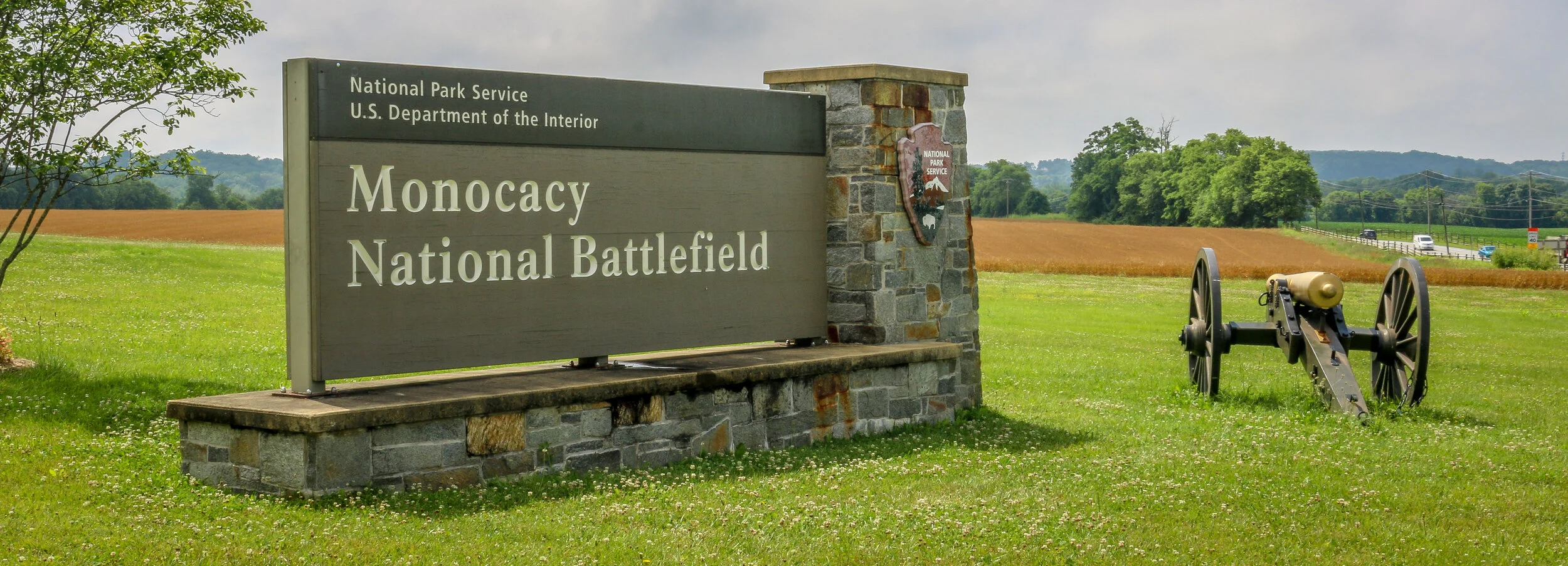
The photos below come from a recent visit to Monocacy National Battlefield Park just south of Frederick Maryland - site of the “Battle that Saved Washington”. Civil War Chronicles will trace the major battles of the Eastern Theater of the war through photos and brief histories.
The Battle of Monocacy is a bit of an outlier in that it wasn’t really a major battle of the Eastern Theater of the Civil War, but a minor one with major implications. While Generals Grant and Lee were engaged in the final grappling of the war around Petersburg, south of Richmond, Lee wanted a distraction to pull some of Grant’s army away. He attempted this by sending General Jubal Early to go on the offensive and attack into Union territory, the third Confederate invasion of the North during the war. Early was sent with 15,000 men to threaten Washington D.C. and, if possible, to raid the prison camp at Point Lookout and free the Confederate soldiers being held there. Lee also knew that a presidential election was looming and he hoped that another invasion of the North might bring about the defeat of Lincoln and a favorable end to the long and brutal war.
Early’s army crossed the Potomac River into Maryland on the 4th of July, 1864 and marched past Sharpsburg, the site of the Battle of Antietam two years earlier. You can’t march 15,000 infantry troops across a state without anyone noticing, and word quickly got to General Lew Wallace who was then the Union commander in Baltimore. Wallace gathered what men he could muster and quickly set off towards the west. Thinking quickly, Wallace decided to head towards Monocacy Junction, just south of Frederick, Maryland. He didn’t know where the Confederates were headed, but this point would allow his troops to defend the Georgetown Pike to Washington, the National Road to Baltimore and the Baltimore and Ohio Rail Line. If he got there first, he could strategically place his men along the Monocacy River and defend all three of those routes which crossed the river at that point. He arrived in time to dig in and establish a line of defense.
The Battle of Gettysburg which took place from July 1st-3rd, 1863 would be the bloodiest battle of the Civil War. 170,000 men would clash over those three hot days in July and over 50,000 would end up dead, captured, wounded or missing. While both armies were looking for a fight, neither expected it to be in this tiny Pennsylvania town.
After his dramatic victories at Fredericksburg and Chancellorsville, General Lee decided to once again push north into Union territory. He wanted a decisive victory on Northern soil to try and force President Lincoln to the negotiating table. Lee marched his Army of Northern Virginia north, crossed the Potomac River and moved through Maryland and into Pennsylvania. The Union’s Army of the Potomac, still under the command of General Hooker, pursued. By the end of June, General George Meade had replaced Hooker at the helm…
The photos below come from a recent visit to Gettysburg National Battlefield, the site of the bloodiest and most well known battles of the war. Civil War Chronicles will trace the major battles of the Eastern Theater through photos and brief histories
After being turned back south after the Battle of Antietam, Confederate General Robert E. Lee marched his army back to Virginia. Union General George McClellan was replaced by General Ambrose Burnside to command the Army of the Potomac, and President Lincoln urged Burnside to pursue the Army of Northern Virginia deep into the state and attack the Confederate Capital at Richmond. The major obstacle lying in their way was the Rappahannock River.
Burnside arrived at Stafford Heights overlooking the river and the small town of Fredericksburg in mid-November, 1862. He had sent orders to have pontoons at the ready to provide a means of bringing his army rapidly across the river. Tragically for Burnside and his men, the pontoons didn’t arrive for several weeks. Instead of crossing the river in boats or rafts, he chose to wait for the pontoons. By the time they got there, Confederate troops had dug in on the high ground south of the city called Marye’s Heights and behind a stone wall along a sunken road to the front of this position.
Union engineers worked through the night of December 10th to assemble the pontoon bridge, but their progress was slowed by Mississippi sharpshooters in town. A small group of Union soldiers crossed the river in boats and fought a battle to secure the streets of the town. They finally secured the town in late afternoon on the 11th, but it was winter and the daylight soon gave out. The bridge would be completed and most of the army would cross it on December 12th.
Antietam National Battlefield was the sight of the bloodiest day in American History and one of the best known battle of the American Civil War. Along Antietam Creek just north of the tiny town of Sharpsburg, Maryland, 100,000 soldiers marched into battle on September 17th, 1862. By the end of that day almost 23,000 were dead, wounded or missing.
After a Confederate victory at the 2nd Manassas/Bull Run, General Robert E. Lee pushed into the North for the first time. The Virginia countryside had been ravaged during the first year of the war, and Lee wanted to give it time to heal, plus a decisive victory in the North might bring President Lincoln to the negotiating table.
On September 15th, 1862, Lee crossed the Potomac River into Maryland and dug in along the high ground west of Antietam Creek. Union forces under Commanding General George McClellan moved in from the east. At dawn on September 17th, the battle began…
The photos below come from a cloudy visit to Antietam National Battlefield, the site of the bloodiest day in the American Civil War. Civil War Chronicles will trace the major battles of the Eastern Theater through photos and brief histories.


