Hello Everyone, it’s hard for me to even fathom that this is week 20 of this post series. I was hoping when I arrived home in the beginning of April that I would only be here for a few weeks and then I would be back out on the road, but here I am 20 weeks later. I’m still enormously grateful to have a place to weather this storm, especially knowing that things could be much worse if I didn’t. I just wish I knew what the end date to all of this was so I could make some plans. It’s been a quietly busy week here in Washington and I’ve actually done quite a bit which has been really nice. I’ve also had some good news in my feed this week which also helps. One of my best friends welcomed a new baby boy to the world this week in New Orleans, so welcome Theodore. Another friend of mine from grade school has announced his wife’s pregnancy this week as well. These are both reminders to me that the world has continued to turn even if my wheels have stopped doing so.
Last Thursday I began a new role which I’ve really enjoyed, even though I’ve only done it a couple of times. My friend James was called back to work after a few months of furlough, but his two year old son’s daycare is still closed. So I’m going to be spending some time with young Mason over the next few weeks or months so they can work and we can play. Mason is a sweet kid, and it’s been a real treat to watch him. His smiles and laughter are such a counterbalance to the challenges we are facing in this country and in the world, and it’s a welcome change. I’ve always loved working with kids, and it’s a wonderful opportunity to spend some time watching him grow up. It’s been great to experience the world through his eyes and I’ll be gladly helping out with this for a while until things change. That could happen tomorrow or a year from now, we’ll just have to wait and see.
Last weekend was also a lot of fun here. After celebrating the “holidays” the last few weeks, we settled in on Friday for a quiet “pub night” of wings, nachos and beers. It was nice to have a relaxing night, listen to some good music and enjoy our time together. Saturday my mom and I headed out to check out some of Washington D.C.’s oldest firehouses for an upcoming photo essay I’m putting together
Last week I decided I wanted to check out a little bit of history and a little bit of seascape as well. It’s the middle of summer and I miss the beach but I’m not heading to the crowded Atlantic beaches right now. So I settled on a Chesapeake Bay view from the western shore towns of North Beach and Chesapeake Beach, only about an hour from Washington D.C. at a straight shot. I also wanted to take some photos at the beautiful Maryland State Capitol Building and wander around Annapolis’ Historic District as well. Connecting these two is Maryland’s Roots and Tides Scenic Byway.
Obviously, some of the key highlights of the journey were closed due to the pandemic, but I still enjoyed a little meander through the countryside, and the beach communities I ended up at sated my need for a little bit of time on the water. It’s definitely good to be out exploring, and I really enjoyed the Roots and Tides Scenic Byway. I hope you enjoy the photos I took along the way…
Hey y’all. How’s everyone doing out there? Another week has come and gone sheltered in place here in Washington D.C. It’s had its ups and downs, like every week has, but I’m feeling a lot more positive this week than I was last week. I’ve gotten out of the house more (though not as much as I need to be), and have gotten back to playing my guitar and avoiding the news as much as possible. As July begins, it continues to heat up here in our Nation’s Capital, and 90+ degree days with high humidity are prevalent in the forecast. I’m getting up earlier to get my walk in before the heat really takes hold of the day and trying to get outside in the evening as well when it cools off again. Meanwhile I’ve been eating a lot of watermelon because really is there anything better than cold watermelon in the middle of a heat wave? I can say that before this summer I only knew how to cut a watermelon into slices. Now I’ve watched some videos on the subject and can cut a whole one into chunks pretty easily (seriously, there are some fascinating methods out there). I’ve also found that making watermelon balls, covering them in vodka and freezing them are quite the treat! In short, despite the heat it’s been a decent week and watermelon is delicious.
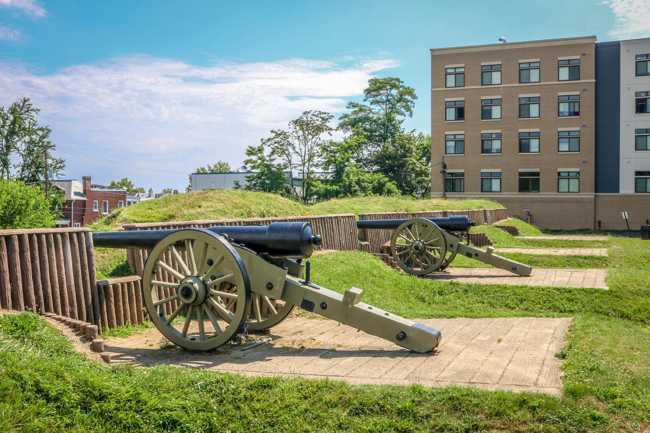
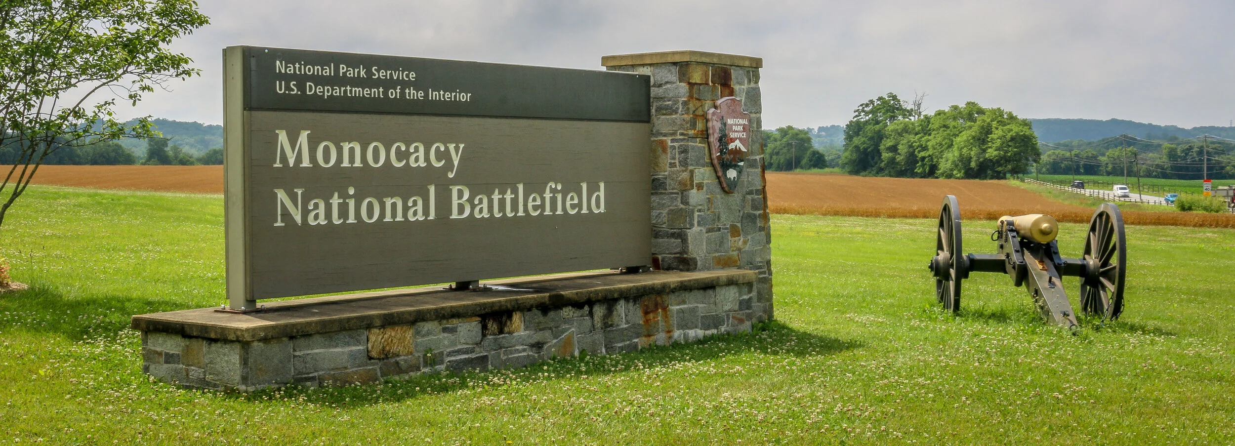
Thursday was an interesting day. As a follow-up to our Tuesday trip to Monocacy Battlefield, we wanted to go and visit Fort Stevens, the site of the only Civil War battle fought inside Washington D.C. After the 1864 Battle of Monocacy, Confederate General Jubal Early trained his sights on the Nation’s Capital. Thankfully, the delay at Monocacy had allowed reinforcements to be brought north from Richmond in steamships and the Confederates were turned out. President Lincoln was there that day and it was the only time that a sitting president has come under enemy fire during a war.
Having been rebuilt by the Civilian Conservation Corps during the New Deal and now administered by the National Park Service, Fort Stevens is the only one of our many forts which actually looks like a fort as most have been turned into parks and receded into the landscape. There isn’t much to it, but it’s only 10 minutes from our house so it was an easy place to visit. After wandering around the fort, we headed up Georgia Avenue to Battlefield National Cemetery, where 40 of the Union soldiers who had been killed during the battle are buried. With just an acre of property in the heart of the city, it is one of the smallest National Cemeteries in the country, and is really quite interesting to visit…
The photos below come from a recent visit to Fort Stevens in Washington D.C. - site of the only battle fought inside D.C. during the Civil War, and of Battleground National Cemetery up the street. The final photo came from Grace Episcopal Church in Silver Spring, MD. Civil War Chronicles will trace the major battles of the Eastern Theater of the war through photos and brief histories.
After overcoming Union General Lew Wallace and his men at the Battle of Monocacy on July 9th, 1864,, Confederate General Jubal Early continued his march towards the Capital of Washington D.C. The Confederate soldiers made the march in two days. Thankfully, Wallace had delayed the Confederates long enough for General Grant to send reinforcements via steamship from Richmond who soon took up position in the northern section of the circle of forts surrounding the city. Fort Stevens guarded the 7th Street Pike, one of the main roads into the city (now Georgia Avenue).
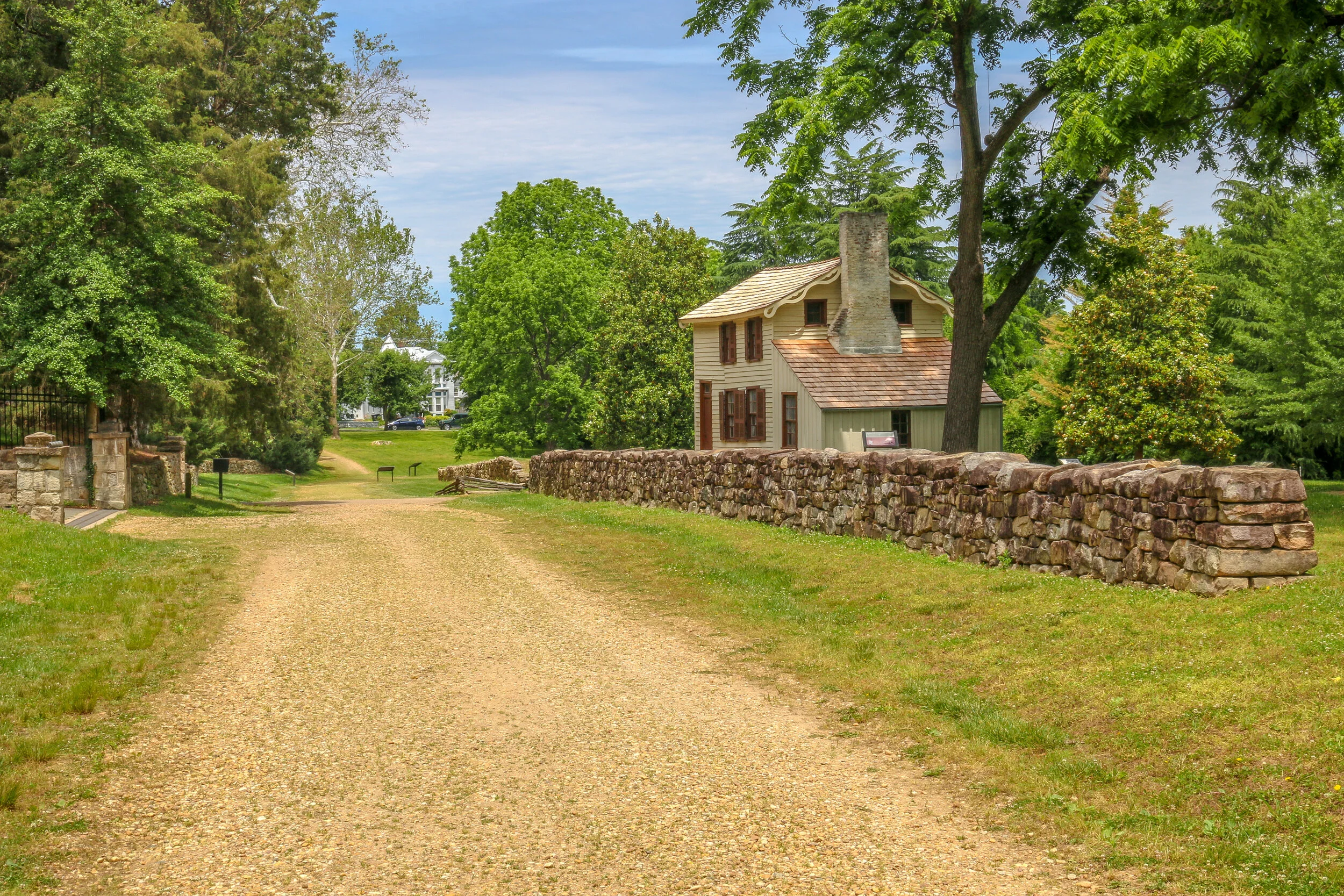
The armies exchanged fire on July 11th and 12th, but Early felt the city was too heavily defended to mount a full scale attack. Both sides lost men in the skirmishing, but casualties were relatively light by Civil War standards. Notably, President Abraham Lincoln came to Fort Stevens on July 12th with his wife, Mary. The two came under fire, the only time in American history that a sitting president was in the direct line of enemy fire. A memorial stone on the parapet marks that location today. That evening, Early would withdraw his men through Maryland and cross the Potomac back into Virginia, marking the end of the final Confederate attack into the North. They paused briefly en-route to bury 17 of their dead comrades at Grace Episcopal Church in Silver Spring…
The photos below come from a recent visit to Monocacy National Battlefield Park just south of Frederick Maryland - site of the “Battle that Saved Washington”. Civil War Chronicles will trace the major battles of the Eastern Theater of the war through photos and brief histories.
The Battle of Monocacy is a bit of an outlier in that it wasn’t really a major battle of the Eastern Theater of the Civil War, but a minor one with major implications. While Generals Grant and Lee were engaged in the final grappling of the war around Petersburg, south of Richmond, Lee wanted a distraction to pull some of Grant’s army away. He attempted this by sending General Jubal Early to go on the offensive and attack into Union territory, the third Confederate invasion of the North during the war. Early was sent with 15,000 men to threaten Washington D.C. and, if possible, to raid the prison camp at Point Lookout and free the Confederate soldiers being held there. Lee also knew that a presidential election was looming and he hoped that another invasion of the North might bring about the defeat of Lincoln and a favorable end to the long and brutal war.
Early’s army crossed the Potomac River into Maryland on the 4th of July, 1864 and marched past Sharpsburg, the site of the Battle of Antietam two years earlier. You can’t march 15,000 infantry troops across a state without anyone noticing, and word quickly got to General Lew Wallace who was then the Union commander in Baltimore. Wallace gathered what men he could muster and quickly set off towards the west. Thinking quickly, Wallace decided to head towards Monocacy Junction, just south of Frederick, Maryland. He didn’t know where the Confederates were headed, but this point would allow his troops to defend the Georgetown Pike to Washington, the National Road to Baltimore and the Baltimore and Ohio Rail Line. If he got there first, he could strategically place his men along the Monocacy River and defend all three of those routes which crossed the river at that point. He arrived in time to dig in and establish a line of defense.
After being turned back south after the Battle of Antietam, Confederate General Robert E. Lee marched his army back to Virginia. Union General George McClellan was replaced by General Ambrose Burnside to command the Army of the Potomac, and President Lincoln urged Burnside to pursue the Army of Northern Virginia deep into the state and attack the Confederate Capital at Richmond. The major obstacle lying in their way was the Rappahannock River.
Burnside arrived at Stafford Heights overlooking the river and the small town of Fredericksburg in mid-November, 1862. He had sent orders to have pontoons at the ready to provide a means of bringing his army rapidly across the river. Tragically for Burnside and his men, the pontoons didn’t arrive for several weeks. Instead of crossing the river in boats or rafts, he chose to wait for the pontoons. By the time they got there, Confederate troops had dug in on the high ground south of the city called Marye’s Heights and behind a stone wall along a sunken road to the front of this position.
Union engineers worked through the night of December 10th to assemble the pontoon bridge, but their progress was slowed by Mississippi sharpshooters in town. A small group of Union soldiers crossed the river in boats and fought a battle to secure the streets of the town. They finally secured the town in late afternoon on the 11th, but it was winter and the daylight soon gave out. The bridge would be completed and most of the army would cross it on December 12th.
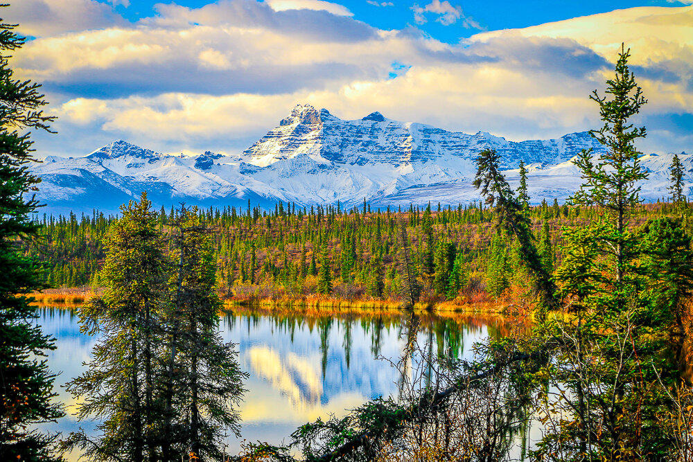
They say a picture is worth a thousand words. In this series I’ve chosen one picture per post which brings out strong memories for me and has a story attached to it. This story is about a beautiful morning along the Nabesna Road in Wrangell-St. Elias National Park, my last morning in Alaska.
It all started with a cigarette.
I haven’t been a regular smoker for many years, but sometimes when I had worked a long season guiding tours and the days were turning cooler as summer turned to fall, I’ve been known to pick up a pack. Usually before that pack is finished I’ll remember why I quit, but those first couple remind me why I started to begin with. And so it was that on a sunny afternoon in early fall I found myself smoking a cigarette outside of my hotel a few miles from LAX International Airport.
This was a hotel we used for our staff during turnarounds between tours in L.A, and there were a few other of our vans than mine in the parking lot that day. A fellow tour leader who I didn’t know had seen me get out of my van, so she came over and introduced herself. We made small talk about what trips we were doing and what else we were up to with a few days off in L.A. and she told me she was filling out an application to return to Alaska to work the following summer. In the company I work for, Alaska is like the Promised Land, it’s somewhere everyone seems to want to go spend the summer, but in the old days it was somewhere you only got to go once. One season in the great north land, and that was it. More recently, she told me, we had started running some high-end tours and they needed some experienced leaders to run them so the application process was open to everyone. We chatted some more, and it got me thinking…
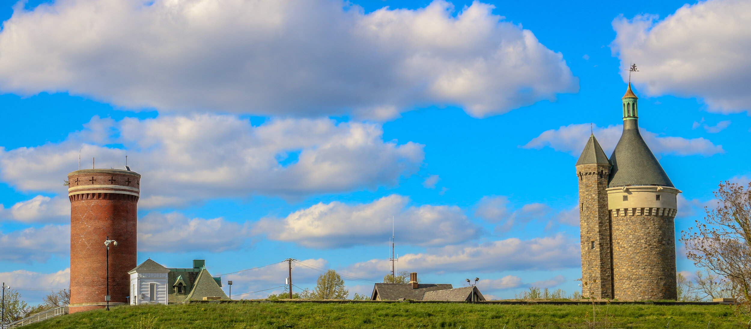
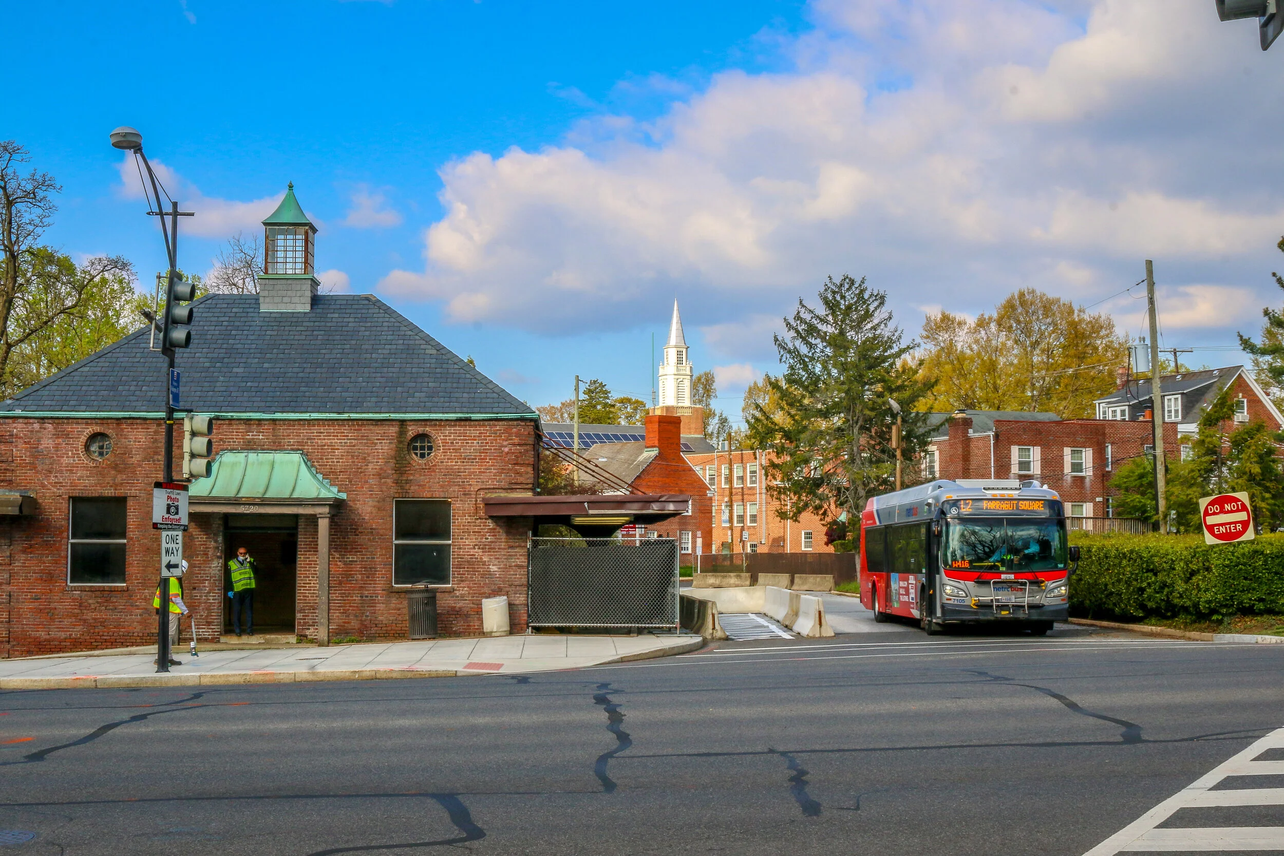
Tenleytown grew up around the intersection of what are now River Road and Wisconsin Avenue, two roads which long predate both the city of Washington D.C. and the United States. River Road, in fact, predates European settlement to the area altogether, serving as a Native American trail to the Potomac River. In the early days of European settlement, the roads were used to transport goods from surrounding farms to Georgetown, then a major port city on the river. It is not surprising, then, that John Tennally, from whom the neighborhood takes its name, would build a tavern and blacksmith shop at the intersection of these historic roads. A small community soon grew up around the tavern and was known as Tennally’s Town. During the Civil War, Fort Pennsylvania was built nearby to protect the Capital City and was later renamed Fort Reno. After the war, a small African-American community known as Reno City was built in the area. When a streetcar came through at the end of the 19th century which connected Tenleytown to Downtown Washington, the neighborhood began to grow and flourish. Woodrow Wilson High School, Alice Deal Middle School and a water revoir and water tower were built, sadly displacing many of the residents of Reno City in the process. A proposed hospital on the site was never built. As the neighborhood developed, two major retailers, Sears and Roebuck and Hechinger’s Hardware Store, opened for business in Tenleytown and a Metro station further connected the neighborhood to the rest of the city. Today, Tenleytown is embracing its history as one of the oldest neighborhoods in what is now Washington D.C. with a wonderful historic walking tour and several historic plaques around town.
Chevy Chase dates back all the way to 1725, when Col. Joseph Belt was granted 1000 acres by Lord Baltimore, the first proprietor of the Colony of Maryland. Col. Belt, who had commanded the Prince George’s County Militia in the French and Indian War, named his new farm Cheivy Chase after an area in Northern England. A portion of the land was bought up for development in the late 1800s, and lots began to sell when a streetcar line connected the neighborhood to downtown Washington. Many of the houses in Chevy Chase were bought straight from a Sears and Roebuck catalog and remain standing today. Much of the architecture in the area is in the humble Bungalow, Foursquare and Dutch Colonial styles, but many of my favorites are in the less well represented Tudor revival style. Some of the key landmarks of the community are Magruder’s Market which opened in 1875, the 1923 Avalon Theater and the far newer Chevy Chase Library and Community Center. Chevy Chase is my home neighborhood, and I have wonderful memories from my childhood of movies at the Avalon, art and gymnastics classes at the community center, going to the old Riggs Bank with my grandmother and for ice cream at the long-gone Baskin Robbins. I often take my morning walk up Connecticut Avenue, the central road of the neighborhood, and reminisce about times gone by and five generations of my family who have wandered these streets. It made my heart feel good to go out and shoot these photos of my home neighborhood.
South Texas was the end of the road for me on this leg of my journey. I set out to make it across the country to the Pacific Ocean and back over the next 16 months or so, but the coronavirus put an end to all of that. When things started going from bad to worse further north, I made my way all the way south to South Padre Island and Port Isabel, stopping off at Palo Alto National Historical Park along the way. The battlefield was awesome to see and I had it almost entirely to myself. I learned a lot about the first battle of the Mexican-American War, and the two future presidents (Ulysses S. Grant and Zachary Taylor) who fought in it. The prickly pears were just starting to bloom, and the day was just on the verge of being too hot to be out in the sun. It was a beautiful and fascinating place. From there I headed to the coast and hunkered down for almost a week. While everything was pretty much shut down, I enjoyed the beach, sand art, peace and quiet and beautiful sunsets on the bay. When Shelter-In-Place orders came down for the beach communities, I knew it was time for me to head home, making this the end of the road for now. I was glad I saw it and had the chance to spend some time in this tiny, far out corner of America.
Like many towns in America with Spanish Colonial roots, Goliad started out as a presidio (fort) and mission, both located on the San Antonio River. Presidio La Bahia and Mission Nuestra Señora del Espíritu Santo de Zúñiga had originally been located elsewhere, but were moved to their current location in 1749. One of the first schools in Texas was founded nearby in 1804. During the Mexican War for Independence, the presidio was a strategic target and changed hands between the Spanish loyalists and Mexican rebels several times. In 1829 La Bahia, the village which had grown up near the fort, changed its name to Goliad, an anagram of the name Hidalgo (minus the “H”) in honor of Father Miguel Hidalgo, a hero of the Mexican Revolution.
In the opening days of the Texas Revolution, American mercenaries captured the fort and held it for six months. It was within the fort’s walls that the first Texas Declaration of Independence was signed. In March of 1836, the American garrison, under the command of Colonel James Fannin, was defeated at the nearby Battle of Coleto. Under the agreement that they would be treated as prisoners of war, they surrendered and were marched back to the fort. A week later, on Palm Sunday, under the orders of Mexican President Antonio Lopez de Santa Anna, 342 of these men, including James Fannin, were marched out of the fort and executed. Just over three weeks after the massacre, at the decisive battle at San Jacinto, Sam Houston rallied his troops with cries of “Remember the Alamo, Remember Goliad” as he led his rebel army on to victory and Texas independence…
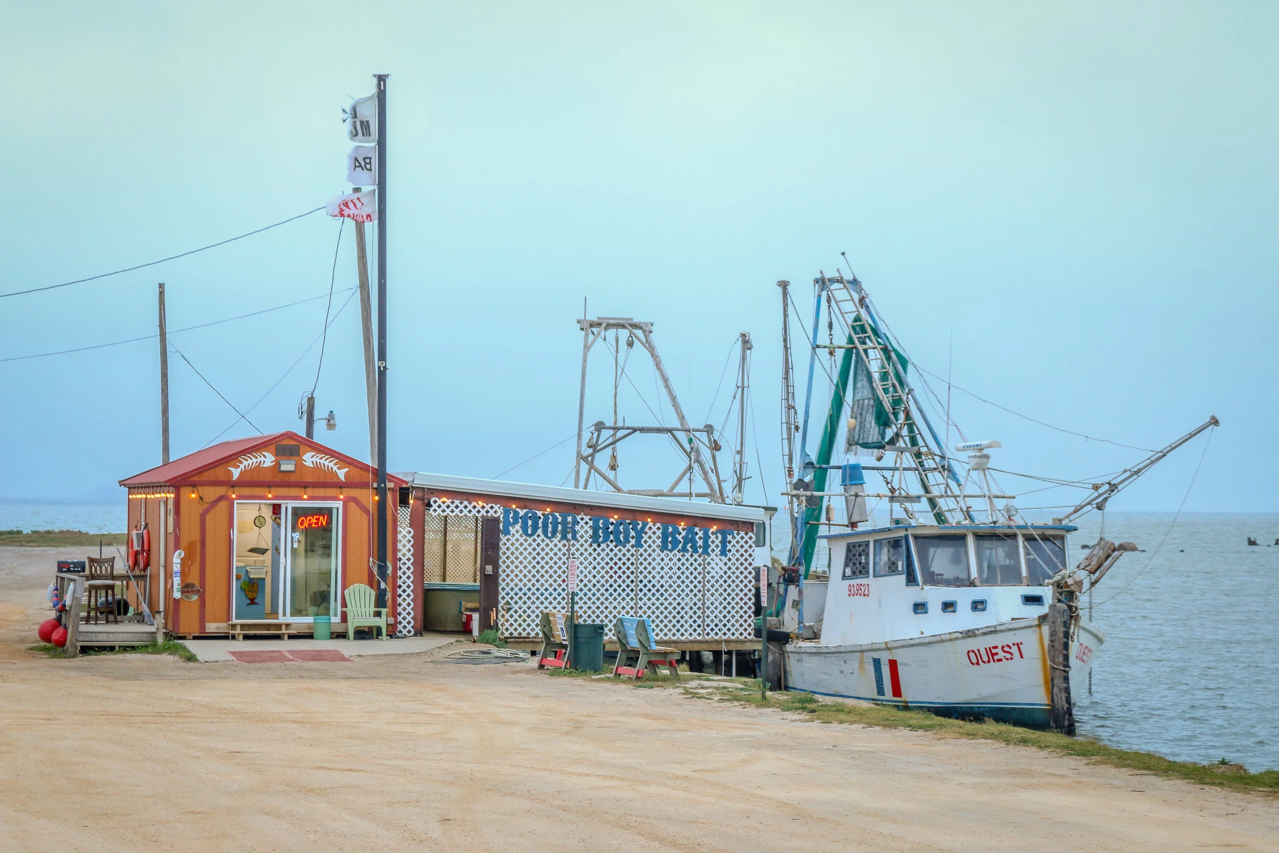
Port Lavaca is a lovely and quiet port town on Matagorda Bay and serves as the county seat of Calhoun County. Originally named simply La Vaca (“the cow”), the town was laid out in 1840 after Comanche raids forced people to abandon their homes in nearby Linnville. In addition to the port, the newly laid out town became the coastal terminus of a stagecoach route from Victoria, and eventually connected to the San Antonio and Mexican Gulf Railroad. In the early days, they did a fair trade in not just cattle, but also cotton, wool, pecans and precious metals. La Vaca lost its role as County Seat to nearby Indianola in 1852 but after a terrible hurricane hit the coast in 1886, it was moved back to La Vaca and remains there today. The port still plays a major role in the town’s economy, as do fishing and shrimping, but manufacturing employs many of the town’s residents today. I enjoyed my short stay in Port Lavaca with its charming downtown, beautiful marina and friendly people. I can see why locals refer to their hometown as “Paradise on the Bay”.


