Antietam National Battlefield was the sight of the bloodiest day in American History and one of the best known battle of the American Civil War. Along Antietam Creek just north of the tiny town of Sharpsburg, Maryland, 100,000 soldiers marched into battle on September 17th, 1862. By the end of that day almost 23,000 were dead, wounded or missing.
After a Confederate victory at the 2nd Manassas/Bull Run, General Robert E. Lee pushed into the North for the first time. The Virginia countryside had been ravaged during the first year of the war, and Lee wanted to give it time to heal, plus a decisive victory in the North might bring President Lincoln to the negotiating table.
On September 15th, 1862, Lee crossed the Potomac River into Maryland and dug in along the high ground west of Antietam Creek. Union forces under Commanding General George McClellan moved in from the east. At dawn on September 17th, the battle began…
The photos below come from a cloudy visit to Antietam National Battlefield, the site of the bloodiest day in the American Civil War. Civil War Chronicles will trace the major battles of the Eastern Theater through photos and brief histories.
On July 21st, 1861 the first major battle of the American Civil War took place near the town of Manassas, Virginia and just west of a meandering creek called Bull Run. The battle was supposed to be a quick and decisive one, and many congressmen and socialites rode out from Washington with picnic baskets to watch it unfold. 10 hours after the battle began, 900 young men lay dead on the battlefield and the bloodiest war in American history began in earnest. This first Battle of Bull Run at Manassas was also where General Thomas J. Jackson earned his nickname as General Barnard Bee commented to his men “There stands Jackson like a stone wall! Rally behind the Virginians”. By the end of the day, the Southerners had sent the Federals running back to Washington and won a major victory for the Confederacy.
Just over a year later, the two armies clashed once again near this critical rail junction just 25 miles from Washington D.C. For three days in August, the Battle of Second Bull Run at Manassas raged violently across the landscape. When the smoke cleared, 3,300 soldiers lay dead and the South once again claimed victory. General Robert E. Lee, now in charge of the South’s Army of the Potomac, knew that their breadbasket in Northern Virginia was running low, so he pushed the war across the Potomac River and into the North for the first time. The tides would turn at the battle of Antietam at Sharpsburg, Maryland. To learn about this next chapter in the war, check back for my next installment of the Civil War Chronicles, coming soon.
The photos below come from a cloudy visit to the Manassas National Battlefield, the site of two important battles from the American Civil War. Civil War
I hope you enjoy this post with photos and history from Forest Hills, a beautiful neighborhood in Northwest Washington D.C.
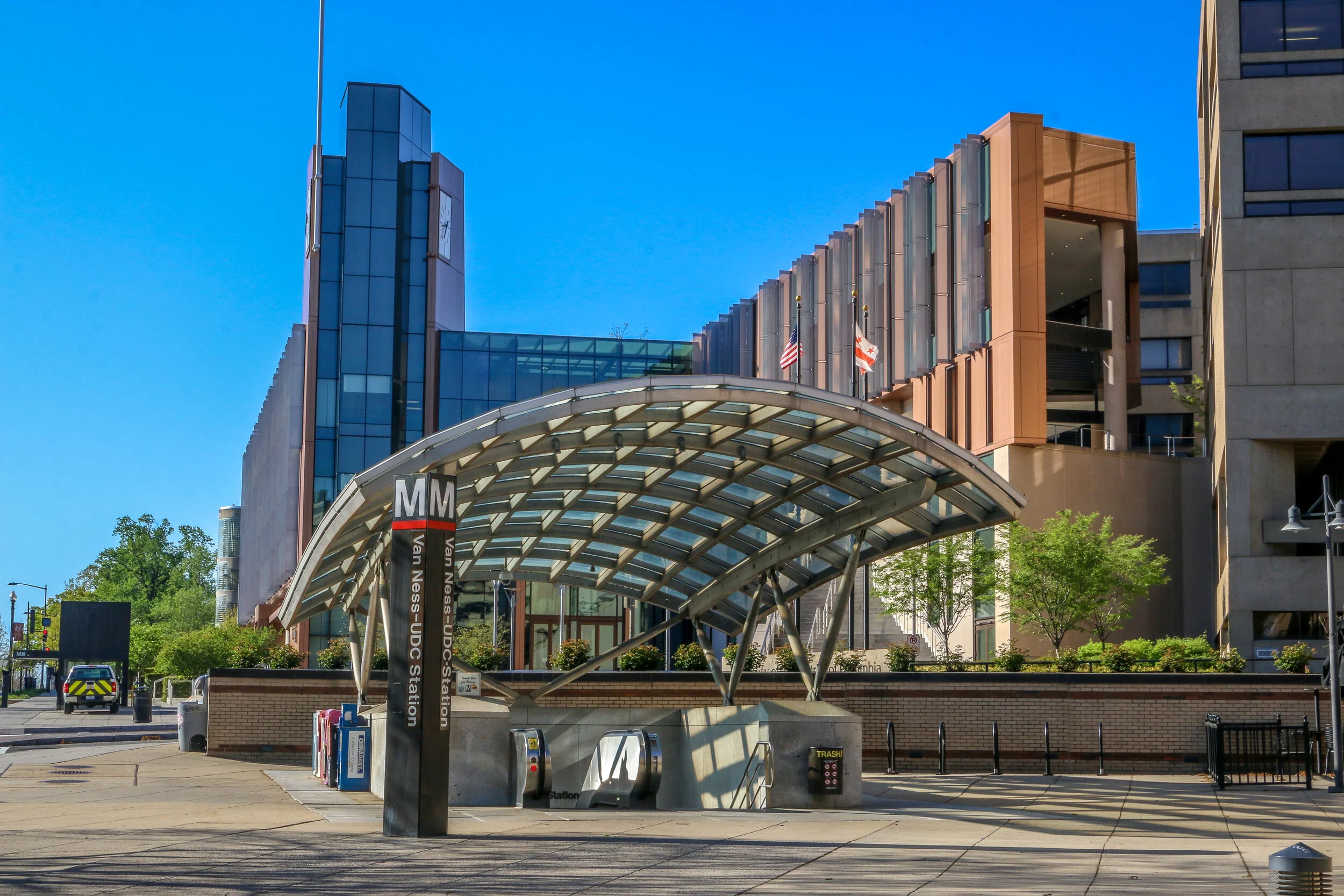
Resting quietly between Cleveland Park and Chevy Chase and bordered by Rock Creek Park to the east is the quaint neighborhood of Forest Hills. Those of us who grew up in the era of the Metro are probably more likely to think about this neighborhood as Van Ness/UDC. The station takes its name from Van Ness Street, the main cross street in the neighborhood, and the University of the District of Columbia. Since the northern border of the neighborhood is considered to be Nebraska Avenue, I grew up right across the street from Forest Hills.
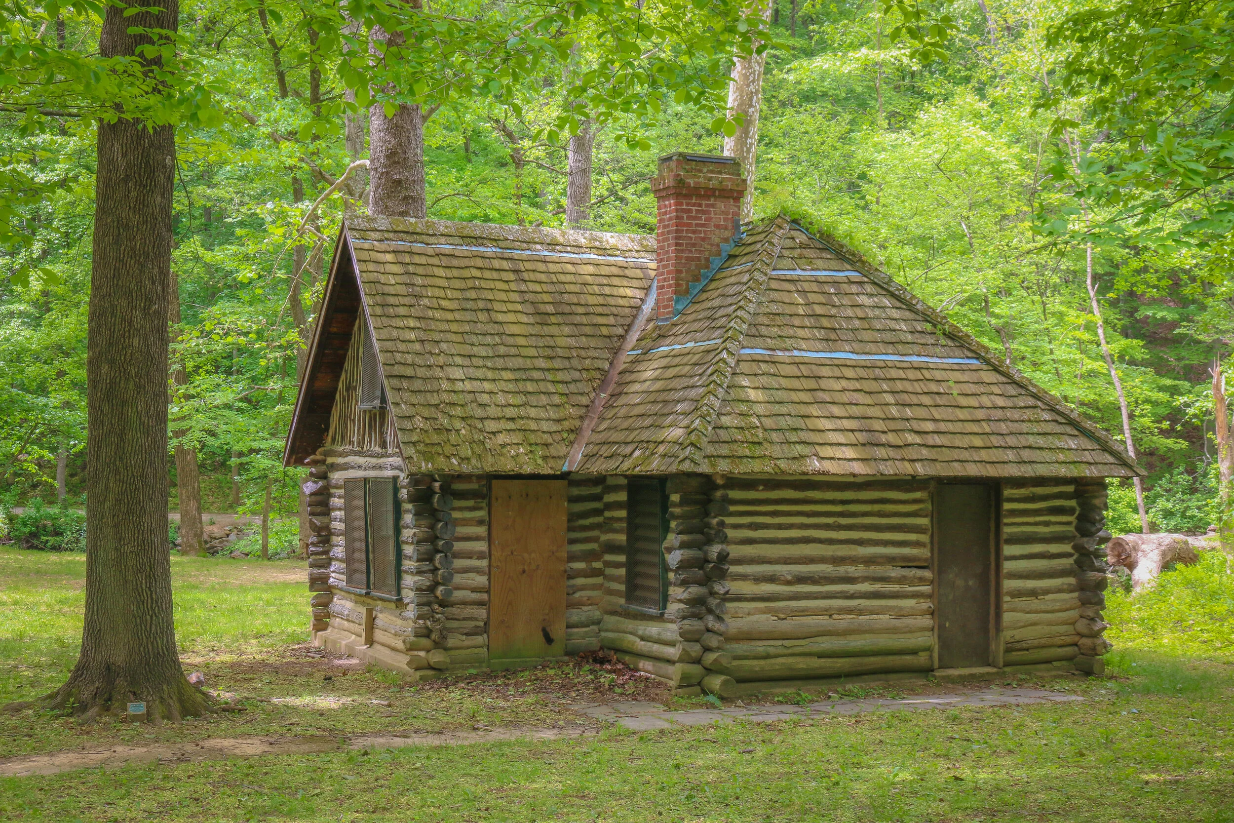
Once home to a Native American soapstone quarry, Forest Hills has quite an interesting history. In 1763, long before the creation of Washington D.C., Col. Samuel Beale was granted a tract of land by Lord Baltimore and named the area Azadia. Much of this tract would later be purchased by Isaac Pierce who would build his namesake mill along Rock Creek. In 1814, Revolutionary War veteran and retired land surveyor John Adlum bought a 200 acre tract of land in the area to start a vineyard. He named his estate Springland Farm and went on to become one of the first commercial producers of wine in the country (Adlum is buried at Oak Hill Cemetery in Georgetown). During the Civil War, Forest Hills was the site of Fort Kearny – one of the ring of forts protecting the Capital City…
Hello everyone, well we’ve made it through another week. I hope it’s been a good one wherever you’re reading this from today. Mine has been really good – probably the best I’ve had since returning home to D.C. now 2 months ago. After a positive start to being sheltered in place and having some free time to catch up on some work and try some fun stay-at-home hobbies, I really hit a downward spiral there for a while as claustrophobia and cabin fever kicked in. With the extended and indefinite closure of my industry (travel and tourism), I found myself staring out at an uncertain and challenging future. I usually keep my anxiety levels in check by being in control of certain aspects of the situation and then allowing the rest to unfold as it will. Under these circumstances, my environment is more controlled than usual, but there are thousands of moving pieces around the world that I have no control over, but which will help shape my near and distant future. I find that to be incredibly frustrating, and with limitations on how I normally deal with my frustration as the gym is closed, travel is limited and my camera is gathering dust.
I’m the kind of person who usually turns inward to sort things out, dealing with them in my own head with little or no outside influence. This week though, I’ve had a lot of outside influences help pull me up out of the mud. First I got some nice messages from some of y’all which is always appreciated. Believe me, I love to hear from you so don’t hesitate to comment or message me. Second, I met with a couple of different friend groups over Zoom which is always good. Third, I went to see some of my friends in person – masked and 10 feet apart, but it was still great to actually see people in the flesh. I hate the fact that I’m home and can’t see my friends or their kids, and this was a chance to at least pop around and say hello. And lastly, my mom came up with a plan to get us out of the house and provide some outlet for being stuck at home indefinitely.
Last Thursday, we went for a walk in Rock Creek Park, the large green space which surrounds its namesake creek through the middle of the city. We took a look at the earthworks that were once Fort DeRussy…
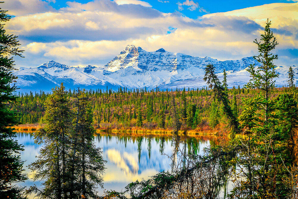
They say a picture is worth a thousand words. In this series I’ve chosen one picture per post which brings out strong memories for me and has a story attached to it. This story is about a beautiful morning along the Nabesna Road in Wrangell-St. Elias National Park, my last morning in Alaska.
It all started with a cigarette.
I haven’t been a regular smoker for many years, but sometimes when I had worked a long season guiding tours and the days were turning cooler as summer turned to fall, I’ve been known to pick up a pack. Usually before that pack is finished I’ll remember why I quit, but those first couple remind me why I started to begin with. And so it was that on a sunny afternoon in early fall I found myself smoking a cigarette outside of my hotel a few miles from LAX International Airport.
This was a hotel we used for our staff during turnarounds between tours in L.A, and there were a few other of our vans than mine in the parking lot that day. A fellow tour leader who I didn’t know had seen me get out of my van, so she came over and introduced herself. We made small talk about what trips we were doing and what else we were up to with a few days off in L.A. and she told me she was filling out an application to return to Alaska to work the following summer. In the company I work for, Alaska is like the Promised Land, it’s somewhere everyone seems to want to go spend the summer, but in the old days it was somewhere you only got to go once. One season in the great north land, and that was it. More recently, she told me, we had started running some high-end tours and they needed some experienced leaders to run them so the application process was open to everyone. We chatted some more, and it got me thinking…
They say a picture is worth a thousand words and as a visual storyteller I usually tell stories through my photos. Since I’ve been sheltered in place though, I haven’t been able to get out and take as many photos as I’m used to. But I was recently reminded that after 20 years on the road, I have a lot of stories to tell. So here’s a crack at some of them. One photo and a thousand words (this is a big story - it’s actually a fair bit longer than a thousand words, but I was never much for rules). So here’s my first crack at this - it’s also a story I tell in Episode 0 of my podcast which you can listen to HERE.
When I was a teenager, I was standing alone one day in the rain, and in a moment of youthful angst I felt overcome with the feeling that I was never going to live to see 30. Through the years I have seen this is a fairly common teenage phenomenon, but I didn't know that at the time. Some of it came from the media, and the exposure to the James Dean and Jim Morrisons and Kurt Cobains of the world. All the cool people died young. And some probably came from anxiety about getting older and watching our youth and vibrancy disappear, becoming more like our parents and teachers. But no matter where it came from, it weighed on me and I set out to live a life with the time that I had, with a sense of purpose and urgency. And I did.
My youthful desires were actually pretty easy to fulfill. At 16, I needed a car and wanted an old Mustang, so I bought a 1968 classic 289. It was a beautiful car!. At 20, I wanted to live at the beach and see what that was like, so during my last two summers in college and for a full year after I graduated, I lived in Myrtle Beach, South Carolina and partied like a rock star. Perhaps most of all though, from the time I was a kid, I wanted to see America. Fulfilling this goal wasn't as easy as the others until, one day, it was. At 24, as I set off on my career running nationwide tours, I saw my dreams become reality. Once I had seen the major American landmarks I had always been enthralled with, I set out into smaller towns and rural communities.
In 1713, two colonists were granted a tract of land extending from what is now Cleveland Park all the way to present-day Rockville. That tract long predates both the city of Washington DC and the United States as a whole, and its owners named it “Friendship”.
By the turn of the 20th Century, only two homes were located in the area, one was located a few hundred yards back from Wisconsin Avenue in a grove of silver maples, and the other lay closer to the road and was owned by the Ball family. This home had an attached blacksmith shop and also served as a changing station for stagecoaches bound between Rockville and Georgetown. In the early 1900s, trolley tracks were laid connecting Georgetown to Montgomery County, and the area became prime real estate.
Over the next decade, the land was purchased and subdivided by two men, Albert Shoemaker and Henry Offutt, and a small community began to developed. By 1914, the Village of Friendship Heights and The Hills was recognized by the state of Maryland, and the community around it was also known as Friendship Heights. This was a rural area, and an annual fall hog slaughter was a much anticipated event…
Another week has come and gone for me here in our Nation’s Capital, and with it the month of April is coming swiftly to a close. I have spent the entire month under quarantine here at home, and I know many of you have been shut in longer than I have. It has definitely become a “new normal” for me, and this week I’ve started to fall into a good rhythm and routine. I’ve also come to terms with the idea of being here for a while and am trying to make the best of it.
First off, I know how incredibly lucky I am to be in the situation I’m in. My folks have been willing to take me in for an indefinite amount of time. They have retirement income and no mortgage to worry about and we all have enough space to not be under each other’s feet all the time. I myself have no debt and really no bills to speak of and because I cut my winter travel plans way short, I still have a reasonable amount of savings in the bank. All of this is good news because as long as this will last for the country, it will last significantly longer for the travel industry. I would be surprised if there’s any real work for me at all this year. I am trying to scout out a few writing gigs and maybe some virtual guiding, but as far as multi-week face to face stuff, it could be a while.
The area we now call Cleveland Park in Washington D.C. was once a part of a massive 1000 acre estate owned by Colonel Ninian Biell. He called his estate Pretty Prospect and built a small stone cottage on the land in 1740. In 1790, the property was acquired by General Uriah Forrest, who would later become mayor of Georgetown, and a large wood-framed house was built onto the front of the stone cottage. Forrest renamed the property Rosedale. When his son inherited this land, he built an even bigger home and called it Forrest Hill. In 1886, Forrest Hill was purchased as a country retreat by then-president Grover Cleveland who converted the house into a Victorian mansion and renamed it Oak View. It is from President Cleveland that the current neighborhood takes its name.
After Cleveland lost his reelection bid in 1889, the land was purchased and converted into housing subdivisions. The neighborhood’s early success was made possible by the Rock Creek Railway line which ran up Connecticut Avenue from downtown all the way to Chevy Chase Lake in Montgomery County, Maryland. In order to make this streetcar line happen, a massive bridge had to be built over the Klingle Valley and Rock Creek connecting the area to the rest of the city. The neighborhood developed around the natural contours of the land, with a little help from the firm of landscape architect Frederick Law Olmstead, and you’ll find more winding roads here than in most parts of the city. Many of the houses were built to be unique to those around them and many were designed by renowned architects of the day. The result was that Cleveland Park was once heralded as the “prettiest suburb of Washington”, and many of those beautiful houses survive in the neighborhood today.
Hello Everyone! Well, another week has blurred past. It’s gotten a bit colder this week in Washington, but we’ve had a lot of sunshine which has helped prop up my spirits most days. It’s already light when I get up in the morning and the sun is out until almost 8 p.m. which I’m really enjoying. I’m looking forward to some beautiful spring days with plenty of sitting-outside weather in the coming weeks. We can fire up the barbecue and the outdoor fire pit and at least be able to enjoy the outdoor section of our shelter. I’ve still been getting out for at least one long walk a day, and the flowers are still fantastic around our part of the city. If nothing else it’s been wonderful to focus on the changing colors of spring in our Nation’s Capital.
Emotionally, it’s been another week of ups and downs though. I had another friend in my close friends network lose a parent this week, and my heart goes out to her and her family. Hard times on top of hard times. Meanwhile another friend is slowly recovering from the virus and doing better by the day. One of my good friends and loyal readers of this blog celebrated his birthday this week, so a big shout-out to Rob on his special day. Ten of us got together on Zoom to celebrate and it was good to see that particular group all in one place, even if it was done virtually. I have one photo that’s on the back of my sun visor in Shadow Catcher which I look at when I’m feeling particularly lonely on the road. Most of the people in that picture were on this call so it made me feel good to be a part of it. On Friday, my folks and I had a Roaring Twenties Prohibition Party in the basement. We sipped fancy cocktails, threw some dice, listened to some cool jazz and big band music and focused our attention away from the quarantine and virus for a few hours. It’s been really nice to have these “parties” and escape from reality for a little while.
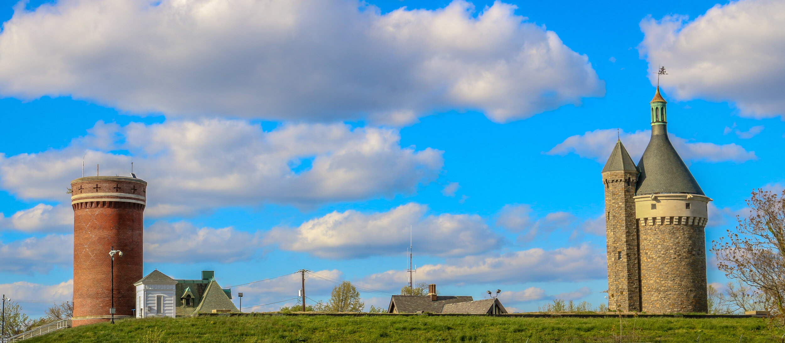
Tenleytown grew up around the intersection of what are now River Road and Wisconsin Avenue, two roads which long predate both the city of Washington D.C. and the United States. River Road, in fact, predates European settlement to the area altogether, serving as a Native American trail to the Potomac River. In the early days of European settlement, the roads were used to transport goods from surrounding farms to Georgetown, then a major port city on the river. It is not surprising, then, that John Tennally, from whom the neighborhood takes its name, would build a tavern and blacksmith shop at the intersection of these historic roads. A small community soon grew up around the tavern and was known as Tennally’s Town. During the Civil War, Fort Pennsylvania was built nearby to protect the Capital City and was later renamed Fort Reno. After the war, a small African-American community known as Reno City was built in the area. When a streetcar came through at the end of the 19th century which connected Tenleytown to Downtown Washington, the neighborhood began to grow and flourish. Woodrow Wilson High School, Alice Deal Middle School and a water revoir and water tower were built, sadly displacing many of the residents of Reno City in the process. A proposed hospital on the site was never built. As the neighborhood developed, two major retailers, Sears and Roebuck and Hechinger’s Hardware Store, opened for business in Tenleytown and a Metro station further connected the neighborhood to the rest of the city. Today, Tenleytown is embracing its history as one of the oldest neighborhoods in what is now Washington D.C. with a wonderful historic walking tour and several historic plaques around town.
Chevy Chase dates back all the way to 1725, when Col. Joseph Belt was granted 1000 acres by Lord Baltimore, the first proprietor of the Colony of Maryland. Col. Belt, who had commanded the Prince George’s County Militia in the French and Indian War, named his new farm Cheivy Chase after an area in Northern England. A portion of the land was bought up for development in the late 1800s, and lots began to sell when a streetcar line connected the neighborhood to downtown Washington. Many of the houses in Chevy Chase were bought straight from a Sears and Roebuck catalog and remain standing today. Much of the architecture in the area is in the humble Bungalow, Foursquare and Dutch Colonial styles, but many of my favorites are in the less well represented Tudor revival style. Some of the key landmarks of the community are Magruder’s Market which opened in 1875, the 1923 Avalon Theater and the far newer Chevy Chase Library and Community Center. Chevy Chase is my home neighborhood, and I have wonderful memories from my childhood of movies at the Avalon, art and gymnastics classes at the community center, going to the old Riggs Bank with my grandmother and for ice cream at the long-gone Baskin Robbins. I often take my morning walk up Connecticut Avenue, the central road of the neighborhood, and reminisce about times gone by and five generations of my family who have wandered these streets. It made my heart feel good to go out and shoot these photos of my home neighborhood.


