This post shares photos and a brief history of the The Old Stone House in Georgetown in Washington D.C.
The Old Stone House was built was built in 1765 on what was then Bridge Street (now M Street) in Georgetown, ten years before the Declaration of Independence and almost 30 years before the founding of Washington D.C. Built of locally quarried stone as a one story structure by a cabinetmaker named Christopher Layman, the building would serve as both his home and shop. After his death later that year, Layman’s widow sold the building to Cassandra Chew who added a rear kitchen in 1767 and a second floor soon thereafter. The third floor was added in the 1790s. Over the next hundred and fifty years, the building would change hands, and uses, many times. By 1953, when the National Park Service purchased the property, it was the site of a local car dealership. The Park Service has since restored much of the Old Stone House to an 18th Century appearance and it is open to the public as part of C & O Canal National Historical Park. It is considered the oldest standing structure in Washington D.C. on it’s original foundation, and is one of very few pre-Revolutionary buildings to be found in the District.
Interestingly, the Park Service points to a mistaken identity as one of the reasons the Old Stone House was preserved. On March 29th, 1791 George Washington was meeting with area landowners to discuss the purchase of land by the federal government to establish the new capital city.
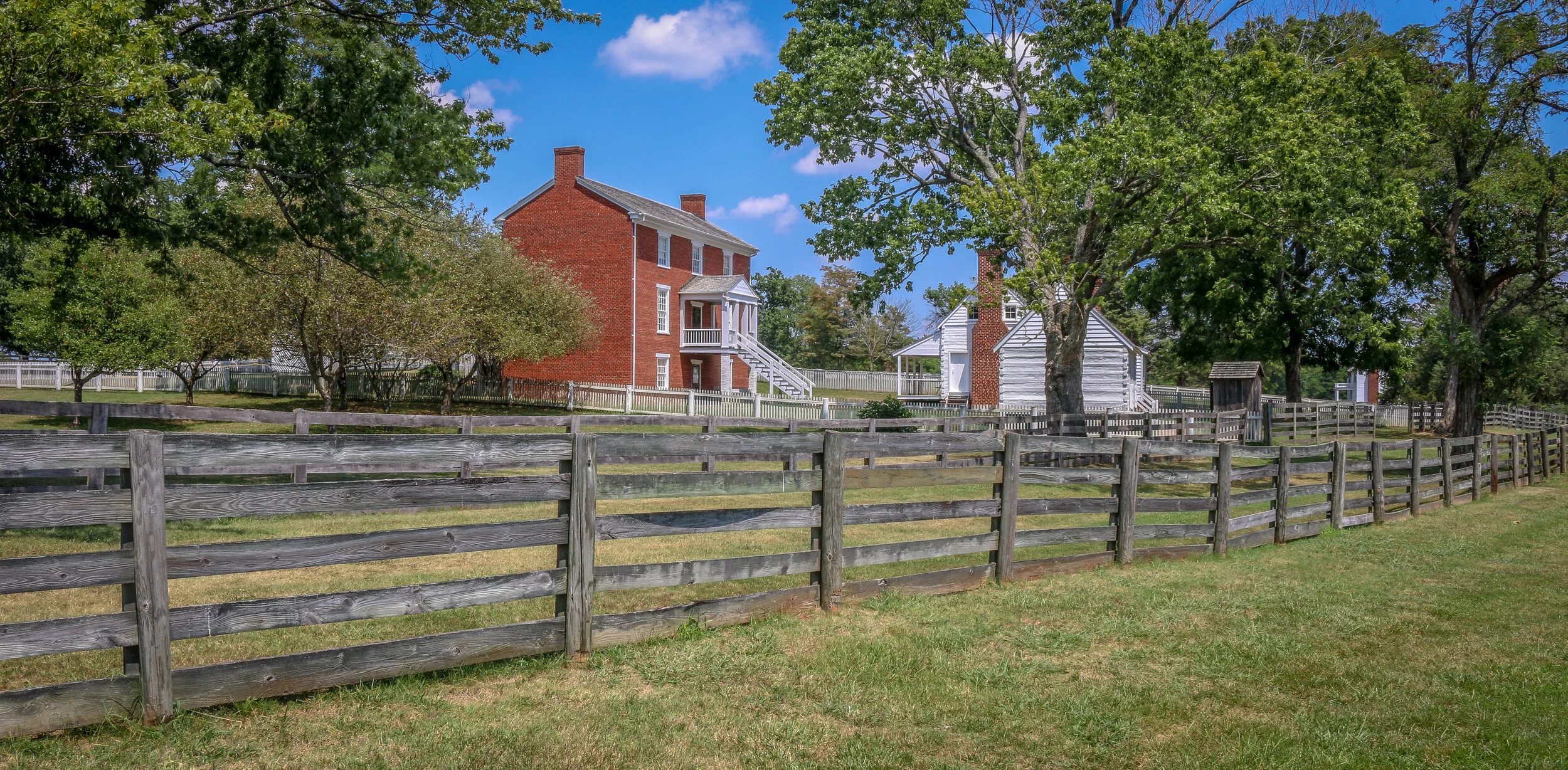
The photos below come from a recent visit to Appomattox Court House National Historical Park near the town of Lynchburg, Virginia. It was the site of the surrender of the Army of Northern Virginia which effectively ended the American Civil War.
After the siege of Petersburg and the fall of the Confederate Capital at Richmond, General Robert E. Lee led his Army of Northern Virginia west with the hopes of turning south to North Carolina and joining with General Joseph Johnson’s army there. They moved towards the train depot at Appomattox Station hoping to find much needed supplies waiting for them there. Union General Phillip Sheridan and his cavalry arrived first, capturing the supply trains and forcing Lee to turn his thoughts towards Lynchburg instead. Surrounded by Union troops, they made one final push at dawn on April 9th, 1865. It didn’t take long to realize that they were surrounded and Lee called for a meeting with Ulysses S. Grant to discuss the terms of surrender.
The site chosen for this conversation was the home of Wilmer McLean in the tiny village of Appomattox Court House. The generals met in the parlor, recreated above, to hammer out the details. The terms offered were very generous as the Confederate soldiers were to be immediately paroled and even allowed to keep their horses and sidearms. Their parole papers were printed in the nearby Clover Hill Tavern. The Southerners marched into town, stacked their rifles, turned over their cannons and marched out. While the surrender of Lee’s Army of Northern Virginia was not the end of the Civil War, there was little chance or hope for the Southern cause in its aftermath. The war would technically drag on until early summer, with skirmishes across the south, but the surrender at Appomattox Courthouse was the beginning of the end. Four long years of fighting which cost over 600,000 lives was finally nearing its conclusion…
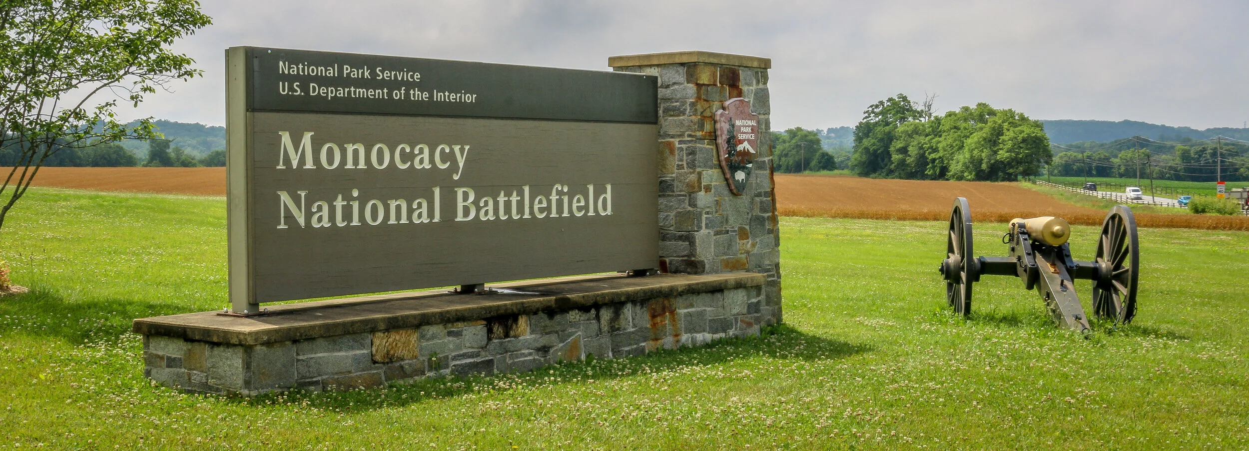
The photos below come from a recent visit to Monocacy National Battlefield Park just south of Frederick Maryland - site of the “Battle that Saved Washington”. Civil War Chronicles will trace the major battles of the Eastern Theater of the war through photos and brief histories.
The Battle of Monocacy is a bit of an outlier in that it wasn’t really a major battle of the Eastern Theater of the Civil War, but a minor one with major implications. While Generals Grant and Lee were engaged in the final grappling of the war around Petersburg, south of Richmond, Lee wanted a distraction to pull some of Grant’s army away. He attempted this by sending General Jubal Early to go on the offensive and attack into Union territory, the third Confederate invasion of the North during the war. Early was sent with 15,000 men to threaten Washington D.C. and, if possible, to raid the prison camp at Point Lookout and free the Confederate soldiers being held there. Lee also knew that a presidential election was looming and he hoped that another invasion of the North might bring about the defeat of Lincoln and a favorable end to the long and brutal war.
Early’s army crossed the Potomac River into Maryland on the 4th of July, 1864 and marched past Sharpsburg, the site of the Battle of Antietam two years earlier. You can’t march 15,000 infantry troops across a state without anyone noticing, and word quickly got to General Lew Wallace who was then the Union commander in Baltimore. Wallace gathered what men he could muster and quickly set off towards the west. Thinking quickly, Wallace decided to head towards Monocacy Junction, just south of Frederick, Maryland. He didn’t know where the Confederates were headed, but this point would allow his troops to defend the Georgetown Pike to Washington, the National Road to Baltimore and the Baltimore and Ohio Rail Line. If he got there first, he could strategically place his men along the Monocacy River and defend all three of those routes which crossed the river at that point. He arrived in time to dig in and establish a line of defense.
It’s been a warm week here in D.C. – summer has definitely arrived. I’ve had some nice days to get out and explore the city this week, but also some hot and humid ones and a few epic thunderstorms as well. It’s been a long time since I’ve experienced summer in our nation’s capital, and there are definitely pluses and minuses. I will say that the lack of traffic anywhere at any time makes the heat of summer a little more tolerable. As I’m sure I’ve mentioned before, that lack of traffic definitely makes for cleaner air and clearer skies – something my camera sees even more than I do. That is one of the plusses of the situation. We’ve been enjoying some summer fruit too, which is one of the best things about summer anywhere. We’ve had beautiful cherries, watermelon, strawberries and others and I’m looking forward to peaches very soon.
Last Friday my stepfather made some wonderful homemade pizzas and we sat in the basement and played some games and listened to some music while we chowed down on a couple of pies. It was another great Forget-About-It Friday, which we are grateful for. This coming week we will tap our homebrew and see how it turned out, and begin our next batch as well – an American Cream Ale. I’m looking forward to having a taste and to keeping the brewing going while I’m home. It’s fun and there’s a (hopefully) fine finished product at the end. After the cream ale, I want to try something a little more complicated now that I’m getting my brewing confidence back up.
The rest of the weekend was pretty quiet. My mom spent Saturday cooking up a storm and we had a wonderful dinner on Saturday night as well. Sunday I spent some time reading my new (to me) book about the Gettysburg Address which I’m really enjoying. I also got some photos edited and published from our trip to Antietam last week, and got some writing done as well. It was a pretty relaxing weekend all around, but it felt good to accomplish a few things along the way.
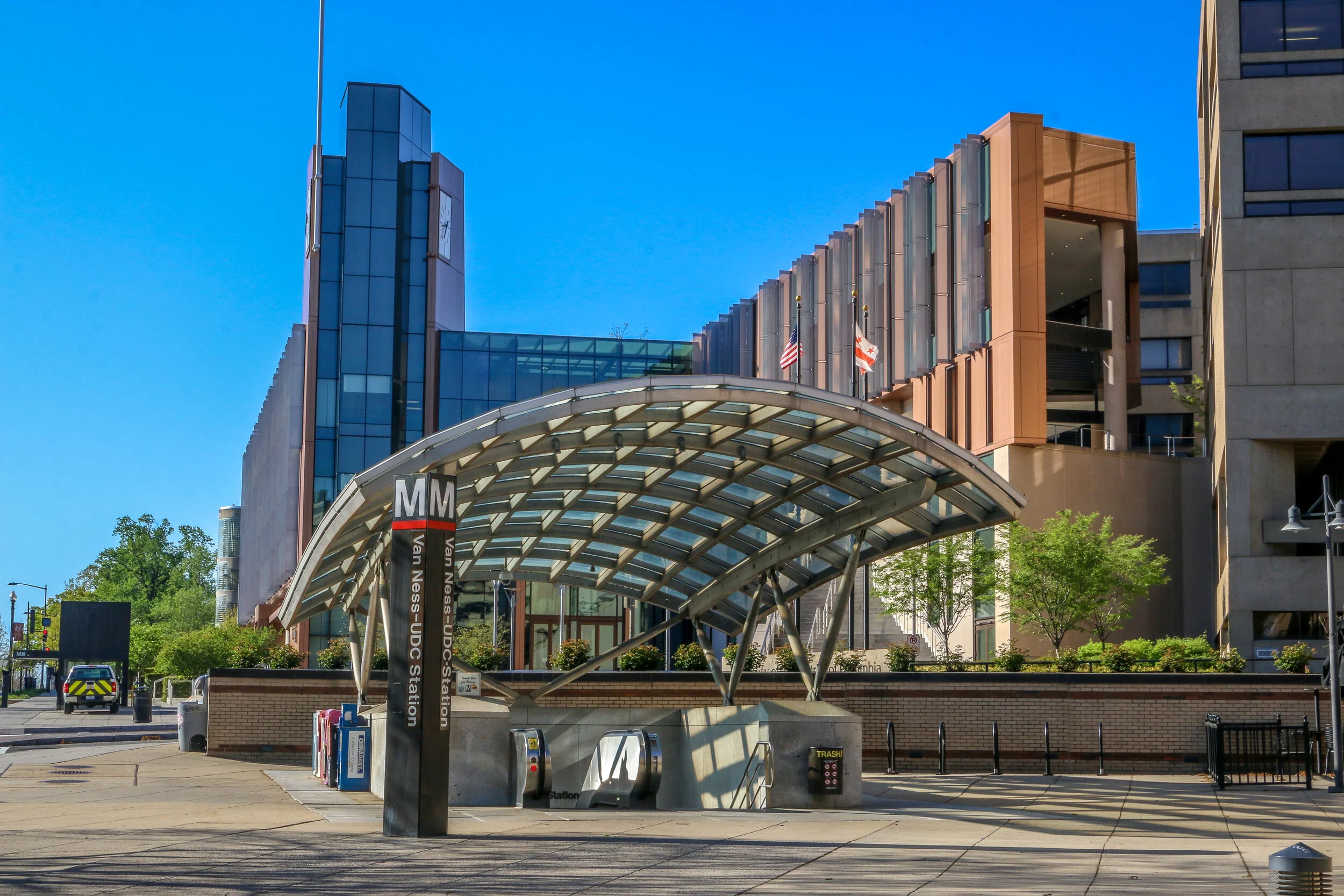
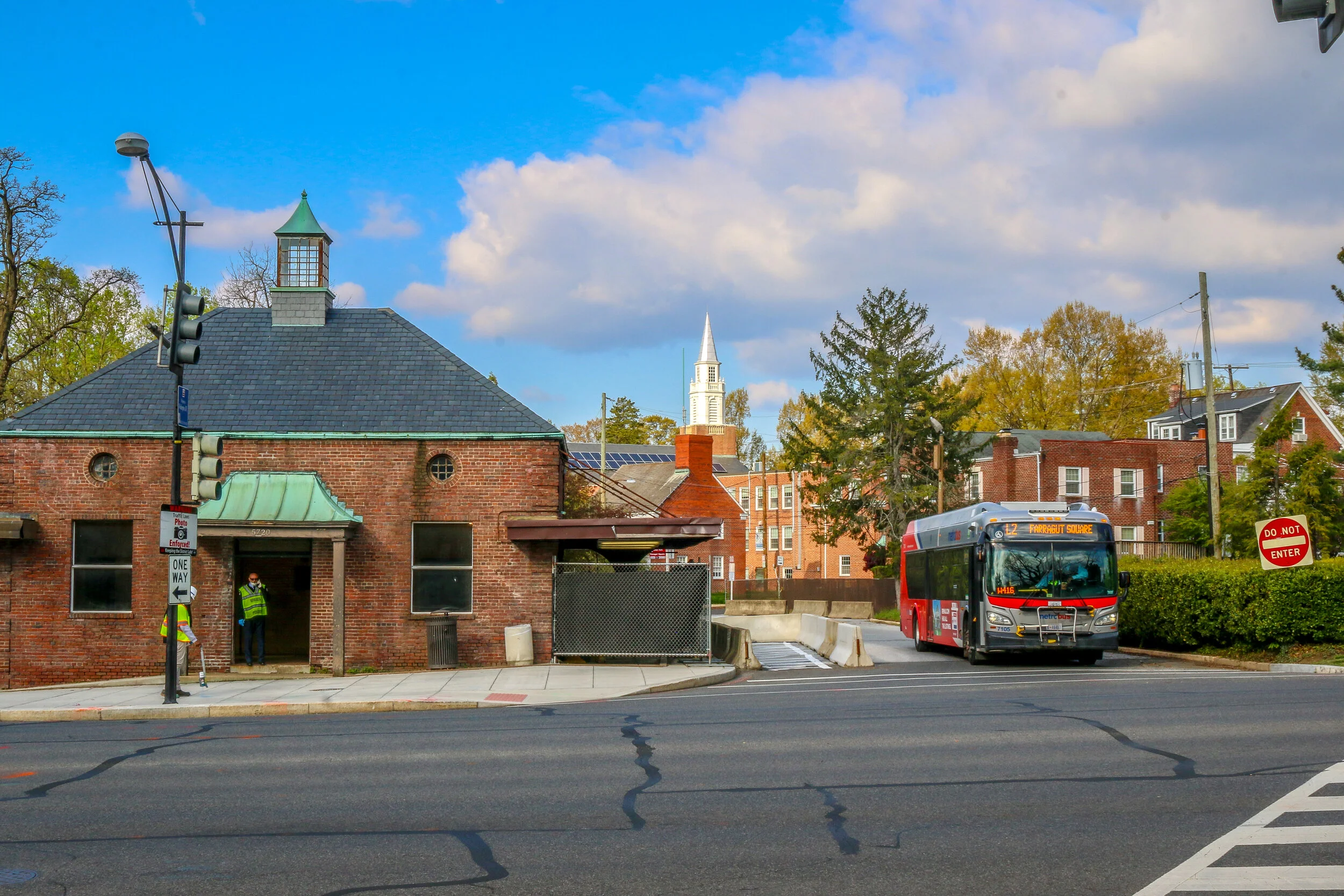
I hope you enjoy this post with photos and history from Forest Hills, a beautiful neighborhood in Northwest Washington D.C.
Resting quietly between Cleveland Park and Chevy Chase and bordered by Rock Creek Park to the east is the quaint neighborhood of Forest Hills. Those of us who grew up in the era of the Metro are probably more likely to think about this neighborhood as Van Ness/UDC. The station takes its name from Van Ness Street, the main cross street in the neighborhood, and the University of the District of Columbia. Since the northern border of the neighborhood is considered to be Nebraska Avenue, I grew up right across the street from Forest Hills.
Once home to a Native American soapstone quarry, Forest Hills has quite an interesting history. In 1763, long before the creation of Washington D.C., Col. Samuel Beale was granted a tract of land by Lord Baltimore and named the area Azadia. Much of this tract would later be purchased by Isaac Pierce who would build his namesake mill along Rock Creek. In 1814, Revolutionary War veteran and retired land surveyor John Adlum bought a 200 acre tract of land in the area to start a vineyard. He named his estate Springland Farm and went on to become one of the first commercial producers of wine in the country (Adlum is buried at Oak Hill Cemetery in Georgetown). During the Civil War, Forest Hills was the site of Fort Kearny – one of the ring of forts protecting the Capital City…
In 1713, two colonists were granted a tract of land extending from what is now Cleveland Park all the way to present-day Rockville. That tract long predates both the city of Washington DC and the United States as a whole, and its owners named it “Friendship”.
By the turn of the 20th Century, only two homes were located in the area, one was located a few hundred yards back from Wisconsin Avenue in a grove of silver maples, and the other lay closer to the road and was owned by the Ball family. This home had an attached blacksmith shop and also served as a changing station for stagecoaches bound between Rockville and Georgetown. In the early 1900s, trolley tracks were laid connecting Georgetown to Montgomery County, and the area became prime real estate.
Over the next decade, the land was purchased and subdivided by two men, Albert Shoemaker and Henry Offutt, and a small community began to developed. By 1914, the Village of Friendship Heights and The Hills was recognized by the state of Maryland, and the community around it was also known as Friendship Heights. This was a rural area, and an annual fall hog slaughter was a much anticipated event…
Tenleytown grew up around the intersection of what are now River Road and Wisconsin Avenue, two roads which long predate both the city of Washington D.C. and the United States. River Road, in fact, predates European settlement to the area altogether, serving as a Native American trail to the Potomac River. In the early days of European settlement, the roads were used to transport goods from surrounding farms to Georgetown, then a major port city on the river. It is not surprising, then, that John Tennally, from whom the neighborhood takes its name, would build a tavern and blacksmith shop at the intersection of these historic roads. A small community soon grew up around the tavern and was known as Tennally’s Town. During the Civil War, Fort Pennsylvania was built nearby to protect the Capital City and was later renamed Fort Reno. After the war, a small African-American community known as Reno City was built in the area. When a streetcar came through at the end of the 19th century which connected Tenleytown to Downtown Washington, the neighborhood began to grow and flourish. Woodrow Wilson High School, Alice Deal Middle School and a water revoir and water tower were built, sadly displacing many of the residents of Reno City in the process. A proposed hospital on the site was never built. As the neighborhood developed, two major retailers, Sears and Roebuck and Hechinger’s Hardware Store, opened for business in Tenleytown and a Metro station further connected the neighborhood to the rest of the city. Today, Tenleytown is embracing its history as one of the oldest neighborhoods in what is now Washington D.C. with a wonderful historic walking tour and several historic plaques around town.
Chevy Chase dates back all the way to 1725, when Col. Joseph Belt was granted 1000 acres by Lord Baltimore, the first proprietor of the Colony of Maryland. Col. Belt, who had commanded the Prince George’s County Militia in the French and Indian War, named his new farm Cheivy Chase after an area in Northern England. A portion of the land was bought up for development in the late 1800s, and lots began to sell when a streetcar line connected the neighborhood to downtown Washington. Many of the houses in Chevy Chase were bought straight from a Sears and Roebuck catalog and remain standing today. Much of the architecture in the area is in the humble Bungalow, Foursquare and Dutch Colonial styles, but many of my favorites are in the less well represented Tudor revival style. Some of the key landmarks of the community are Magruder’s Market which opened in 1875, the 1923 Avalon Theater and the far newer Chevy Chase Library and Community Center. Chevy Chase is my home neighborhood, and I have wonderful memories from my childhood of movies at the Avalon, art and gymnastics classes at the community center, going to the old Riggs Bank with my grandmother and for ice cream at the long-gone Baskin Robbins. I often take my morning walk up Connecticut Avenue, the central road of the neighborhood, and reminisce about times gone by and five generations of my family who have wandered these streets. It made my heart feel good to go out and shoot these photos of my home neighborhood.
Corpus Christi’s Marina Arts District is a wonderful story of urban renewal and public art. When Terry Sweeny moved to Corpus Christi in 2014, he found a city, like so many others, which had sold its soul to suburban sprawl. He also saw an area with tons of potential and set about trying to revitalize downtown. He joined forces with Brad Lomax, who had been working on revitalizing downtown Corpus Christi for years, and a dedicated group of like-minded citizens. The result is staggering. The colorful murals and public art projects make downtown look clean, sharp and vibrant. If you look closely enough, you’ll see that there are still plenty of empty storefronts looking for an opportunity to be resurrected, but they are hard to spot as your eyes are constantly drawn elsewhere. My favorite part is the wonderful seawall walk overlooking the marina on one side, and the Arts District on the other.
I enjoyed my time in the Marina Arts District even though I was there right as everything was closing up shop for a while due to the coronavirus. As I wandered around taking these photos, I heard wonderful music echoing up and down the empty streets. When I finally found where it was coming from, I sat for a few minutes to listen to the performance of a wonderful street musician in front of the shuttered Executive Surf Club. I needed a few songs in my day to blow thoughts of the virus away, and he gave me hope with his music. And hope is a wonderful thing. It is, in fact, the only thing more powerful than fear. I know I’ll be back in Corpus Christi at some point when all of this has blown over. I’m looking forward to it already.
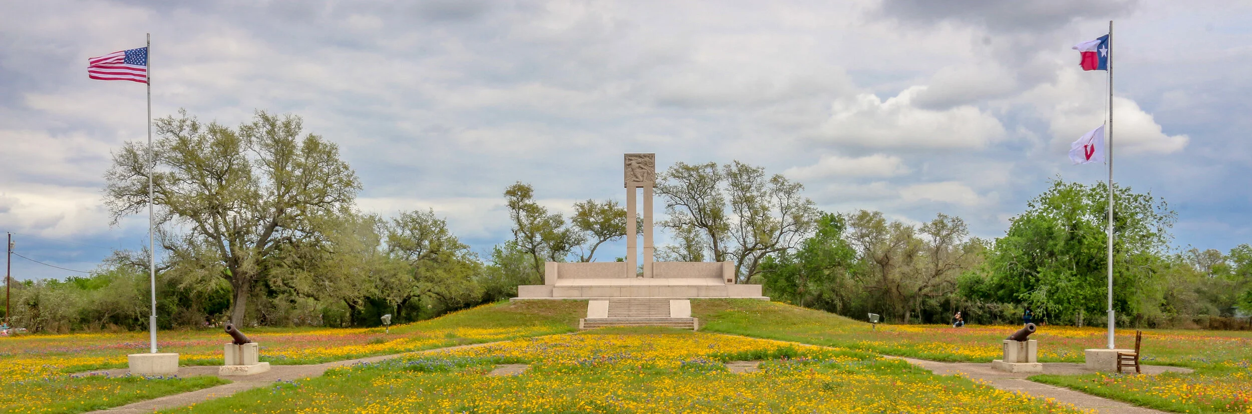
Like many towns in America with Spanish Colonial roots, Goliad started out as a presidio (fort) and mission, both located on the San Antonio River. Presidio La Bahia and Mission Nuestra Señora del Espíritu Santo de Zúñiga had originally been located elsewhere, but were moved to their current location in 1749. One of the first schools in Texas was founded nearby in 1804. During the Mexican War for Independence, the presidio was a strategic target and changed hands between the Spanish loyalists and Mexican rebels several times. In 1829 La Bahia, the village which had grown up near the fort, changed its name to Goliad, an anagram of the name Hidalgo (minus the “H”) in honor of Father Miguel Hidalgo, a hero of the Mexican Revolution.
In the opening days of the Texas Revolution, American mercenaries captured the fort and held it for six months. It was within the fort’s walls that the first Texas Declaration of Independence was signed. In March of 1836, the American garrison, under the command of Colonel James Fannin, was defeated at the nearby Battle of Coleto. Under the agreement that they would be treated as prisoners of war, they surrendered and were marched back to the fort. A week later, on Palm Sunday, under the orders of Mexican President Antonio Lopez de Santa Anna, 342 of these men, including James Fannin, were marched out of the fort and executed. Just over three weeks after the massacre, at the decisive battle at San Jacinto, Sam Houston rallied his troops with cries of “Remember the Alamo, Remember Goliad” as he led his rebel army on to victory and Texas independence…
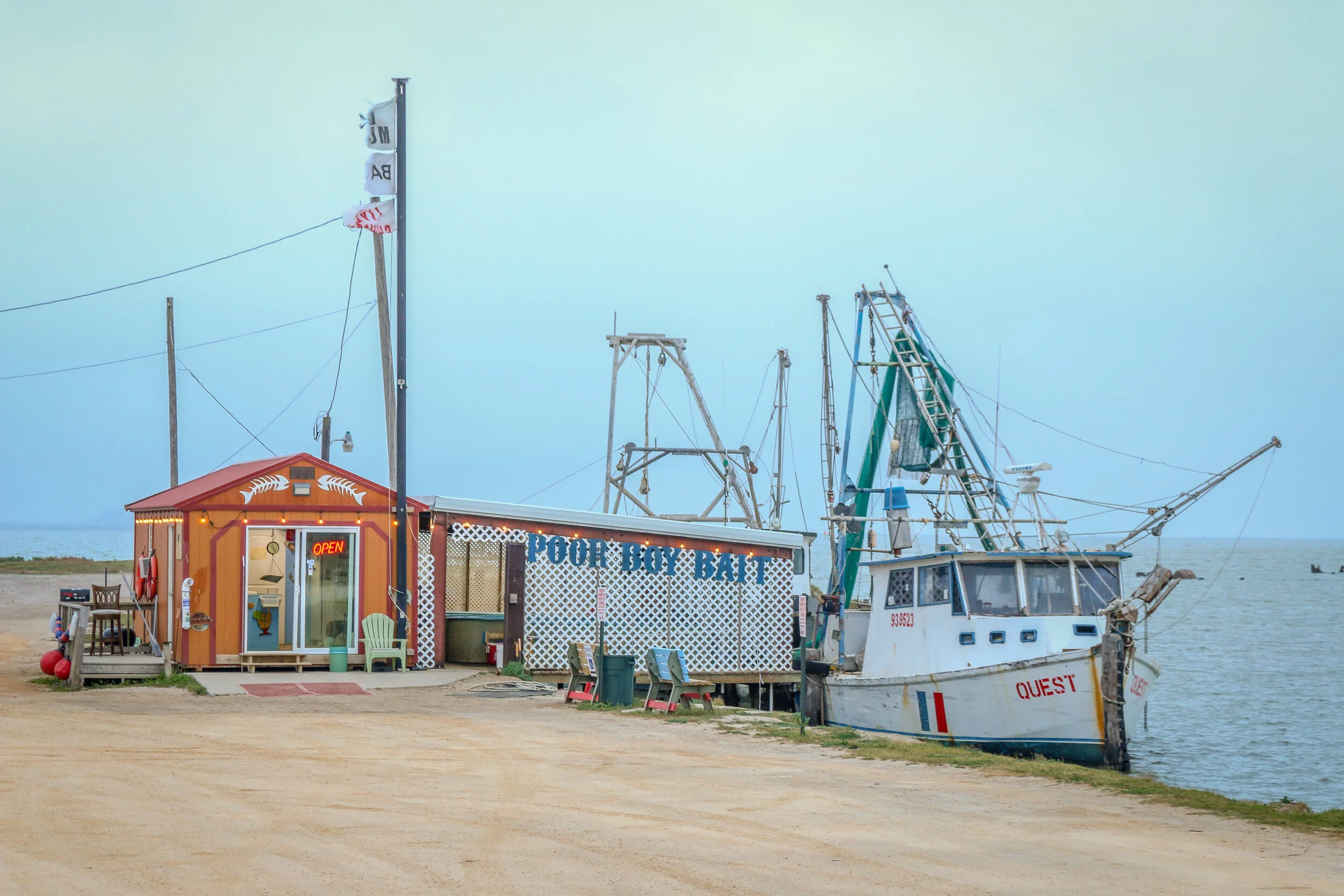
Port Lavaca is a lovely and quiet port town on Matagorda Bay and serves as the county seat of Calhoun County. Originally named simply La Vaca (“the cow”), the town was laid out in 1840 after Comanche raids forced people to abandon their homes in nearby Linnville. In addition to the port, the newly laid out town became the coastal terminus of a stagecoach route from Victoria, and eventually connected to the San Antonio and Mexican Gulf Railroad. In the early days, they did a fair trade in not just cattle, but also cotton, wool, pecans and precious metals. La Vaca lost its role as County Seat to nearby Indianola in 1852 but after a terrible hurricane hit the coast in 1886, it was moved back to La Vaca and remains there today. The port still plays a major role in the town’s economy, as do fishing and shrimping, but manufacturing employs many of the town’s residents today. I enjoyed my short stay in Port Lavaca with its charming downtown, beautiful marina and friendly people. I can see why locals refer to their hometown as “Paradise on the Bay”.
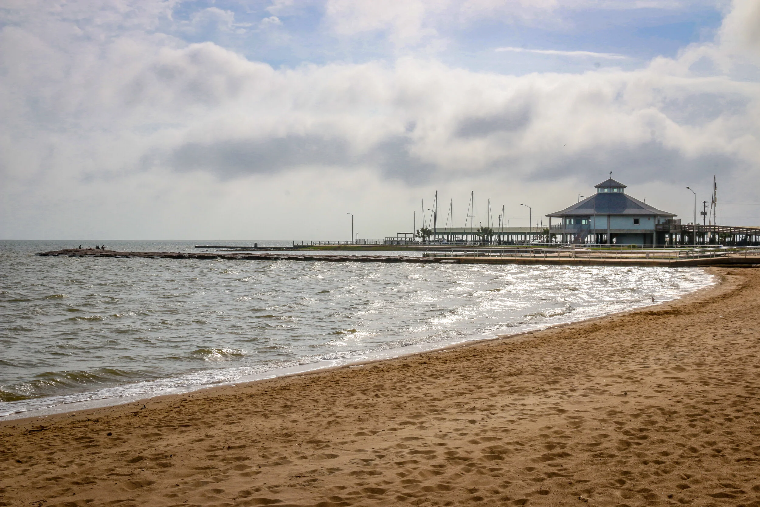
Originally home to the Karankawa people, Palacios was first settled by Europeans in the 1820s. In 1901, the land was purchased by a development company, divided into lots and sold to people looking to settle along the beautiful coast of the Gulf of Mexico. The Southern Pacific Railroad came through about the same time, providing overland access to the town-site. Over the next 20 years, the town grew as a resort community, and many businesses opened their doors to provide for the tourists flocking to the beaches. After World War I, a National Guard base called Camp Hulen opened nearby. The camp would be taken over by the War Department in World War II, eventually accommodating almost 15,000 soldiers. The base was also the site of a POW camp during the war. In the years following the war, Camp Hulen was closed and in 1961 Hurricane Carla slammed into the coast causing major damage. Today, Palacios is a quiet, pleasant seaside community of about 5,000. Home to about 400 shrimping boats, it has been called the Shrimp Capital of Texas. During my visit I found it quiet enough to enjoy its small-town tranquility but bustling enough to know it’s still alive and well. I had only planned on stopping for a few minutes to enjoy some sun by the water, and ended up staying most of the day, taking these photos, enjoying the views and chatting with the locals. I hope you enjoy these photos of Palacio, Texas, Matagorda County’s City by the Sea.