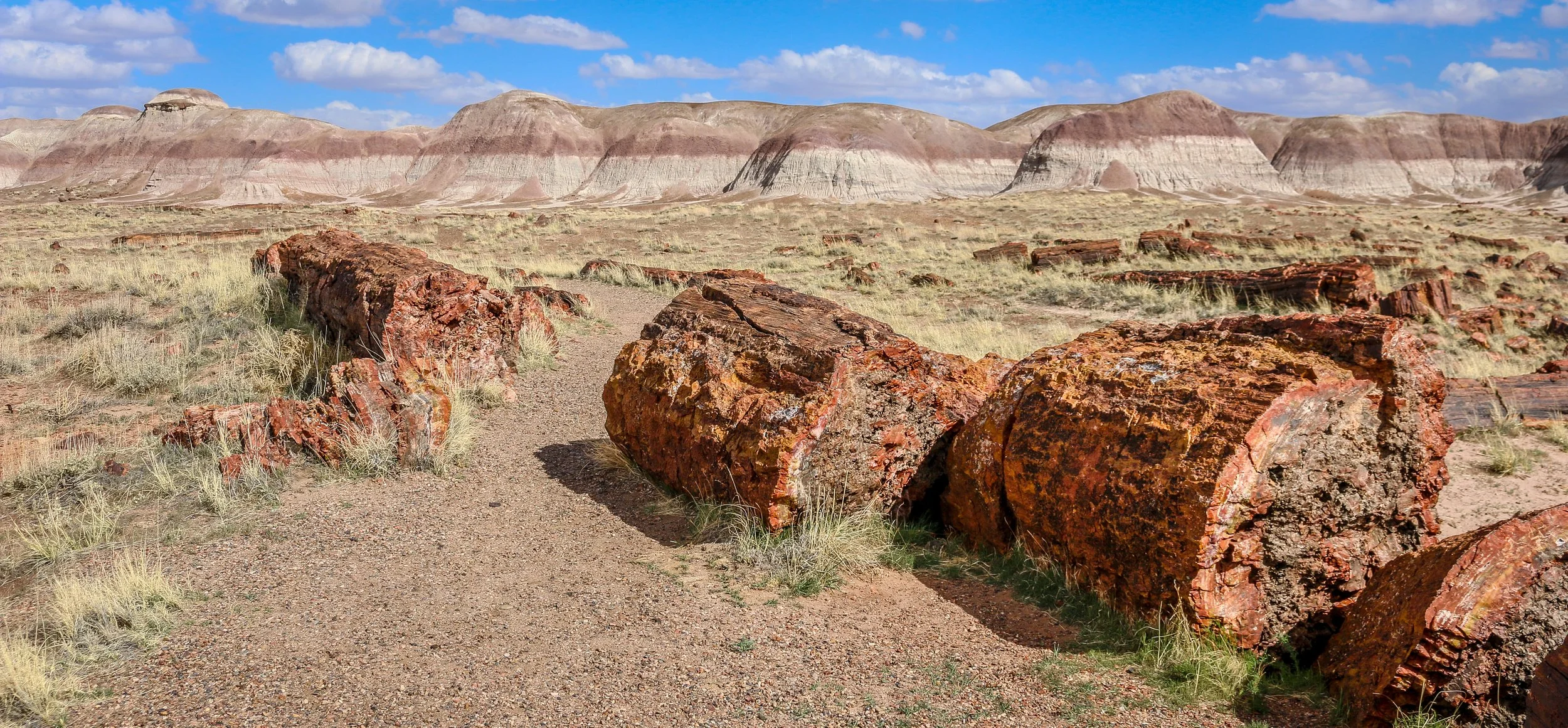
Petrified Forest National Park in eastern Arizona contains a beautiful collection of petrified wood and also includes the Painted Desert, Blue Mounds and an old stretch of Route 66. It’s a park best explored by car, but you won’t really appreciate it unless you get out and hike out into the wilderness. Petrified Forest was designated a National Monument back in 1906 and was upgraded to a National Park in 1962. I enjoyed my visit to the park and hope you enjoy these photos I took exploring the Petrified Forest.
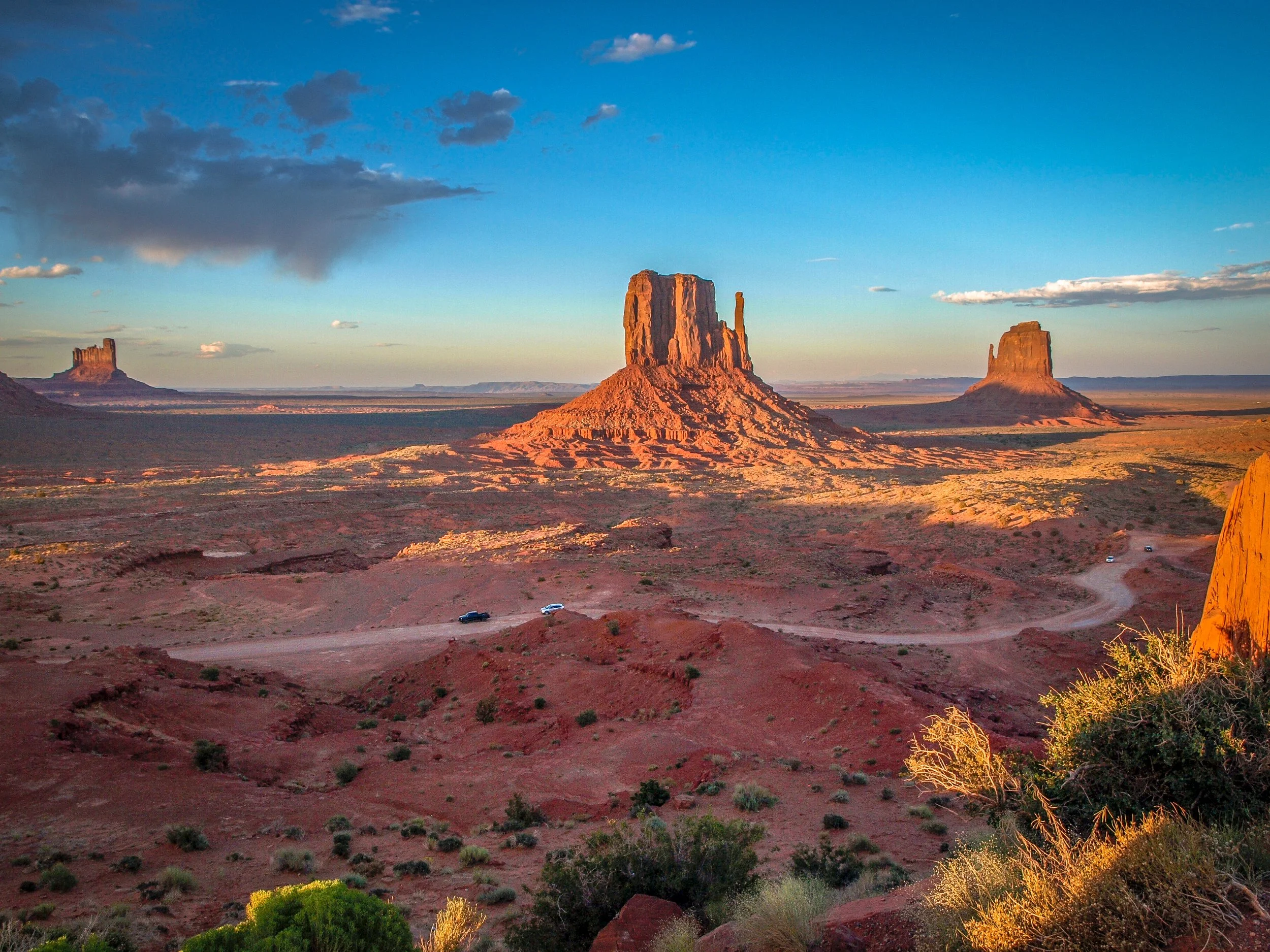
I’ve spent many months of my life on the Navajo Reservation, more than I’ve spent with any other Native American group. I’ve always found the Navajo People (or the Diné as they refer to themselves) to be warm and welcoming with a wonderful sense of humor. I’ve had the incredible opportunity to lead tours throughout the Navajo lands and to explore on my own as well. Some of these photos are from my recent travels on the Rez and some are old favorites. I hope they show the diversity of the landscape and the splendor of my time in Navajo Country.
Rio Grande del Norte is one of our more recent National Monuments, having been designated as such in 2013. It protects the confluence of the Red River and the Rio Grande which are both designated Wild and Scenic Rivers. Both gorges are gorgeous and the point of land above the confluence, called simply El Punto, provides amazing views from high above the two rivers. I hiked the Little Arsenic Trail while I was there, which brought me down to the Rio Grande and led me straight to the confluence. It was one of the better hikes I did during my stay in New Mexico and was very rewarding around every turn. I spent the night at the campground on the canyon rim and enjoyed a beautiful sunset in the evening and a magical sunrise the following morning. In between, the stars were spectacular. I debated whether to drive out to this park as it was somewhat out of the way, but I’m sure glad I did as it is stunning from end to end. If you’re ever in the area, you should as well. I hope you enjoy these photos from beautiful Rio Grande del Norte National Monument.
Organ Mountains - Desert Peaks National Monument is a beautiful park in Southeast New Mexico managed by the Bureau of Land Management. Just 25 minutes from Las Cruces, this park makes for a great day trip from the city or a stop-off on your way to or from White Sands National Park. I enjoyed a wonderful 7 mile round-trip hike up to Baylor Pass, a saddle with wonderful views out over the Chihuahuan Desert. In the afternoon, I made a 3 mile round-trip hike to the ruins at Dripping Springs. This area, which contains a natural spring deep in a hollow, was once home to Boyd’s Sanitarium and Van Patton’s Mountain Camp. The sanitarium catered to tuberculosis patients while the mountain camp was a fancy hotel and resort. Opened in 1897, the hotel had 15 guest rooms, a dining hall, a concert hall, a gazebo and a roller-skating rink and hosted the likes of Pat Garrett and Pancho Villa. The resort fell on hard times during World War I and Eugene Van Patten sold it to Dr. Boyd who ran the sanitarium. The Great Depression would be the final blow to the resort and it closed for good in the 1920s. Today it is maintained in a state of arrested decay and makes for a cool walk in the late afternoon. There is so much more to this park than just these two hikes, but they were all I had time for during my visit. I hope you enjoy these photos from Organ Mountains - Dripping Springs National Monument.
Magnificent White Sands National Park in central New Mexico preserves the largest gypsum dune field of its kind in the world. This dune field in the heart of the Tularosa Basin covers 145,762 acres and includes 4.5 billion tons of gypsum sand. This gypsum was left in the area after the Permean Sea retreated several million years ago, and water and wind shape the dunes we find there today. The dunes are ever changing, though, so you will never see the same landscapes on any two visits to the park.
People have been coming through the area for at least 11,000 years and we believe that a group we call the Jornada Mogollon were the first to farm the area (see my photos of their nearby petroglyph site here). Groups of Apache made their way into the area in the 1600s and European-Americans arrived in the 1800s. White Sands National Monument was created by Herbert Hoover in 1933 and it was made a National Park in 2019.
I arrived for my visit to the park just after dawn. The mountains to the east block the sunrise, but the skies were blue and full of amazing white clouds. I headed straight out to the heart of the dunes and hiked the wonderful 5 mile Alkali Flats Trail. The sun reflected brightly off the white sand making photography difficult, but I was grateful that there was no wind. In the late afternoon I set out to capture some of the beautiful plant life in the park, mainly different kinds of yucca, which contrast nicely with the white sand. I stayed to watch the sunset and found real peace and solitude out in the middle of the park. It was a wonderful day in White Sands National Park. You can find some of these photos for sale in my store , but please contact me if the one you want isn’t there and I’ll be happy to add it. I hope you enjoy these photos from my time in White Sands National Park.
Lake Itasca State Park spans over 32,000 acres in North-Central Minnesota. Native Americans have hunted in this region for thousands of years. In more recent times the area was inhabited by semi-nomadic bands of Ojibwe and played a roll in the fur trade. In 1832 an Ojibwe leader and guide named Ozawindib guided explorer Henry Schoolcraft to the lake they called Omashkoozo-zaaga'igan (Elk Lake), where he showed Schoolcraft the headwaters of the Mississippi River. Schoolcraft chose a new name for the lake by combining the Latin words Veritas (truth) and Caput (head) to form ‘Itasca’ honoring the ‘true head’ of the Mississippi. A monument has been placed there marking the beginning of the river’s 2,552 mile run to the Gulf of Mexico and is one of the more iconic photos in the state. The park is so much more than just the headwaters though, with dozens of miles of trails, the historic Douglas Lodge, campgrounds, lakes and even a climbable fire tower. The area is so wonderful, in fact, that Minnesota declared it a state park in 1891 making it the oldest state park in the state and one of the oldest in the country. I had a wonderful day in Itasca State Park and found it one of the prettiest places I’ve seen in Minnesota. I hope you enjoy these photos from lovely Itasca State Park, a real gem in the heart of the state.
Minnesota’s North Shore stretches along Lake Superior from Duluth all the way to the Canadian border. This region was at the top of all of my Minnesotan friends’ must-see lists and after five days of exploring, I certainly understand why. There are eight beautiful state parks along this stretch, as well as Grand Portage National Monument which is a cooperative effort between the National Park Service and the Grand Portage Band of Lake Superior Chippewa. This park tells the story of the early fur traders, voyageurs and Native Americans who came together on the western shore of Lake Superior. Waterfalls abound along the North Shore, including Minnesota’s tallest - High Falls in Grand Portage State Park. I also found lighthouses, cute little lakeside towns and breathtaking views out over Lake Superior. Also in this region is the wonderful Gunflint Trail Scenic Byway which stretches 40 miles, from Grand Marais to Gull Lake, and offers wonderful lodging and recreation activities in the state’s Boundary Waters Canoe Area. While not technically on the North Shore, I’ve included some of my favorite shots from my two days along this beautiful road as well. I so enjoyed watching the sun set and then rise again in the morning over Gunflint Lake, and the stars at night were simply amazing. I will echo my friends’ recommendation - if you’re coming to Minnesota, the North Shore is definitely a place you must see. For such a compact area, it’s one of the most beautiful regions I’ve seen in my travels anywhere in the country. I hope you enjoy these photos from Minnesota’s North Shore and the Gunflint Trail Scenic Byway.
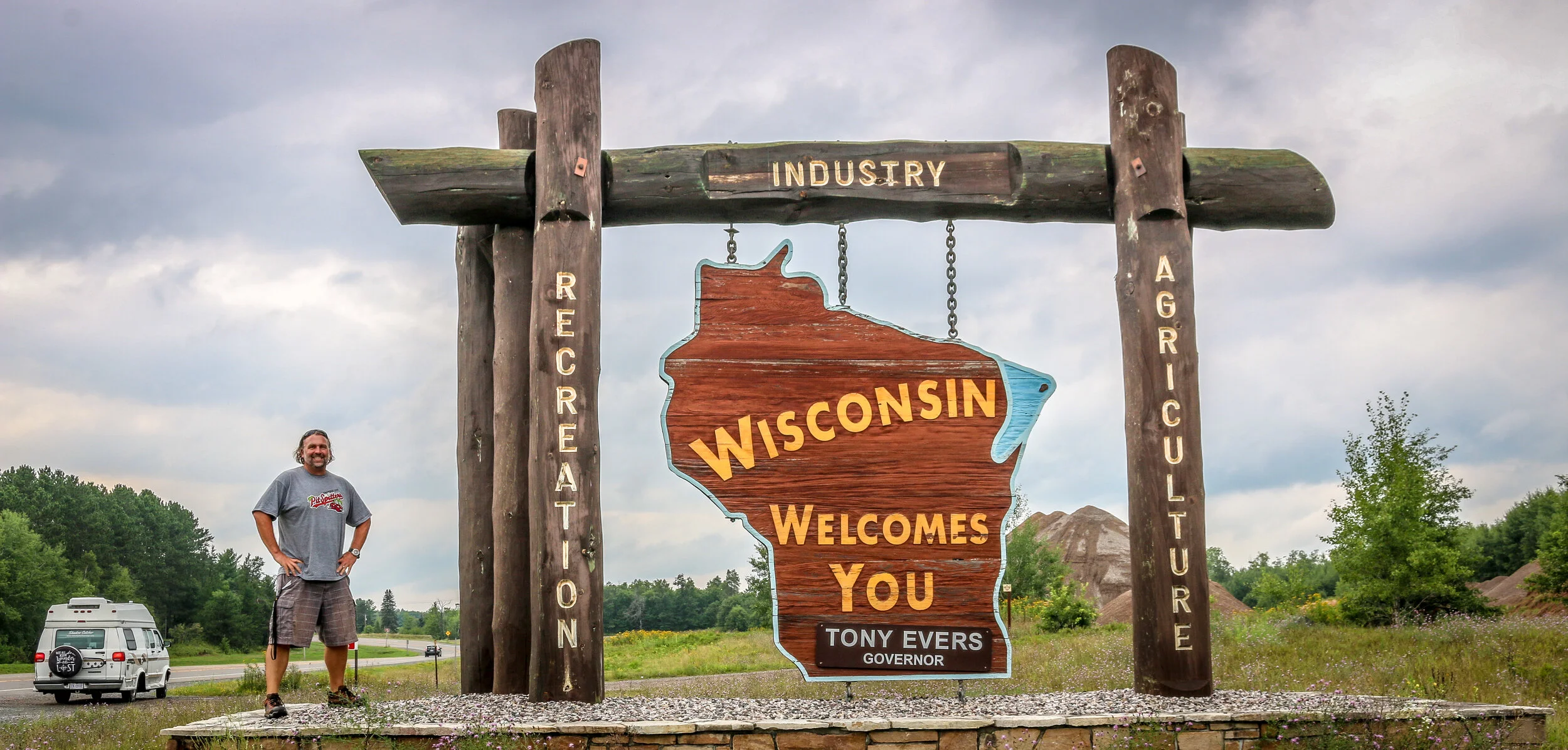
Apostle Islands National Lakeshore is a beautiful park which stretches along Wisconsin’s Lake Superior coastline. The park extends over 21 of the 22 islands in the area with only Madeline Island being outside its boundary. In addition to the islands themselves, the park extends to the historic fishing area at Little Sand Bay and the beautiful coastline and sea caves at Myers Beach. Nobody is quite sure who gave the islands their names, but French maps referred to them as the Apostle Islands as early as the 1700s. The National Lakeshore was established in 1970, having been proposed by Wisconsin’s Senator Gaylord Nelson who is also considered the founder of Earth Day.
During my time in the park, I enjoyed a scenic cruise around the islands with Apostle Island Cruises. Our 2.5 hour journey took us around most of the islands with special attention paid to the beautiful, outer Devil’s Island and the historic lighthouse at Raspberry Island. Unfortunately, the islands were closed to camping during my stay so I wasn’t able to spend the night out there which I really would have enjoyed. Beyond the cruise, I spent some time learning about the history of the area at the outdoor museum at Little Sand Bay (which was also a wonderful place to watch the sunset). There were also recorded stories from rangers, historians and Native Americans in this section to listen to. On my last morning in the park I visited the Myers Beach section to hike the Lakeshore Trail to The Bowl to view the amazing sea caves and beautiful coastline. I was also pleasantly surprised by the number and variety of mushrooms I experienced along this trail. I had a wonderful visit to the Apostle Islands and hope you enjoy these photos from my stay.
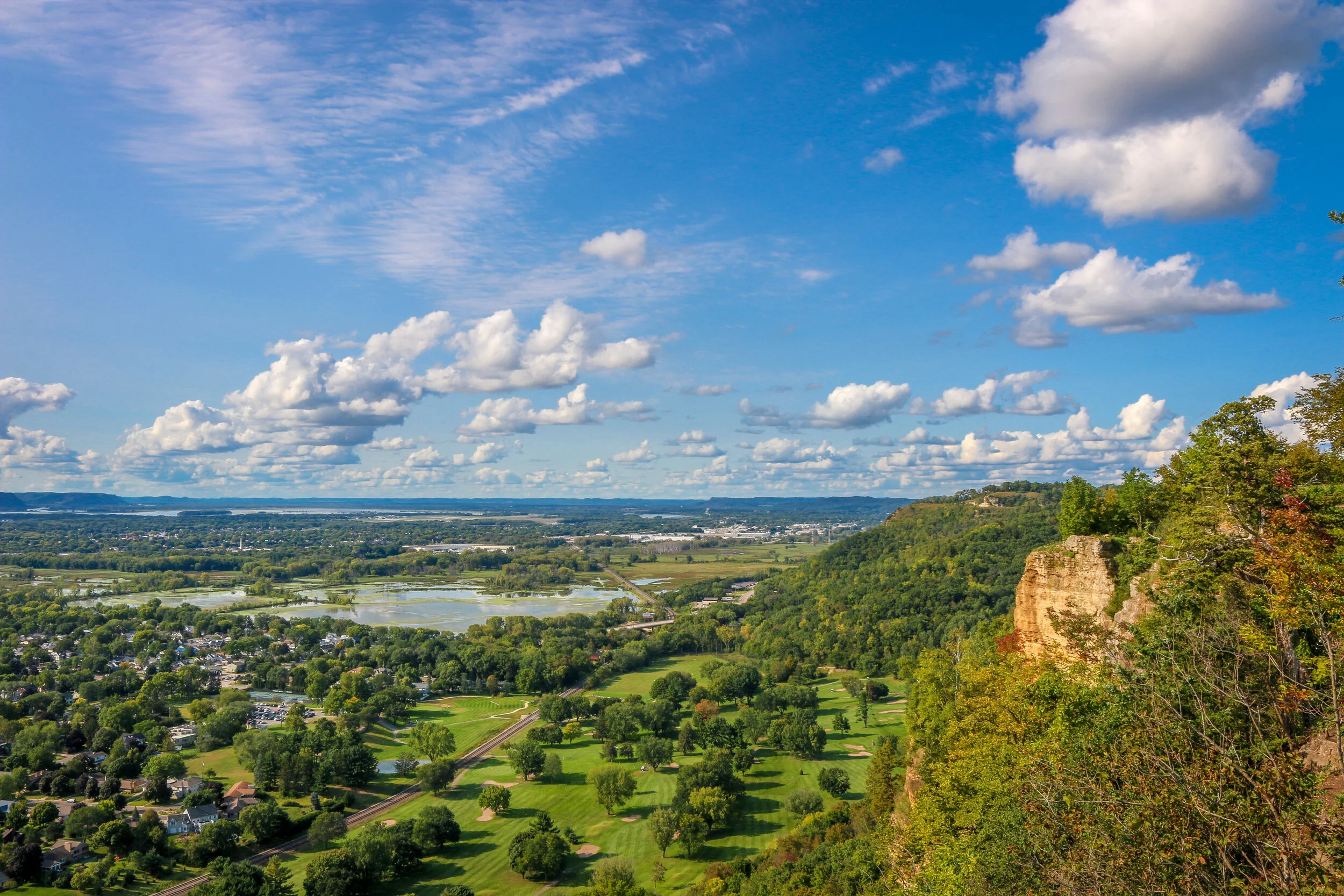
The Driftless Region of Wisconsin is the area below the furthest advance of the glaciers during the last Ice Age and covers most of the southwest portion of the state.. It is home to wonderful, ancient sandstone formations, beautiful parks and great little towns. This area is definitely hillier than much of the rest of the state and ends (at least as far as Wisconsin is concerned) at the Mississippi River on its western border. I had a great time exploring the Driftless, boating through the Wisconsin Dells, walking the State Park trails, driving the Great River Road and exploring the towns I found along the way. I encountered many different European-American traditions along the way including two of Wisconsin’s most famous: beer and cheese. I visited Wisconsin’s first Capital at Belmont, it’s biggest tourist attraction at House on the Rock and some of the state’s mining history at Mineral Point The Driftless is a sprawling region with a diverse culture and a fascinating history. I hope you enjoy these photos from Wisconsin’s Driftless Region, a unique place which I really enjoyed visiting.
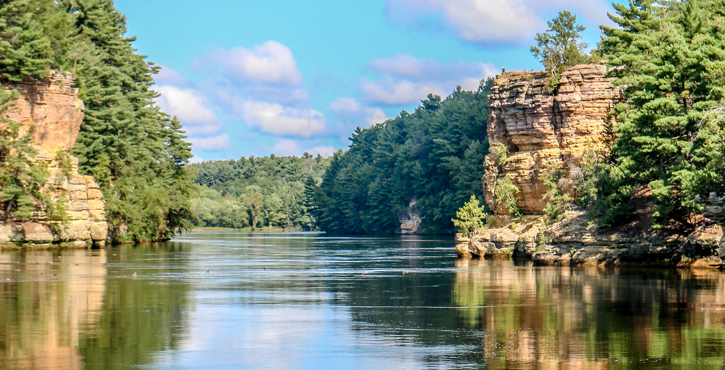
The Potsdam Sandstone that makes the beautiful formations we find in the Wisconsin Dells was formed 500 million years ago during the Cambrian Era when this area was the sandy shore of a vast inland sea. 15,000 years ago, during the last Ice Age, the glaciers came within 4 miles of The Dells but never quite got there, making this the edge of what is called The Driftless Region (the part of Wisconsin which evaded glaciation). When the Ice Age started to end, the meltwater formed a massive lake known as Glacial Lake Wisconsin. When the ice dam that held the lake back finally collapsed, it unleashed a massive flood which carved the gorges of the Wisconsin Dells in a matter of days or weeks. We get the word ‘Dells’ from the French word ‘dalles’ which means slabs of rock.
Human history in the area stretches back thousands of years, but the modern era of The Dells as a tourist draw can be traced to legendary photographer H.H. Bennett. Bennett took up photography after the Civil War but became frustrated that he could not capture moving objects on film without them blurring. He built his own camera which he referred to as a “snapper” and took a famous photo of his son jumping to Stand Rock. This photo circulated around the country and then the world and people had to come and see these Dells for themselves. The Dells became quite a mess with all of the attempts to capitalize on this beautiful natural area’s popularity (think Niagara Falls), but thankfully it has been designated a State Natural Area which is overseen by the State of Wisconsin. The weird tourist traps which have persisted are thankfully out of view of The Dells themselves.
I came to The Dells a few times when I was a kid and always remembered it as a beautiful place. I was happy to find I still thought that after many years away and having visited a lot of beautiful areas in the interim. I took the Upper Dells boat tour and a DUCK tour of the Lower Dells while I was there and enjoyed both of them (although choosing between the two would be easy - the Upper Dells all the way). I was also lucky to have absolutely beautiful weather while I was there. I hope you enjoy these photos from my visit to the beautiful Wisconsin Dells.
The Ojibwa Indians called Isle Royale “Minong” meaning “a good place to be” and they certainly hit the nail on the head with that one. Isle Royale National Park consists of Isle Royale itself and over 400 smaller islands making up an archipelago in the middle of Lake Superior. Isle Royale is the largest natural island on Lake Superior and the second largest in the Great Lakes at 45 miles long and 9 miles wide. Some of Michigan’s earliest copper mines were established on Isle Royale in the 1840s, continuing the Ojibwa copper-mining tradition which stretched back hundreds of years. Commercial fishing operations also ran off of Isle Royale for many years, but it was the island’s beauty and ability to attract tourism which would create its lasting industry. Isle Royale National Park was established in 1940 and it was made a part of the UNESCO International Biosphere Reserve in 1980.
I had a wonderful 4 day/3 night visit to Isle Royale in the beginning of August. The island is only accessible by boat or plane, with ferries originating out of Houghton and Copper Harbor in Michigan and Grand Portage in Minnesota. I chose the Isle Royale Queen IV out of Copper Harbor which dropped me off in Rock Harbor on the island’s northeast side in about three and a half hours. After getting my backcountry permit from the ranger there, I headed off into the wilderness for the next three nights, staying at Daisy Farm, Lynn Cove and Three Mile campgrounds. I hiked about 25 miles during my time on Isle Royale and really found the island to be a beautiful place to be. After hiking all day, an afternoon dip in Lake Superior always felt great. I saw 9 moose during my visit and also a handful of beavers along with plenty of birds and toads. I really cherished my time on Isle Royale and hope you enjoy these photos from America’s least visited National Park.
Hello Everyone and greetings from Green Bay, Wisconsin! I have completed my two month journey through Michigan and have moved on to the Badger State. I spent the first half of the week out in beautiful Isle Royale National Park, a destination I was really looking forward to and which definitely lived up to my expectations. Returning from the park on Saturday, it was time for me to make tracks and get myself into Wisconsin. Summer is passing quickly and I still hope to get through both Wisconsin and Minnesota before winter sets in. It’s been a good week, and I’m excited to tell you what I’ve been up to.
I headed out to Isle Royale on the Isle Royale Queen IV out of Copper Harbor bright and early on Wednesday morning. There are three boats that make the trip to the island, and this one just worked better with my schedule. It was fast and made the 55 mile crossing in about 3.5 hours and I enjoyed chatting with a mother and daughter who I sat with on the way out. The mother owned the rock shop in Copper Harbor and had a grandfather who once lived and worked as a fisherman on Isle Royale. Her daughter was in Copper Harbor for the summer and working at one of the restaurants in town. I was surprised by how many people I met who had family connections back to Isle Royale before it became a National Park.
When we arrived on the island, the rangers gave us their briefing, issued backcountry permits and we were off and running. Most of the park is designated wilderness, so unless you are staying at the lodge near the ferry dock you are on your own for the duration of your stay. I shouldered my pack and made my way a little over 7 miles to Daisy Farm Campground on the east side of the island. It’s been years since I’ve carried a full pack that distance, but I have been doing a lot of walking and hiking and it really wasn’t too bad. I even saw my first of nine moose I would see during my visit on this hike. Because I was there alone, it was easy to hear footsteps which weren’t my own and an adult moose has some pretty heavy footsteps. I was able to see the moose through the dense forest and enjoyed spending some time with her before heading on to camp where I took up residence in one of the shelters they had there. I had my tent with me, but since the shelters were available it seemed like an easier option even though it only takes 5 minutes to set up my tent. I had my first dehydrated meal in many years, something which has improved dramatically since the last time I ate one. It was a beautiful campground right on the lake and even though it was pretty busy, people were spread out and it didn’t seem crowded. I met some really nice people in camp and found it easy to talk to people as we obviously had shared interests in hiking, camping and/or National Parks and had gone to some length to get to this remote island.